Category:Aerial photographs of Aragon
Jump to navigation
Jump to search
Autonomous communities of Spain: Andalusia · Aragon · Asturias · Balearic Islands · Basque Autonomous Community · Canary Islands · Cantabria · Castile and León · Castile-La Mancha · Catalonia · Extremadura · Galicia · Community of Madrid · Region of Murcia · Valencian Community · Autonomous cities:
Media in category "Aerial photographs of Aragon"
The following 13 files are in this category, out of 13 total.
-
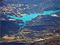
 Abizanda foto aérea 2.jpg 4,000 × 3,000; 7.31 MB
-
 Abizanda foto aérea.jpg 4,000 × 3,000; 6.58 MB
-
 Aerial Zaragoza 7423a.jpg 2,272 × 1,704; 924 KB
-
 Calanda (Teruel) (Spain) - 50601214768.jpg 5,184 × 3,888; 22.4 MB
-
 Calanda (Teruel) (Spain) - 50601956986.jpg 5,184 × 3,888; 21.87 MB
-
 Candosnos.jpg 3,072 × 2,048; 2.41 MB
-
 Palomar de Arroyos (Teruel) (Spain) - 50601338263.jpg 5,184 × 3,888; 22.48 MB
-
 Santolea (Teruel) (Spain) - 50601285608.jpg 5,184 × 3,888; 23.4 MB
-
 Santolea (Teruel) (Spain) - 50602023551.jpg 5,184 × 3,888; 22.77 MB
-
 Santolea (Teruel) (Spain) - 50602026821.jpg 5,184 × 3,888; 23.05 MB
-
 Santolea (Teruel) (Spain) - 50602139602.jpg 5,184 × 3,888; 23.35 MB
-
 Zaragoza from air Durand-1.jpg 685 × 1,025; 621 KB
-
 Zaragoza, Spain ESA24606422.tiff 2,877 × 3,501; 28.85 MB


_(Spain)_-_50601214768.jpg)
_(Spain)_-_50601956986.jpg)

_(Spain)_-_50601338263.jpg)
_(Spain)_-_50601285608.jpg)
_(Spain)_-_50602023551.jpg)
_(Spain)_-_50602026821.jpg)
_(Spain)_-_50602139602.jpg)
