Category:Adstock, Buckinghamshire
Jump to navigation
Jump to search
English: Adstock is a village and civil parish within Aylesbury Valedistrict in Buckinghamshire, England, about 3 miles north west of Winslow. According to the 2001 census the parish had a population of 415.
village and civil parish in Buckinghamshire, United Kingdom  | |||||
| Upload media | |||||
| Instance of | |||||
|---|---|---|---|---|---|
| Location | Buckinghamshire, South East England, England | ||||
| Different from | |||||
 | |||||
Subcategories
This category has the following 3 subcategories, out of 3 total.
C
- St Cecilia's Church, Adstock (12 F)
O
Media in category "Adstock, Buckinghamshire"
The following 61 files are in this category, out of 61 total.
-
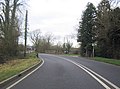 A413 approaching Adstock turning - geograph.org.uk - 2743158.jpg 640 × 473; 82 KB
-
 A413 nearing The Folly Inn, Adstock - geograph.org.uk - 4873082.jpg 640 × 480; 58 KB
-
 Adstock - geograph.org.uk - 337807.jpg 640 × 427; 117 KB
-
 Adstock - geograph.org.uk - 338428.jpg 640 × 480; 158 KB
-
 Adstock Cattery at Pear Tree Hill Farm - geograph.org.uk - 3305635.jpg 1,600 × 1,066; 453 KB
-
 Adstock Priory, Main Street, Adstock, Buckinghamshire.jpg 2,283 × 1,917; 1.28 MB
-
 Adstock Village from the Churchyard - geograph.org.uk - 2317914.jpg 798 × 532; 455 KB
-
 Arable farmland, Adstockfields - geograph.org.uk - 338424.jpg 640 × 480; 128 KB
-
 Bridge at junction near Adstock - geograph.org.uk - 349101.jpg 640 × 415; 176 KB
-
 Bridleway, Plich Farm - geograph.org.uk - 846368.jpg 640 × 480; 69 KB
-
 Cottage by the Churchyard, Adstock - geograph.org.uk - 2316033.jpg 798 × 532; 598 KB
-
 Cottage next to the Churchyard, Adstock - geograph.org.uk - 2317922.jpg 798 × 532; 660 KB
-
 Cottages and the Pure Fleece pub, Adstock - geograph.org.uk - 4632043.jpg 4,320 × 3,240; 4.13 MB
-
 Cottages in Adstock Village - geograph.org.uk - 2315992.jpg 798 × 532; 521 KB
-
 Countryside Barn - geograph.org.uk - 883568.jpg 640 × 480; 86 KB
-
 Failte, Church End, Adstock, Buckinghamshire.jpg 2,781 × 1,904; 1.89 MB
-
 Farmland at Pilch Farm - geograph.org.uk - 337997.jpg 640 × 480; 121 KB
-
 Farmland, Adstock - geograph.org.uk - 337814.jpg 640 × 480; 162 KB
-
 Farmland, Adstockfields - geograph.org.uk - 338002.jpg 640 × 480; 119 KB
-
 Fern Cottage, Main Street, Adstock, Buckinghamshire.jpg 2,587 × 1,940; 1.88 MB
-
 Fig Tree Cottage, Main Street, Adstock, Buckinghamshire.jpg 3,718 × 1,940; 2.34 MB
-
 Footbridge over the stream - geograph.org.uk - 3305697.jpg 1,200 × 1,600; 644 KB
-
 Footpath from Pilch Lane - geograph.org.uk - 3162826.jpg 1,600 × 1,067; 642 KB
-
 Footpath near Adstock - geograph.org.uk - 4137200.jpg 4,320 × 3,240; 4.21 MB
-
 Footpath to Adstock Manor - geograph.org.uk - 3305691.jpg 1,600 × 1,067; 553 KB
-
 Fox Cottage, Church End, Adstock, Buckinghamshire.jpg 1,940 × 3,233; 2.29 MB
-
 Hintons, Main Street, Adstock, Buckinghamshire.jpg 2,807 × 1,882; 1.48 MB
-
 Icicle cottage on The Gardens - geograph.org.uk - 3305665.jpg 1,600 × 1,068; 428 KB
-
 Independence House, Main Street, Adstock, Buckinghamshire.jpg 2,587 × 1,940; 1.86 MB
-
 Jasmine Cottage, Main Street, Adstock, Buckinghamshire.jpg 3,030 × 1,955; 1.68 MB
-
 Kates Cottage and Peacock House, Church End, Adstock, Buckinghamshire.jpg 2,849 × 1,940; 1.44 MB
-
 Lane, Adstockfields - geograph.org.uk - 338004.jpg 640 × 480; 128 KB
-
 Main Street - geograph.org.uk - 1932573.jpg 640 × 480; 94 KB
-
 Main Street, Adstock - geograph.org.uk - 883996.jpg 640 × 480; 94 KB
-
 Mature hedge by an icy field - geograph.org.uk - 3305619.jpg 1,600 × 1,067; 328 KB
-
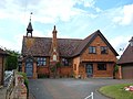 Old School House - geograph.org.uk - 883980.jpg 640 × 480; 71 KB
-
 Open gate to cattle field - geograph.org.uk - 3305631.jpg 1,600 × 1,066; 411 KB
-
 Paddock by Adstockfields Lane - geograph.org.uk - 3305689.jpg 1,600 × 1,068; 350 KB
-
 Path along the field edge to Great Horwood - geograph.org.uk - 3162809.jpg 1,200 × 1,600; 619 KB
-
 Path by Oakridge farm to the A421 - geograph.org.uk - 3162812.jpg 1,600 × 1,067; 584 KB
-
 Path by the copse - geograph.org.uk - 3162822.jpg 1,600 × 1,067; 782 KB
-
 Path from Pilch Lane - geograph.org.uk - 3162817.jpg 1,200 × 1,600; 840 KB
-
 Path through the woods near Pilch Farm - geograph.org.uk - 3162823.jpg 1,200 × 1,600; 944 KB
-
 Path to Adstockfields House - geograph.org.uk - 3305660.jpg 1,200 × 1,600; 303 KB
-
 Path to Pilch Farm - geograph.org.uk - 3162828.jpg 1,600 × 1,068; 503 KB
-
 Path toward Great Horwood - geograph.org.uk - 3162807.jpg 1,600 × 1,068; 560 KB
-
 Path toward Pear Tree Hill farm - geograph.org.uk - 3162819.jpg 1,600 × 1,068; 548 KB
-
 Pilch Farm - geograph.org.uk - 337789.jpg 640 × 480; 136 KB
-
 Public Bridleway - geograph.org.uk - 884007.jpg 640 × 480; 71 KB
-
 Public Footpath - geograph.org.uk - 883585.jpg 640 × 480; 83 KB
-
 Ryan's Cottage on Adstock Main Street - geograph.org.uk - 3305640.jpg 1,600 × 1,068; 403 KB
-
 Ryans Cottage, Main Street, Adstock, Buckinghamshire.jpg 1,940 × 2,587; 1.51 MB
-
 Sheep, Adstockfields - geograph.org.uk - 337797.jpg 640 × 480; 115 KB
-
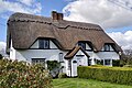
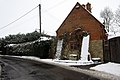
 Snowy cottages on Main Street - geograph.org.uk - 3305653.jpg 1,600 × 1,067; 463 KB
-
 Stream flows under the A413 - geograph.org.uk - 3305646.jpg 1,600 × 1,067; 488 KB
-
 Stubble field by the lane - geograph.org.uk - 3305669.jpg 1,600 × 1,069; 480 KB
-
 The A413, Adstock - geograph.org.uk - 5684847.jpg 1,454 × 1,990; 747 KB
-
 The A413, Adstock - geograph.org.uk - 5685659.jpg 2,014 × 1,490; 860 KB
-
 The Folly Inn near Adstock - geograph.org.uk - 187787.jpg 640 × 480; 81 KB
-
 The lane to Adstockfields - geograph.org.uk - 3305671.jpg 1,600 × 1,067; 450 KB
-
 The Old Punch Bowl and Grapes, Main Street, Adstock, Buckinghamshire.jpg 3,308 × 1,905; 2.01 MB


