Category:Adforton
Jump to navigation
Jump to search
village and civil parish in Herefordshire, England, UK  Eglwys Sant Andreas, Adforton | |||||
| Upload media | |||||
| Instance of | |||||
|---|---|---|---|---|---|
| Location | Herefordshire, West Midlands, England | ||||
 | |||||
Cymraeg: Pentref yn Swydd Hertford, Gorllewin Canolbarth Lloegr, Lloegr ydy Adforton. Saif 20 milltir i'r gogledd o henffordd. (→Adforton)
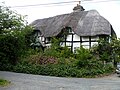
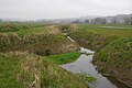
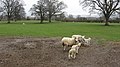
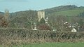
English: Adforton is a small village and civil parish in north Herefordshire, England. It is located north of Wigmore, close to the Wales border, and is surrounded by agricultural fields. (→Adforton)

Subcategories
This category has the following 3 subcategories, out of 3 total.
Media in category "Adforton"
The following 111 files are in this category, out of 111 total.
-
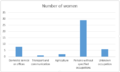 A bar graph showing the occupation of Women in Adforton..PNG 485 × 291; 7 KB
-
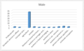
 A bar graph to show male occupation data for 2011 in Adforton..PNG 486 × 291; 12 KB
-

-
 A green lane - geograph.org.uk - 3156310.jpg 640 × 360; 244 KB
-
-
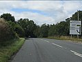
 A4110 at Gotherment - geograph.org.uk - 5679891.jpg 1,600 × 901; 578 KB
-

-

-
 A4110 in Adforton - geograph.org.uk - 2559189.jpg 640 × 480; 74 KB
-

-
 A4110 near Brandon Camp - geograph.org.uk - 2559204.jpg 640 × 480; 46 KB
-
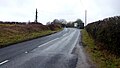
 A4110 north of Adforton - geograph.org.uk - 2559191.jpg 640 × 480; 59 KB
-
 A4110 south of Adforton - geograph.org.uk - 3742251.jpg 3,382 × 2,413; 1.36 MB
-
 A4110 towards Leintwardine - geograph.org.uk - 5680829.jpg 1,600 × 901; 732 KB
-
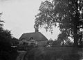
 Adforton (1293851).jpg 1,000 × 700; 97 KB
-
 Adforton (1294967).jpg 1,000 × 718; 112 KB
-
 Adforton employment statistics from 1881. (Male)..PNG 492 × 299; 15 KB
-
 Adforton houses (1) (geograph 7544292).jpg 4,320 × 3,240; 3.67 MB
-
 Adforton houses (10) (geograph 7544364).jpg 4,320 × 3,240; 2.86 MB
-
 Adforton houses (2) (geograph 7544303).jpg 4,038 × 2,894; 2.57 MB
-
 Adforton houses (3) (geograph 7544307).jpg 4,124 × 3,077; 3.09 MB
-
 Adforton houses (4) (geograph 7544316).jpg 4,320 × 3,240; 2.86 MB
-
 Adforton houses (5) (geograph 7544322).jpg 4,104 × 3,151; 2.55 MB
-
 Adforton houses (7) (geograph 7544350).jpg 3,977 × 2,983; 1.97 MB
-
 Adforton Parish Council notice board - geograph.org.uk - 3938805.jpg 3,872 × 2,592; 4.1 MB
-
 Adforton population graph..PNG 480 × 289; 8 KB
-
 Adforton Population over time graph..PNG 488 × 297; 9 KB
-
 Adforton total population between 1861 and 1961..PNG 501 × 327; 10 KB
-
 Burrington turn off the A4110 South of Adforton - geograph.org.uk - 5487325.jpg 3,996 × 2,030; 3.2 MB
-
 Church Cottage (Adforton) - geograph.org.uk - 6333562.jpg 3,648 × 2,736; 4.75 MB
-
 Conifers, Wigmore Rolls - geograph.org.uk - 5352194.jpg 1,024 × 683; 497 KB
-
 Ditch, Grange - geograph.org.uk - 5217846.jpg 800 × 534; 225 KB
-
 Down the lane - geograph.org.uk - 846942.jpg 640 × 480; 97 KB
-
 Drainage ditches, Wigmore Moor - geograph.org.uk - 5217856.jpg 800 × 534; 185 KB
-
 Driveway to Court House - geograph.org.uk - 2747221.jpg 640 × 480; 88 KB
-
 Edge of the marsh - geograph.org.uk - 5680812.jpg 1,600 × 901; 674 KB
-
 Elan Aqueduct valve structure near Leintwardine - geograph.org.uk - 3888338.jpg 2,700 × 1,469; 1.29 MB
-
 Ewes and lambs, Paytoe - geograph.org.uk - 3156319.jpg 640 × 360; 242 KB
-
 Fields near Wigmore - geograph.org.uk - 2011044.jpg 640 × 480; 115 KB
-
 Galanthus nivalis - geograph.org.uk - 5680499.jpg 1,600 × 901; 867 KB
-
 GOML near Adforton - geograph.org.uk - 5736103.jpg 1,000 × 563; 657 KB
-
 Information Board at Adforton - geograph.org.uk - 6333584.jpg 3,648 × 2,736; 4.66 MB
-
 Junction for Lower House lane - geograph.org.uk - 846943.jpg 640 × 480; 119 KB
-
 Junction with A4110 - geograph.org.uk - 5679898.jpg 1,600 × 901; 616 KB
-
 Lane at Paytoe - geograph.org.uk - 5680505.jpg 1,600 × 901; 625 KB
-
 Lane to Paytoe and Adforton - geograph.org.uk - 5680513.jpg 1,600 × 901; 740 KB
-
 Larch wood, Wigmore Rolls - geograph.org.uk - 5352189.jpg 1,024 × 683; 548 KB
-
 Lone tree - geograph.org.uk - 5679905.jpg 1,600 × 901; 621 KB
-

-
 Main road at Adforton - geograph.org.uk - 3938825.jpg 2,592 × 3,872; 4.44 MB
-
 Map of Adforton from the 20th Century..PNG 719 × 477; 892 KB
-
 Mature conifers, Wigmore Rolls - geograph.org.uk - 5352182.jpg 1,024 × 683; 441 KB
-
 Mature conifers, Wigmore Rolls - geograph.org.uk - 5352184.jpg 1,024 × 683; 457 KB
-
 Men at Work - geograph.org.uk - 846948.jpg 480 × 640; 91 KB
-
 Minor road to Paytoe and Burrington - geograph.org.uk - 5679896.jpg 1,600 × 901; 711 KB
-
 Muddy track onto Wigmore Moor - geograph.org.uk - 5679901.jpg 1,600 × 901; 678 KB
-
 North side of Wigmore Rolls - geograph.org.uk - 5352198.jpg 1,024 × 683; 553 KB
-
 Oak wood, Wigmore Rolls - geograph.org.uk - 5352156.jpg 1,024 × 683; 566 KB
-
 Old building in Adforton - geograph.org.uk - 4418543.jpg 640 × 480; 61 KB
-
 Passing Paytoe Hall - geograph.org.uk - 992163.jpg 640 × 480; 94 KB
-
 Path, Wigmore Rolls - geograph.org.uk - 5352199.jpg 1,024 × 683; 557 KB
-
 Paytoe morning mists - geograph.org.uk - 4684636.jpg 4,048 × 2,030; 2.02 MB
-
 Paytoe sheep - geograph.org.uk - 4199969.jpg 4,048 × 2,029; 2.81 MB
-
 Phone box at Adforton - geograph.org.uk - 2465587.jpg 640 × 480; 114 KB
-
 Piping The Water - geograph.org.uk - 145166 (cropped).jpg 638 × 359; 45 KB
-
 Piping The Water - geograph.org.uk - 145166.jpg 640 × 480; 66 KB
-
 Ploughed field at Adforton - geograph.org.uk - 2747229.jpg 640 × 480; 72 KB
-
 Postbox at Paytoe Hall - geograph.org.uk - 699714.jpg 426 × 640; 85 KB
-
 Private fishing - geograph.org.uk - 700410.jpg 640 × 426; 93 KB
-
 Red phone box and green wheelie bin - geograph.org.uk - 3938793.jpg 2,592 × 3,872; 4.69 MB
-
 Road junction, A4110-B4530 - geograph.org.uk - 4716440.jpg 1,024 × 683; 383 KB
-
 Rolling north Herefordshire countryside. - geograph.org.uk - 5680831.jpg 1,600 × 903; 655 KB
-
-
 Singletrack, Wigmore Rolls - geograph.org.uk - 5352150.jpg 1,024 × 683; 514 KB
-
 St. Andrew's Church (Adforton) - geograph.org.uk - 6333389.jpg 3,648 × 2,736; 4.19 MB
-
 St. Andrew's Church (Adforton) - geograph.org.uk - 6333524.jpg 3,648 × 2,736; 3.91 MB
-
 St. Mary Magdalene Church (Leintwardine) - geograph.org.uk - 6066172.jpg 4,096 × 2,304; 2.85 MB
-
 Telephone Box at Adforton - geograph.org.uk - 6333395.jpg 2,736 × 3,648; 4.81 MB
-
 Telephone Box at Adforton - geograph.org.uk - 6333565.jpg 2,736 × 3,648; 4.49 MB
-
 Teme valley floor - geograph.org.uk - 5680510.jpg 1,600 × 901; 672 KB
-
 Teme Valley gateway near Leintwardine - geograph.org.uk - 5064119.jpg 2,661 × 1,002; 1.02 MB
-
 The A4110 Road (Adforton) - geograph.org.uk - 6333567.jpg 3,648 × 2,736; 4.05 MB
-
 The A4110 through Adforton - geograph.org.uk - 3996631.jpg 4,048 × 2,292; 4.25 MB
-
 The Farm - geograph.org.uk - 3742315.jpg 3,568 × 2,861; 1.51 MB
-
 The Farm, Adforton - geograph.org.uk - 3938742.jpg 3,872 × 2,592; 4.46 MB
-
 Two Vauxhalls - geograph.org.uk - 3938770.jpg 3,872 × 2,592; 4.59 MB
-
 Un-named lane north of Lower House Farm - geograph.org.uk - 3742335.jpg 3,587 × 2,503; 1.38 MB
-
 Vale of Wigmore - geograph.org.uk - 3156331.jpg 640 × 360; 193 KB
-
 Vegetation boundary - geograph.org.uk - 5352187.jpg 1,024 × 683; 506 KB
-
 View across Wigmore Moor - geograph.org.uk - 5679894.jpg 1,600 × 901; 687 KB
-
 View across Wigmore Moor - geograph.org.uk - 5680501.jpg 1,600 × 901; 703 KB
-
 View to Lawn Bank Coppice - geograph.org.uk - 5679889.jpg 1,600 × 901; 660 KB
-
 View to Lower House Farm - geograph.org.uk - 5680828.jpg 1,600 × 901; 605 KB
-
 Volcano sunset 1 - geograph.org.uk - 1806522.jpg 1,024 × 768; 135 KB
-
 Volcano sunset 2 - geograph.org.uk - 1806547.jpg 1,024 × 768; 176 KB
-
 Wanderings around the Welsh-English border (288) (geograph 7560150).jpg 4,310 × 3,232; 3.01 MB
-
 Water meadows, Paytoe - geograph.org.uk - 5217843.jpg 800 × 534; 164 KB
-
 Weetabix in the making - geograph.org.uk - 3742357.jpg 3,901 × 2,859; 1.95 MB
-
 Wigmore Moor - geograph.org.uk - 5217850.jpg 800 × 534; 145 KB
-
 Wigmore Rolls - geograph.org.uk - 5352192.jpg 1,024 × 683; 556 KB
-
 Wigmore Rolls singletrack - geograph.org.uk - 5352154.jpg 1,024 × 683; 529 KB
-
 Wild snowdrops by Paytoe Lane - geograph.org.uk - 5680497.jpg 1,600 × 901; 739 KB
-
 Young trees, Wigmore Rolls - geograph.org.uk - 5352143.jpg 1,024 × 683; 535 KB
-

-
 Cottages near Paytoe Hall - geograph.org.uk - 700434.jpg 640 × 426; 78 KB
-
 Drainage ditch on Wigmore Moor - geograph.org.uk - 700507.jpg 426 × 640; 66 KB
-
 Fields south-east of Adforton - geograph.org.uk - 586840.jpg 640 × 480; 79 KB
-
 Flooded field edge, Wigmore Moor - geograph.org.uk - 700483.jpg 426 × 640; 78 KB
-
 Gateway on Wigmore Moor - geograph.org.uk - 700492.jpg 640 × 426; 68 KB
-
 Lower House - geograph.org.uk - 590239.jpg 640 × 480; 85 KB
-
 Old Roman Road - geograph.org.uk - 700506.jpg 640 × 426; 62 KB


_-_geograph.org.uk_-_2559197.jpg)

_-_geograph.org.uk_-_2559199.jpg)


.jpg)
.jpg)
..PNG)
_(geograph_7544292).jpg)
_(geograph_7544364).jpg)
_(geograph_7544303).jpg)
_(geograph_7544307).jpg)
_(geograph_7544316).jpg)
_(geograph_7544322).jpg)
_(geograph_7544350).jpg)


_-_geograph.org.uk_-_6333562.jpg)


.jpg)


_-_geograph.org.uk_-_6333389.jpg)
_-_geograph.org.uk_-_6333524.jpg)
_-_geograph.org.uk_-_6066172.jpg)


_-_geograph.org.uk_-_6333567.jpg)


_(geograph_7560150).jpg)


