Category:Adderley
Jump to navigation
Jump to search
English: Adderley is a village and civil parish in the English county of Shropshire. It is known as Eldredelei in the Domesday Book.
village and civil parish in Shropshire, UK  | |||||
| Upload media | |||||
| Instance of | |||||
|---|---|---|---|---|---|
| Location | Shropshire, West Midlands, England | ||||
 | |||||
Subcategories
This category has the following 4 subcategories, out of 4 total.
Media in category "Adderley"
The following 148 files are in this category, out of 148 total.
-
-
 Sundial, Adderley - geograph.org.uk - 1015830.jpg 480 × 640; 99 KB
-
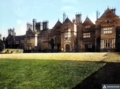
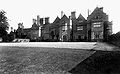 Adderley Hall.jpg 450 × 278; 59 KB
-
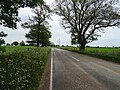
 Adderley Road (A529) - geograph.org.uk - 6172058.jpg 640 × 480; 62 KB
-

-
-
 Adderley School - geograph.org.uk - 4357056.jpg 800 × 450; 362 KB
-

-
 Band in Adderley Road (A529) - geograph.org.uk - 6172060.jpg 800 × 600; 92 KB
-
 Beautiful field edge flowers near Adderley in Shropshire - geograph.org.uk - 6053057.jpg 1,440 × 1,080; 1.84 MB
-

-
 Board store, Shropshire Union Canal - geograph.org.uk - 1211269.jpg 457 × 640; 80 KB
-

-
 Canal at Adderley Wharf in Shropshire - geograph.org.uk - 4833394.jpg 1,024 × 763; 574 KB
-
 Cattle pasture near Bettonwood Farm - geograph.org.uk - 257931.jpg 640 × 480; 140 KB
-
 Congestion at Adderley locks in Shropshire - geograph.org.uk - 4833353.jpg 807 × 1,024; 696 KB
-
 Congestion at Adderley locks in Shropshire - geograph.org.uk - 4833359.jpg 1,280 × 1,011; 1.06 MB
-
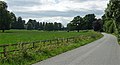 Country road near Adderley - geograph.org.uk - 2157661.jpg 640 × 348; 148 KB
-

-
 Crop field near Gas House Farm - geograph.org.uk - 6171159.jpg 800 × 600; 105 KB
-
 Crop remnants near Pepperhill - geograph.org.uk - 4659811.jpg 800 × 451; 210 KB
-

-
 Eastern lodge, Tittenley Lodges - geograph.org.uk - 6171172.jpg 800 × 600; 137 KB
-
 Entering Adderley - geograph.org.uk - 6171151.jpg 800 × 600; 138 KB
-
 Exiting the penultimate top lock - geograph.org.uk - 2055326.jpg 640 × 480; 107 KB
-
 Farm track to Highfields Farm - geograph.org.uk - 2055338.jpg 640 × 480; 127 KB
-
 Farmland near Longslow - geograph.org.uk - 2158013.jpg 640 × 456; 180 KB
-
 Farmland north-east of Adderley in Shropshire - geograph.org.uk - 6053736.jpg 1,600 × 900; 1.08 MB
-
 Field entrance near Gas House Farm - geograph.org.uk - 6171164.jpg 800 × 600; 164 KB
-
 Field entrance off Adderley Road (A529) - geograph.org.uk - 6171142.jpg 800 × 600; 135 KB
-
 Field off Adderley Road (A529) - geograph.org.uk - 6172062.jpg 800 × 600; 111 KB
-
 Fields east of the canal, Adderley - geograph.org.uk - 5000341.jpg 1,600 × 1,064; 337 KB
-
 Fields near Adderley, Shropshire - geograph.org.uk - 1594683.jpg 640 × 447; 133 KB
-
 Fields south-east of Adderley in Shropshire - geograph.org.uk - 4835010.jpg 1,280 × 872; 792 KB
-
 Fodder maize, Adderley - geograph.org.uk - 4357046.jpg 800 × 450; 373 KB
-
 Footpath near Spoonley - geograph.org.uk - 6172050.jpg 800 × 600; 190 KB
-
 Game rearing facilities^ - geograph.org.uk - 4659755.jpg 800 × 451; 189 KB
-
 Grass cutting near Adderley, Shropshire - geograph.org.uk - 1594716.jpg 640 × 474; 143 KB
-
 Grassland and woodland near Adderley - geograph.org.uk - 6171153.jpg 800 × 600; 107 KB
-
 Grazing and hedgerow near Manor Farm - geograph.org.uk - 6172057.jpg 800 × 600; 100 KB
-

-
 Grazing near Shavington Park - geograph.org.uk - 6171161.jpg 800 × 609; 120 KB
-
 Grazing near Spoonley - geograph.org.uk - 6172052.jpg 800 × 600; 93 KB
-
 Grazing south-east of Adderley, Shropshire - geograph.org.uk - 5276337.jpg 1,280 × 795; 922 KB
-
 Hawksmoor, Adderley, from the canal towpath - geograph.org.uk - 5000335.jpg 1,600 × 1,064; 460 KB
-
 Heading east towards Spoonley - geograph.org.uk - 6172056.jpg 800 × 600; 115 KB
-
 Lane at Tittenley Pool - geograph.org.uk - 4997259.jpg 1,600 × 1,064; 676 KB
-
 Lane by Shavington Park - geograph.org.uk - 4659763.jpg 800 × 450; 179 KB
-
 Lane near Pepperhill - geograph.org.uk - 4659816.jpg 800 × 451; 205 KB
-
 Lane to Spoonley - geograph.org.uk - 4659855.jpg 800 × 451; 206 KB
-
 Large field near Adderley - geograph.org.uk - 6171134.jpg 800 × 600; 80 KB
-
 Lonesome oak - geograph.org.uk - 1211247.jpg 640 × 457; 177 KB
-
 Looking down from Adderley Bottom Lock - geograph.org.uk - 5672601.jpg 1,280 × 851; 398 KB
-
 Low fields and willows - geograph.org.uk - 4659779.jpg 800 × 451; 205 KB
-
 Lush fields and Woodland - geograph.org.uk - 1318395.jpg 640 × 480; 82 KB
-
 Maize crop by Upper Hill Farm - geograph.org.uk - 4659838.jpg 800 × 451; 200 KB
-
 Manor Farm, Spoonley, 1 - geograph.org.uk - 4659877.jpg 800 × 450; 184 KB
-
 Manor Farm, Spoonley, 2 - geograph.org.uk - 4659884.jpg 800 × 451; 191 KB
-
 Manor Farm, Spoonley, 3 - geograph.org.uk - 4659886.jpg 800 × 451; 173 KB
-
 Market Drayton Branch at Adderley - geograph.org.uk - 1298450.jpg 640 × 480; 306 KB
-
 Milepost by the Shropshire Union Canal - geograph.org.uk - 257952.jpg 509 × 640; 184 KB
-
 Milepost near Adderley Locks.jpg 1,600 × 1,064; 590 KB
-
 Minor road towards Adderley - geograph.org.uk - 6171135.jpg 800 × 600; 92 KB
-
 Minor road towards Hawksmoor - geograph.org.uk - 6171138.jpg 800 × 600; 117 KB
-
 Minor road towards Tittenley - geograph.org.uk - 6171165.jpg 800 × 600; 109 KB
-
 Minor road towards Wilkesley - geograph.org.uk - 6171157.jpg 800 × 600; 96 KB
-
 Minor road towards Wilkesley - geograph.org.uk - 6171160.jpg 800 × 600; 92 KB
-
 Moated farm near Middle Morrey Farm - geograph.org.uk - 1296419.jpg 640 × 480; 301 KB
-
 Moated farm near Middle Morrey Farm - geograph.org.uk - 1296427.jpg 640 × 480; 274 KB
-
 Mounting stone at Adderley - geograph.org.uk - 1015849.jpg 640 × 480; 65 KB
-
 Narrowboats at Adderley Locks in Shropshire - geograph.org.uk - 4835248.jpg 1,024 × 1,024; 741 KB
-
 Narrowboats at Adderley Locks, Shropshire - geograph.org.uk - 4833154.jpg 1,280 × 891; 817 KB
-
 North Lodge Adderley.jpg 4,160 × 3,120; 1.79 MB
-
 North Lodge Adderley2.jpg 2,486 × 1,857; 740 KB
-
 North Shropshire farmland near Tittenley - geograph.org.uk - 4659791.jpg 800 × 451; 134 KB
-

-
 Old Toll House, Adderley - geograph.org.uk - 6114891.jpg 640 × 426; 207 KB
-
 Overgrown stile - geograph.org.uk - 4659868.jpg 800 × 451; 226 KB
-
 Parkland near Adderley (1) - geograph.org.uk - 2157652.jpg 640 × 438; 204 KB
-
 Parkland near Adderley (2) - geograph.org.uk - 2157852.jpg 640 × 415; 184 KB
-

-
 Pasture east of Adderley in Shropshire - geograph.org.uk - 4836476.jpg 1,024 × 643; 414 KB
-
 Pasture east of Adderley in Shropshire - geograph.org.uk - 5276312.jpg 1,280 × 960; 823 KB
-
 Pasture east of Adderley in Shropshire - geograph.org.uk - 5276320.jpg 1,280 × 889; 837 KB
-
 Pasture east of Adderley in Shropshire - geograph.org.uk - 5276325.jpg 1,280 × 871; 765 KB
-
 Pasture land near Adderley, Shropshire - geograph.org.uk - 1594666.jpg 640 × 480; 154 KB
-
 Pasture land near Adderley, Shropshire - geograph.org.uk - 1594751.jpg 640 × 480; 144 KB
-
 Pasture land near Adderley, Shropshire - geograph.org.uk - 1594879.jpg 640 × 480; 142 KB
-
 Pasture near Adderley in Shropshire - geograph.org.uk - 5275864.jpg 1,024 × 1,024; 908 KB
-
 Pasture near Adderley in Shropshire - geograph.org.uk - 5275868.jpg 1,600 × 906; 1.27 MB
-
 Pasture near Adderley, Shropshire - geograph.org.uk - 1594744.jpg 640 × 448; 141 KB
-
 Pasture near Adderley, Shropshire - geograph.org.uk - 1597016.jpg 640 × 431; 146 KB
-
 Pasture near Adderley, Shropshire - geograph.org.uk - 1597023.jpg 640 × 450; 150 KB
-
 Pasture north-east of Adderley in Shropshire - geograph.org.uk - 5275402.jpg 1,280 × 814; 784 KB
-
 Pasture north-east of Adderley, Shropshire - geograph.org.uk - 5275861.jpg 1,280 × 835; 809 KB
-
 Pasture south of Adderley, Shropshire - geograph.org.uk - 2770948.jpg 800 × 505; 251 KB
-

-
 Raven House - geograph.org.uk - 5727894.jpg 1,600 × 1,200; 989 KB
-
 Rectory Lane - geograph.org.uk - 1211135.jpg 640 × 457; 159 KB
-
 Rectory Lane - geograph.org.uk - 1211277.jpg 640 × 457; 77 KB
-
 Remains of a railway bridge - geograph.org.uk - 2055291.jpg 640 × 480; 154 KB
-
 Road bridge over the tiny River Duckow - geograph.org.uk - 930350.jpg 640 × 480; 105 KB
-
 Road junction near Tittenley Lodges - geograph.org.uk - 6171177.jpg 800 × 600; 159 KB
-
 Road to Adderley - geograph.org.uk - 4659782.jpg 800 × 451; 197 KB
-
 Roundabout near Market Drayton - geograph.org.uk - 6319327.jpg 3,528 × 2,006; 2.58 MB
-
 Shaded towpath - geograph.org.uk - 2055245.jpg 640 × 480; 184 KB
-
 Shropshire Cheshire border - geograph.org.uk - 4659741.jpg 800 × 451; 182 KB
-
 Shropshire farmland near Adderley - geograph.org.uk - 6053735.jpg 1,440 × 960; 1.12 MB
-
 Shropshire farmland north-east of Adderley - geograph.org.uk - 5275087.jpg 1,600 × 941; 1.13 MB
-
 Shropshire pasture near Cobscot Hey, Adderley - geograph.org.uk - 5275361.jpg 1,280 × 813; 1.05 MB
-
 Shropshire pasture south-east of Adderley - geograph.org.uk - 5276543.jpg 1,280 × 775; 866 KB
-
 Shropshire Union Canal at Adderley Locks, Shropshire - geograph.org.uk - 6053742.jpg 1,280 × 960; 1.48 MB
-
 South end of Tittenley Pool - geograph.org.uk - 4659801.jpg 800 × 451; 148 KB
-
 South Lodge to Adderley Hall - geograph.org.uk - 6171150.jpg 800 × 450; 87 KB
-
 The Gingerbread Man, Market Drayton - geograph.org.uk - 6172064.jpg 800 × 600; 155 KB
-
 Tittenley Lodges - geograph.org.uk - 4659796.jpg 800 × 451; 163 KB
-
 Tittenley Lodges, Adderley.jpg 640 × 376; 165 KB
-
 Tittenley Pool - geograph.org.uk - 4997248.jpg 1,600 × 1,064; 363 KB
-
 Tittenley Pool - geograph.org.uk - 6171167.jpg 640 × 480; 78 KB
-
 Tittenley Pool - geograph.org.uk - 930348.jpg 640 × 480; 58 KB
-

-
 Upper Hill Farm - geograph.org.uk - 4659834.jpg 800 × 451; 207 KB
-
 Victoria Wharf - geograph.org.uk - 4599148.jpg 640 × 427; 89 KB
-
 View towards Bettoncoppice Farm - geograph.org.uk - 257973.jpg 640 × 414; 115 KB
-
 View towards Shavington Home Farm - geograph.org.uk - 4659747.jpg 800 × 451; 198 KB
-
 View west at Tittenley Pool - geograph.org.uk - 4997265.jpg 1,600 × 1,064; 456 KB
-
 Village sign, Adderley - geograph.org.uk - 4357049.jpg 800 × 450; 437 KB
-
 Western lodge, Tittenley Lodges - geograph.org.uk - 6171174.jpg 800 × 600; 142 KB
-
 Adderley School - geograph.org.uk - 8458.jpg 640 × 445; 98 KB
-
 Arable field - geograph.org.uk - 793457.jpg 640 × 480; 93 KB
-
 Cattle pasture near Rooms Farm - geograph.org.uk - 252692.jpg 640 × 444; 126 KB
-
 Drinking Trough and Lane - geograph.org.uk - 629877.jpg 640 × 428; 63 KB
-
 Fallen Tree - geograph.org.uk - 629883.jpg 640 × 428; 90 KB
-
 Farm cats at Rooms Farm - geograph.org.uk - 252699.jpg 640 × 459; 164 KB
-
 Farming - geograph.org.uk - 5467.jpg 640 × 480; 64 KB
-
 Farmland south of Adderley - geograph.org.uk - 581974.jpg 640 × 480; 127 KB
-
 Kynsal Farm, near to Coxbank - geograph.org.uk - 761678.jpg 640 × 480; 55 KB
-
 Old Farm - geograph.org.uk - 3909.jpg 640 × 480; 57 KB
-
 Old Farm building alongside the road - geograph.org.uk - 183760.jpg 640 × 480; 135 KB
-
 Outbuilding at Rooms Farm - geograph.org.uk - 252687.jpg 640 × 459; 89 KB
-
 Rooms Farm, near Adderley - geograph.org.uk - 252695.jpg 640 × 463; 162 KB
-

-
 The entrance to Bawhill Farm - geograph.org.uk - 533372.jpg 640 × 354; 64 KB
-
 The Winter Fields - geograph.org.uk - 629873.jpg 640 × 428; 67 KB
-
 Tittenley Farm - geograph.org.uk - 5464.jpg 640 × 480; 119 KB
-
 Tittenley Pool - geograph.org.uk - 5466.jpg 640 × 480; 127 KB
-
 Track to The Lees - geograph.org.uk - 581979.jpg 640 × 480; 129 KB
-
 White Gates Farm - geograph.org.uk - 272530.jpg 640 × 480; 92 KB


_-_geograph.org.uk_-_6172058.jpg)
_approaching_roundabout_-_geograph.org.uk_-_6172063.jpg)
_towards_Market_Drayton_-_geograph.org.uk_-_6171147.jpg)


_-_geograph.org.uk_-_6172060.jpg)


_-_geograph.org.uk_-_6171142.jpg)
_-_geograph.org.uk_-_6172062.jpg)


_-_geograph.org.uk_-_2157652.jpg)
_-_geograph.org.uk_-_2157852.jpg)


