Category:Achmelvich
Jump to navigation
Jump to search
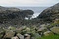
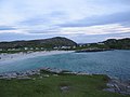
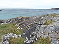
English: Achmelvich ( Gaelic: Achadh Mhealbhaich) is a settlement situated in the Highland region of Scotland. The name comes from the Gaelic "Achadh" - a plain or meadow and "mealvaich" - sandy dunes . (An unsurprising name as the beach is dominated by sandy dunes and machair.)
human settlement in Highland, Scotland, UK .jpg) | |||||
| Upload media | |||||
| Instance of | |||||
|---|---|---|---|---|---|
| Location |
| ||||
 | |||||
Subcategories
This category has the following 3 subcategories, out of 3 total.
A
- Achmelvich Beach (27 F)
H
- Hermit's Castle (15 F)
Media in category "Achmelvich"
The following 39 files are in this category, out of 39 total.
-
 Achmelvich - geograph.org.uk - 138504.jpg 640 × 428; 88 KB
-
 Achmelvich - geograph.org.uk - 50642.jpg 640 × 480; 68 KB
-
 Achmelvich Bay - geograph.org.uk - 2665003.jpg 640 × 425; 98 KB
-
 Achmelvich Bay - geograph.org.uk - 4767977.jpg 640 × 537; 94 KB
-
 Achmelvich Campsite - geograph.org.uk - 1094273.jpg 640 × 480; 97 KB
-
 Achmelvich evening - geograph.org.uk - 50639.jpg 640 × 480; 70 KB
-
 Achmelvich from the hill path - geograph.org.uk - 3989620.jpg 1,024 × 678; 229 KB
-
 Achmelvich Headland - geograph.org.uk - 83942.jpg 640 × 480; 131 KB
-
 Achmelvich Youth Hostel - geograph.org.uk - 248378.jpg 640 × 480; 102 KB
-
 Achmelvich Youth Hostel - geograph.org.uk - 292838.jpg 640 × 431; 48 KB
-
 Ardroe - geograph.org.uk - 408874.jpg 640 × 480; 110 KB
-
 Beach at Achmelvich - geograph.org.uk - 5782241.jpg 4,320 × 2,367; 1.98 MB
-
 Beach at Achmelvich Bay - geograph.org.uk - 2035764.jpg 3,296 × 2,472; 1.88 MB
-
 Dyke through gneiss at Achmelvich Bay - geograph.org.uk - 5782234.jpg 4,320 × 3,240; 3.57 MB
-
 Flag & boats, Achmelvich.jpg 1,536 × 2,048; 711 KB
-

-

-
 Lewisian Gneiss - geograph.org.uk - 155359.jpg 640 × 425; 273 KB
-
 Loch Dubh - geograph.org.uk - 408866.jpg 640 × 480; 83 KB
-
 Loch Dubh, Nr Achmelvich - geograph.org.uk - 82451.jpg 640 × 480; 173 KB
-
 Looking NW from the headland - geograph.org.uk - 5782250.jpg 4,320 × 3,240; 3.23 MB
-
 Looking SE from the tip of the headland - geograph.org.uk - 5782255.jpg 4,320 × 3,240; 2.67 MB
-
 Sea cliff at Achmelvich - geograph.org.uk - 1958591.jpg 1,600 × 1,200; 395 KB
-
 Sunset, Achmelvich Beach - geograph.org.uk - 364193.jpg 640 × 480; 121 KB
-
 The B869 Lochinver road - geograph.org.uk - 620839.jpg 640 × 615; 120 KB
-
 Vestey's beach, Achmelvich.jpg 6,000 × 4,000; 11.16 MB
-
 Bridge at the Eastern end of Loch Roe - geograph.org.uk - 677876.jpg 640 × 480; 111 KB
-
 Cairn - geograph.org.uk - 155367.jpg 640 × 425; 203 KB
-

-
 Footbridge over outflow of Lochan Saile - geograph.org.uk - 709299.jpg 497 × 640; 120 KB
-

-
 Loch Braigh a Bhaile - geograph.org.uk - 306956.jpg 640 × 427; 164 KB
-
 Loch Roe - geograph.org.uk - 82485.jpg 640 × 480; 116 KB
-
 Lochan - geograph.org.uk - 155363.jpg 640 × 425; 266 KB
-
 Looking down towards the Stoer Road - geograph.org.uk - 121070.jpg 640 × 480; 120 KB
-

-
 Rocky Coast - geograph.org.uk - 155365.jpg 640 × 425; 208 KB
-
 Typical Lewisian Gneiss Landscape - geograph.org.uk - 155361.jpg 640 × 425; 223 KB
-
 View to Quinag from Loch Braigh a Bhaile - geograph.org.uk - 306970.jpg 640 × 427; 161 KB


