Category:Acer distribution maps
Jump to navigation
Jump to search
Subcategories
This category has the following 14 subcategories, out of 14 total.
C
- Acer circinatum range maps (4 F)
F
- Acer floridanum range maps (7 F)
G
- Acer glabrum range maps (5 F)
L
- Acer leucoderme range maps (5 F)
M
- Acer macrophyllum range maps (5 F)
N
- Acer negundo range maps (9 F)
- Acer nigrum range maps (6 F)
P
R
- Acer rubrum range maps (6 F)
S
- Acer saccharinum range maps (6 F)
- Acer saccharum range maps (8 F)
- Acer spicatum range maps (7 F)
Pages in category "Acer distribution maps"
This category contains only the following page.
Media in category "Acer distribution maps"
The following 12 files are in this category, out of 12 total.
-
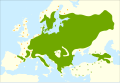
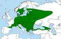
 Map genus Acer.png 1,252 × 612; 48 KB
-
 Acer campestre NY-dist-map.png 2,000 × 1,500; 64 KB
-
 Acer campestre range.png 4,250 × 2,362; 300 KB
-
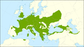
 Acer campestre range.svg 1,488 × 850; 928 KB
-
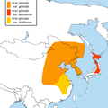 Acer ginnala map.png 800 × 800; 46 KB
-
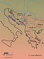 Acer heldreichii distributinal map.jpg 4,568 × 6,000; 1.48 MB
-
 Acer monspessulanum range.svg 1,488 × 850; 1.09 MB
-
 Acer platanoides range.svg 1,346 × 922; 925 KB
-
 Acer platanoides.png 902 × 587; 41 KB
-
 Acer pseudoplatanus range.svg 1,418 × 886; 974 KB
-
 Acer Section Ginnala map.png 2,000 × 800; 96 KB
-
 Acer tataricum map.png 1,200 × 800; 54 KB


