Category:Abel Tasmanbrug, Utrecht
Jump to navigation
Jump to search
| Object location | | View all coordinates using: OpenStreetMap |
|---|
bridge in Utrecht, Netherlands ,_514202.JPG) | |||||
| Upload media | |||||
| Instance of | |||||
|---|---|---|---|---|---|
| Part of | |||||
| Named after | |||||
| Location | Utrecht, Netherlands | ||||
| Crosses | |||||
| Heritage designation |
| ||||
 | |||||
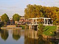
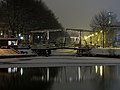
Nederlands: De Abel Tasmanbrug is een rijksmonumentale brug in de Nederlandse stad Utrecht. De brug is in 1906 aangelegd in de vorm van een dubbele ophaalbrug over de Leidse Rijn.
|
This is a category about rijksmonument number 514202
|
| Address |
|
Media in category "Abel Tasmanbrug, Utrecht"
The following 12 files are in this category, out of 12 total.
-
 Abel Tasmanbrug doorkijk.jpg 3,872 × 2,592; 2.92 MB
-
 Abel Tasmanbrug.jpg 3,872 × 2,592; 5.86 MB
-
 Abel-Tasmanbrug-1906 Utrecht Nederland.JPG 2,592 × 1,944; 2.7 MB
-
 De Rijksmunt te Utrecht bij nacht..JPG 3,264 × 1,648; 1.36 MB
-

-
 Leidsekade-3.JPG 2,894 × 2,171; 2.36 MB
-
 Utrecht Abel Tasmanbrug Rijksmonument 514202.jpg 3,181 × 2,385; 6.65 MB
-
 Utrecht, Leidseweg 90 (tegenover), 514202.JPG 2,016 × 1,347; 2.23 MB
-
 Utrecht-IMG 2798.JPG 2,592 × 1,944; 2.32 MB
-
 Utrecht-IMG 2831.JPG 2,592 × 1,944; 2.96 MB
-
 Utrecht-IMG 2887.JPG 2,592 × 1,944; 2.79 MB
-
 Utrecht-IMG 2893.JPG 2,592 × 1,944; 2.66 MB


