Category:Abbasi786786's maps of Pakistani administrative units
Jump to navigation
Jump to search
English: This is a category where I (Abbasi786786) can keep my own created maps on the districts, divisions, and provinces of Pakistan for organization purposes. I like knowing where everything is. I keep my maps up-to-date and only use official maps to create the maps you see below. My maps are all made using data from the Pakistan Bureau of Statistics and UN OCHA's HumData Database (which citypopulation.de uses).
The maps you can find in this category have borders dating up to September 30, 2020 in the cases of Punjab, Sindh, Khyber Pakhtunkhwa, Balochistan, Azad Jammu & Kashmir, and the Islamabad Capital Territory. In the case of Gilgit-Baltistan, the maps you can find in this category date to June 15, 2019, because I haven't been able to find any official maps showing the borders of Gilgit-Baltistan's four new districts (specifically Darel District, Tangir District, Yaseen District, and Rondu District), so these are not depicted. Only the ten districts dating to the 2017 census are depicted. If anyone can find any official maps for these districts (all fourteen districts), let me know on my talk page and I'll update the maps in this category as promptly as I can.
Have fun!
Updates:
September 05, 2020: Kemari District added to all existing national maps
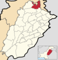
September 08, 2020: Locator maps of the districts of Punjab, Pakistan created. 36 files uploaded.
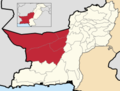
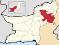
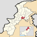
September 28, 2020: Added section with Districts of Khyber Pakhtunkhwa and maps of Divisions, Districts, and province-wide maps
The maps you can find in this category have borders dating up to September 30, 2020 in the cases of Punjab, Sindh, Khyber Pakhtunkhwa, Balochistan, Azad Jammu & Kashmir, and the Islamabad Capital Territory. In the case of Gilgit-Baltistan, the maps you can find in this category date to June 15, 2019, because I haven't been able to find any official maps showing the borders of Gilgit-Baltistan's four new districts (specifically Darel District, Tangir District, Yaseen District, and Rondu District), so these are not depicted. Only the ten districts dating to the 2017 census are depicted. If anyone can find any official maps for these districts (all fourteen districts), let me know on my talk page and I'll update the maps in this category as promptly as I can.
Have fun!
Updates:
September 05, 2020: Kemari District added to all existing national maps
September 08, 2020: Locator maps of the districts of Punjab, Pakistan created. 36 files uploaded.
September 28, 2020: Added section with Districts of Khyber Pakhtunkhwa and maps of Divisions, Districts, and province-wide maps
Subcategories
This category has the following 4 subcategories, out of 4 total.
Media in category "Abbasi786786's maps of Pakistani administrative units"
The following 108 files are in this category, out of 108 total.
-
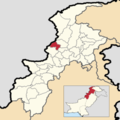
 Abbottabad District, Khyber Pakhtunkhwa.png 3,840 × 3,840; 1.23 MB
-
 Attock District, Punjab, Pakistan.png 3,880 × 4,000; 2.24 MB
-
 Bahawalnagar District, Punjab, Pakistan.png 3,880 × 4,000; 2.23 MB
-
 Bahawalpur District, Punjab, Pakistan.png 3,880 × 4,000; 2.22 MB
-
 Bahawalpur Division, Punjab, Pakistan.png 3,880 × 4,000; 2.15 MB
-
 Bajaur District, Khyber Pakhtunkhwa.png 3,840 × 3,840; 1.23 MB
-
 Bannu District, Khyber Pakhtunkhwa.png 3,840 × 3,840; 1.23 MB
-
 Bannu Division, Khyber Pakhtunkhwa.png 3,840 × 3,840; 1.23 MB
-
 Batagram District, Khyber Pakhtunkhwa.png 3,840 × 3,840; 1.23 MB
-
 Bhakkar District, Punjab, Pakistan.png 3,880 × 4,000; 2.25 MB
-
 Buner District, Khyber Pakhtunkhwa.png 3,840 × 3,840; 1.23 MB
-
 Chakwal District, Punjab, Pakistan.png 3,880 × 4,000; 2.25 MB
-
 Charsadda District, Khyber Pakhtunkhwa.png 3,840 × 3,840; 1.23 MB
-
 Chiniot District, Punjab, Pakistan.png 3,880 × 4,000; 2.26 MB
-
 Dera Ghazi Khan District, Punjab, Pakistan.png 3,880 × 4,000; 2.24 MB
-
 Dera Ghazi Khan Division, Punjab, Pakistan.png 3,880 × 4,000; 2.17 MB
-
 Dera Ismail Khan District, Khyber Pakhtunkhwa.png 3,840 × 3,840; 1.23 MB
-
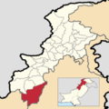
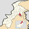
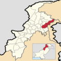
 Dera Ismail Khan Division, Khyber Pakhtunkhwa.png 3,840 × 3,840; 1.23 MB
-
 Districts of Balochistan, Pakistan with district names.png 3,960 × 3,000; 1.91 MB
-
 Districts of Balochistan, Pakistan.png 3,960 × 3,000; 1.51 MB
-
 Districts of Khyber Pakhtunkhwa, Pakistan with district names.png 3,840 × 3,840; 1.71 MB
-
 Districts of Khyber Pakhtunkhwa, Pakistan.png 3,840 × 3,840; 1.45 MB
-
 Districts of Pakistan (merged Karachi).png 2,720 × 1,890; 387 KB
-

-

-
 Districts of Pakistan with a transparent background (merged Karachi).png 2,720 × 1,890; 426 KB
-
 Districts of Pakistan with a transparent background.png 2,720 × 1,890; 447 KB
-
 Districts of Pakistan.png 2,720 × 1,890; 352 KB
-
 Districts of Punjab, Pakistan with district names.png 3,880 × 4,000; 2.97 MB
-
 Districts of Punjab, Pakistan.png 3,880 × 4,000; 2.64 MB
-
 Faisalabad District, Punjab, Pakistan.png 3,880 × 4,000; 2.25 MB
-
 Faisalabad Division, Punjab, Pakistan.png 3,880 × 4,000; 2.2 MB
-
 Gujranwala District, Punjab, Pakistan.png 3,880 × 4,000; 2.26 MB
-
 Gujranwala Division, Punjab, Pakistan.png 3,880 × 4,000; 2.2 MB
-
 Gujrat District, Punjab, Pakistan.png 3,880 × 4,000; 2.26 MB
-
 Hafizabad District, Punjab, Pakistan.png 3,880 × 4,000; 2.26 MB
-
 Hangu District, Khyber Pakhtunkhwa.png 3,840 × 3,840; 1.23 MB
-
 Haripur District, Khyber Pakhtunkhwa.png 3,840 × 3,840; 1.23 MB
-
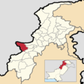
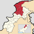
 Hazara Division, Khyber Pakhtunkhwa.png 3,840 × 3,840; 1.24 MB
-
 Jhang District, Punjab, Pakistan.png 3,880 × 4,000; 2.25 MB
-
 Jhelum District, Punjab, Pakistan.png 3,880 × 4,000; 2.25 MB
-
 Karak District, Khyber Pakhtunkhwa.png 3,840 × 3,840; 1.23 MB
-
 Khanewal District, Punjab, Pakistan.png 3,880 × 4,000; 2.25 MB
-
 Khushab District, Punjab, Pakistan.png 3,880 × 4,000; 2.25 MB
-
 Khyber District, Khyber Pakhtunkhwa.png 3,840 × 3,840; 1.23 MB
-
 Kohat District, Khyber Pakhtunkhwa.png 3,840 × 3,840; 1.23 MB
-
 Kohat Division, Khyber Pakhtunkhwa.png 3,840 × 3,840; 1.23 MB
-
 Kolai-Palas District, Khyber Pakhtunkhwa.png 3,840 × 3,840; 1.23 MB
-
 Kurram District, Khyber Pakhtunkhwa.png 3,840 × 3,840; 1.23 MB
-
 Lahore District, Punjab, Pakistan.png 3,880 × 4,000; 2.26 MB
-
 Lahore Division, Punjab, Pakistan.png 3,880 × 4,000; 2.21 MB
-
 Lakki Marwat District, Khyber Pakhtunkhwa.png 3,840 × 3,840; 1.23 MB
-
 Layyah District, Punjab, Pakistan.png 3,880 × 4,000; 2.25 MB
-
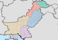
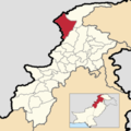
 Locator Map of Khyber Pakhtunkhwa, Pakistan.png 3,840 × 3,840; 1.22 MB
-
 Locator Map of Khyber Pakhtunkhwa, Pakistan.svg 3,840 × 3,840; 1.67 MB
-
 Lodhran District, Punjab, Pakistan.png 3,880 × 4,000; 2.26 MB
-
 Lower Chitral District, Khyber Pakhtunkhwa.png 3,840 × 3,840; 1.23 MB
-
 Lower Dir District, Khyber Pakhtunkhwa.png 3,840 × 3,840; 1.23 MB
-
 Lower Kohistan District, Khyber Pakhtunkhwa.png 3,840 × 3,840; 1.23 MB
-
 Makran Division, Balochistan, Pakistan.png 3,960 × 3,000; 1.51 MB
-
 Malakand District, Khyber Pakhtunkhwa.png 3,840 × 3,840; 1.23 MB
-
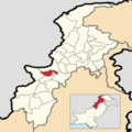
 Malakand Division, Khyber Pakhtunkhwa.png 3,840 × 3,840; 1.24 MB
-
 Mandi Bahauddin District, Punjab, Pakistan.png 3,880 × 4,000; 2.26 MB
-
 Mansehra District, Khyber Pakhtunkhwa.png 3,840 × 3,840; 1.23 MB
-
 Mardan District, Khyber Pakhtunkhwa.png 3,840 × 3,840; 1.23 MB
-
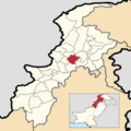
 Mardan Division, Khyber Pakhtunkhwa.png 3,840 × 3,840; 1.23 MB
-
 Mianwali District, Punjab, Pakistan.png 3,880 × 4,000; 2.25 MB
-
 Mohmand District, Khyber Pakhtunkhwa.png 3,840 × 3,840; 1.23 MB
-
 Multan District, Punjab, Pakistan.png 3,880 × 4,000; 2.25 MB
-
 Multan Division, Punjab, Pakistan.png 3,880 × 4,000; 2.21 MB
-
 Muzaffargarh District, Punjab, Pakistan.png 3,880 × 4,000; 2.24 MB
-
 Nankana Sahib District, Punjab, Pakistan.png 3,880 × 4,000; 2.25 MB
-
 Narowal District, Punjab, Pakistan.png 3,880 × 4,000; 2.26 MB
-
 Nasirabad Division, Balochistan, Pakistan.png 3,960 × 3,000; 1.54 MB
-
 North Waziristan District, Khyber Pakhtunkhwa.png 3,840 × 3,840; 1.23 MB
-
 Nowshera District, Khyber Pakhtunkhwa.png 3,840 × 3,840; 1.23 MB
-
 Okara District, Punjab, Pakistan.png 3,880 × 4,000; 2.25 MB
-
 Orakzai District, Khyber Pakhtunkhwa.png 3,840 × 3,840; 1.23 MB
-
 Pakpattan District, Punjab, Pakistan.png 3,880 × 4,000; 2.26 MB
-
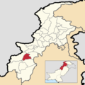
 Peshawar District, Khyber Pakhtunkhwa.png 3,840 × 3,840; 1.23 MB
-
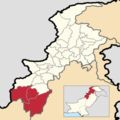
 Peshawar Division, Khyber Pakhtunkhwa.png 3,840 × 3,840; 1.23 MB
-
 Qalat Division, Balochistan, Pakistan.png 3,960 × 3,000; 1.47 MB
-
 Qasur District, Punjab, Pakistan.png 3,880 × 4,000; 2.25 MB
-
 Quetta Division, Balochistan, Pakistan.png 3,960 × 3,000; 1.54 MB
-
 Rahim Yar Khan District, Punjab, Pakistan.png 3,880 × 4,000; 2.23 MB
-
 Rajanpur District, Punjab, Pakistan.png 3,880 × 4,000; 2.23 MB
-
 Rakhshan Division, Balochistan, Pakistan.png 3,960 × 3,000; 1.5 MB
-
 Rawalpindi District, Punjab, Pakistan.png 3,880 × 4,000; 2.24 MB
-
 Rawalpindi Division, Punjab, Pakistan.png 3,880 × 4,000; 2.18 MB
-
 Sahiwal District, Punjab, Pakistan.png 3,880 × 4,000; 2.25 MB
-
 Sahiwal Division, Punjab, Pakistan.png 3,880 × 4,000; 2.23 MB
-
 Sargodha District, Punjab, Pakistan.png 3,880 × 4,000; 2.25 MB
-
 Sargodha Division, Punjab, Pakistan.png 3,880 × 4,000; 2.19 MB
-
 Shangla District, Khyber Pakhtunkhwa.png 3,840 × 3,840; 1.23 MB
-
 Sheikhupura District, Punjab, Pakistan.png 3,880 × 4,000; 2.25 MB
-
 Sialkot District, Punjab, Pakistan.png 3,880 × 4,000; 2.26 MB
-
 Sibi Division, Balochistan, Pakistan.png 3,960 × 3,000; 1.51 MB
-
 South Waziristan District, Khyber Pakhtunkhwa.png 3,840 × 3,840; 1.23 MB
-
 Swabi District, Khyber Pakhtunkhwa.png 3,840 × 3,840; 1.23 MB
-
 Swat District, Khyber Pakhtunkhwa.png 3,840 × 3,840; 1.23 MB
-
 Tank District, Khyber Pakhtunkhwa.png 3,840 × 3,840; 1.23 MB
-
 Toba Tek Singh District, Punjab, Pakistan.png 3,880 × 4,000; 2.25 MB
-
 Tor Ghar District, Khyber Pakhtunkhwa.png 3,840 × 3,840; 1.23 MB
-
 Upper Chitral District, Khyber Pakhtunkhwa.png 3,840 × 3,840; 1.23 MB
-
 Upper Dir District, Khyber Pakhtunkhwa.png 3,840 × 3,840; 1.23 MB
-
 Upper Kohistan District, Khyber Pakhtunkhwa.png 3,840 × 3,840; 1.23 MB
-
 Vehari District, Punjab, Pakistan.png 3,880 × 4,000; 2.25 MB
-
 Zhob Division, Balochistan, Pakistan.png 3,960 × 3,000; 1.48 MB


.png)


.png)
.png)
.png)