Category:AMSR images
Jump to navigation
Jump to search
The Advanced Microwave Scanning Radiometer has operated on three satellites:[1]
- AMSR-E on NASA's EOS Aqua spacecraft, launched May 4, 2002. The instrument stopped rotating Oct 4, 2011.
- AMSR on JAXA's ADEOS-II spacecraft, launched Dec 14, 2002. The satellite solar panels failed Oct 25, 2003.
- AMSR-2 on JAXA's GCOM-W1 spacecraft, launched May 18, 2012. This instrument is currently operating.
Media in category "AMSR images"
The following 42 files are in this category, out of 42 total.
-
 2005 Atlantic Hurricane Season, Image of the Day DVIDS755746.jpg 2,560 × 1,848; 1.61 MB
-
 2005 Atlantic Hurricane Season, Image of the Day DVIDS755747.jpg 4,096 × 2,048; 5.94 MB
-
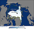
 2007 Arctic Sea Ice-ar.jpg 540 × 451; 84 KB
-
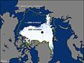
 2007 Arctic Sea Ice-fr.jpg 540 × 451; 150 KB
-
 2007 Arctic Sea Ice.jpg 540 × 451; 124 KB
-
2013 Daily Arctic Sea Ice from AMSR2 - May - September 2013.ogv 30 s, 1,920 × 1,080; 3.72 MB
-
2013 Daily Arctic Sea Ice from AMSR2 May - September 2013 01.webm 30 s, 640 × 360; 1.59 MB
-
2013 Daily Arctic Sea Ice from AMSR2 May - September 2013 02.webm 30 s, 1,280 × 720; 4.08 MB
-
2013 Daily Arctic Sea Ice from AMSR2 May - September 2013 03.webm 30 s, 1,920 × 1,080; 7.8 MB
-
 2013 Daily Arctic Sea Ice from AMSR2 May - September 2013 STILL IMAGE.png 5,760 × 3,240; 18.49 MB
-

-
 A Snapshot of Sea Ice (4989578009).jpg 1,280 × 720; 523 KB
-
 Amsr006.jpg 576 × 432; 110 KB
-
AMSR2 Daily Arctic Sea Ice - 2014.ogv 33 s, 1,920 × 1,080; 5.87 MB
-
 AMSRE Hurricane Carlos July 14 2009 1000Z.jpg 800 × 673; 212 KB
-
 AMSRE rainfall Hurricane Carlos July 14 2009 1012Z.jpg 800 × 673; 174 KB
-
 AMSRE Sea Ice Extent.png 720 × 450; 100 KB
-
AMSRE SSTAn M.ogv 28 s, 472 × 316; 1.04 MB
-
 AntarcticaTemps 1957-2006.jpg 720 × 480; 267 KB
-
Approaching the 2011 Arctic Sea Ice Minimum.ogv 35 s, 1,280 × 720; 17.73 MB
-
 Arctic 2007.JPG 540 × 404; 35 KB
-
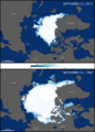
 Arctic Sea Ice - September 2009 to March 2010 (4497233026).jpg 6,400 × 3,600; 15.76 MB
-
 Arctic Sea Ice - September 2009 to March 2010 (HD VIDEO) (4497218048).jpg 1,280 × 720; 479 KB
-
 Arctic Sea Ice Minimum Comparison.png 720 × 1,005; 226 KB
-
 Atlantic2 amsre 2005216.jpg 540 × 450; 101 KB
-
 Earth's northern hemisphere with sea ice and clouds.jpg 18,000 × 13,500; 43.21 MB
-
 Global View of the Arctic and Antarctic.jpg 8,400 × 8,400; 5.41 MB
-
 Haiyan 2007-10-05 0204Z 36V.jpg 800 × 800; 378 KB
-
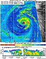
 JMA TD 9.jpg 500 × 500; 37 KB
-

-
 La Nina and Pacific Decadal Anomalies - April 2008.png 709 × 553; 487 KB
-
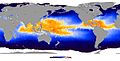
 LaNina Pacific 2006JanFeb.jpg 540 × 465; 109 KB
-
Maximum Antarctic Sea Ice 2014.ogv 42 s, 1,920 × 1,080; 3.87 MB
-
 Maximum of Antarctic ice in 2013.jpg 720 × 720; 177 KB
-
 Minimum of Arctic ice in 2012.png 720 × 480; 102 KB
-
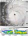
 Nida 09 ERC.jpg 800 × 800; 524 KB
-
 NOAA-CPC-NWS-NOAA SST Anoms 2015.jpg 920 × 596; 73 KB
-
 OceanTemps AMSRE 18sep05.jpg 1,440 × 730; 195 KB
-
 PIA12179 fig1.jpg 864 × 1,108; 364 KB
-
 PIA12179 fig2.jpg 864 × 1,108; 554 KB
-
 Sea Surface Temperature - November 2007.jpg 1,440 × 720; 669 KB
-


.jpg)


.jpg)
_(4497218048).jpg)


