Category:A697 road (Great Britain)
Jump to navigation
Jump to search

road in England | |||||
| Upload media | |||||
| Instance of | |||||
|---|---|---|---|---|---|
| Location | Northumberland, North East England, England | ||||
| Transport network |
| ||||
 | |||||
Media in category "A697 road (Great Britain)"
The following 54 files are in this category, out of 54 total.
-
 A cottage at Crookham Westfield Farm - geograph.org.uk - 1195603.jpg 640 × 480; 64 KB
-
 A697 northbound - geograph.org.uk - 3188091.jpg 640 × 429; 53 KB
-
 A697 northbound - geograph.org.uk - 3188179.jpg 640 × 480; 62 KB
-
 A697 northbound - geograph.org.uk - 3394795.jpg 640 × 452; 40 KB
-
 A697 towards Coldstream - geograph.org.uk - 1743214.jpg 640 × 480; 62 KB
-
 A697, Black Strip. - geograph.org.uk - 291159.jpg 640 × 480; 77 KB
-
 A697-B6345 Junction - geograph.org.uk - 1653860.jpg 640 × 413; 89 KB
-
 Ambulance Station - geograph.org.uk - 261006.jpg 640 × 475; 99 KB
-
 Bridge of Aln hotel - geograph.org.uk - 1204840.jpg 640 × 480; 66 KB
-
 Cat's Paw Picnic Site - geograph.org.uk - 389950.jpg 640 × 480; 140 KB
-
 Coldstream to Greenlaw Road - geograph.org.uk - 1041742.jpg 640 × 480; 42 KB
-

-
 Farm Buildings - geograph.org.uk - 260999.jpg 640 × 475; 84 KB
-
 Hedgeley station site geograph-3628885-by-Ben-Brooksbank.jpg 2,432 × 1,459; 3.94 MB
-
 Junction at the A697 - geograph.org.uk - 1131043.jpg 640 × 480; 86 KB
-
 Junction of A697 and A6089 Roads - geograph.org.uk - 938734.jpg 640 × 480; 66 KB
-
 Junction of B6352 and A697 roads - geograph.org.uk - 1195327.jpg 640 × 344; 66 KB
-
 Junction on the A697 near Greenlaw - geograph.org.uk - 1459377.jpg 640 × 480; 57 KB
-

-
 Longframlington United Reformed Church - geograph.org.uk - 429786.jpg 629 × 468; 122 KB
-

-
 Main A697 near Crookham - geograph.org.uk - 1939172.jpg 1,024 × 768; 223 KB
-
 Pallinsburn - geograph.org.uk - 1195468.jpg 640 × 480; 54 KB
-
 Parapet of a bridge over the Lilburn - geograph.org.uk - 644426.jpg 640 × 480; 64 KB
-
 Playground and A687 at Powburn - geograph.org.uk - 1332555.jpg 640 × 480; 96 KB
-
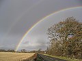 Rainbow over the A697 - geograph.org.uk - 288114.jpg 640 × 480; 45 KB
-
 Road junction - geograph.org.uk - 288949.jpg 640 × 480; 62 KB
-
 Road junction, Crookham - geograph.org.uk - 4778331.jpg 1,024 × 683; 350 KB
-
 Road to Lilburn - geograph.org.uk - 644418.jpg 640 × 475; 79 KB
-

-
 Snow plough, Newbigging Walls - geograph.org.uk - 1628562.jpg 640 × 359; 85 KB
-
 Tankerville Arms - geograph.org.uk - 261000.jpg 640 × 475; 84 KB
-

-

-
 The A697 heading east - geograph.org.uk - 1132001.jpg 640 × 430; 57 KB
-

-
 The A697 heading towards Houndslow - geograph.org.uk - 1458600.jpg 640 × 480; 44 KB
-

-
 The A697 in Northumberland - geograph.org.uk - 1195459.jpg 640 × 480; 57 KB
-

-
 The Baronial - geograph.org.uk - 1044435.jpg 640 × 480; 83 KB
-
 The Red Lion Inn at Milfield - geograph.org.uk - 288935.jpg 640 × 432; 54 KB
-
 UK road A697.PNG 597 × 184; 10 KB
-
 View down A697 at Rumbleton - geograph.org.uk - 1131142.jpg 640 × 480; 68 KB
-
 Wandy Burn - geograph.org.uk - 1497802.jpg 407 × 640; 66 KB
-
 Wanton Walls - geograph.org.uk - 291172.jpg 640 × 422; 46 KB
-

-
 Wooler Fire Station - geograph.org.uk - 261007.jpg 640 × 475; 85 KB
-
-
 A697 near Weldon Bridge - geograph.org.uk - 285668.jpg 600 × 450; 80 KB
-
 A697 south of Longframlington - geograph.org.uk - 260928.jpg 640 × 480; 107 KB
-

-
 The A697 near Thrunton - geograph.org.uk - 542529.jpg 635 × 430; 106 KB
-
 The A697 near Wooperton - geograph.org.uk - 327376.jpg 640 × 480; 79 KB


