Category:A635 road (England)
Jump to navigation
Jump to search
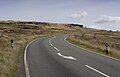
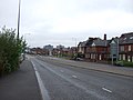
The A635 road (England) runs from Manchester to Doncaster

road in England .jpg) | |||||
| Upload media | |||||
| Instance of | |||||
|---|---|---|---|---|---|
| Location |
| ||||
| Transport network |
| ||||
 | |||||
Subcategories
This category has the following 2 subcategories, out of 2 total.
A
H
Media in category "A635 road (England)"
The following 101 files are in this category, out of 101 total.
-

-
 A635 by Marsh Lane junction - geograph.org.uk - 3436653.jpg 640 × 434; 47 KB
-
 A635 entering New Mill - geograph.org.uk - 3436657.jpg 640 × 427; 61 KB
-
 A635 heading east. - geograph.org.uk - 534180.jpg 640 × 438; 72 KB
-
 A635 Holmfirth to Greenfield Road - geograph.org.uk - 377952.jpg 640 × 480; 84 KB
-
 A635 Holmfirth to Greenfield Road - geograph.org.uk - 406333.jpg 640 × 480; 93 KB
-
 A635 junction near Cannon Hall Cawthorne - geograph.org.uk - 708537.jpg 640 × 480; 122 KB
-
 A635 looking towards New Mill - geograph.org.uk - 3398015.jpg 640 × 480; 86 KB
-
 A635 near Wessenden Head - geograph.org.uk - 3551249.jpg 750 × 563; 84 KB
-
 A635 road flooded at Darfield Bridge - geograph.org.uk - 480814.jpg 640 × 480; 141 KB
-

-
 A635 towards Holmfirth town centre - geograph.org.uk - 1439277.jpg 640 × 480; 46 KB
-

-
 Appliances and computer shop, Openshaw.JPG 4,320 × 3,240; 2.88 MB
-
 Ardsley sunburst - geograph.org.uk - 747654.jpg 640 × 489; 76 KB
-
 Barnsley Road Cawthorne - geograph.org.uk - 521429.jpg 640 × 480; 91 KB
-
 Boundary Stone at Junction of Marsh Lane.jpg 800 × 600; 182 KB
-
 Boundary Stone near Snowgate Head.jpg 800 × 600; 171 KB
-
 Car Park ^^^ A635 - geograph.org.uk - 379044.jpg 640 × 480; 75 KB
-
 Cockbrook, Ashton under Lyne - geograph.org.uk - 2589.jpg 512 × 323; 35 KB
-
 Crossing Saddleworth Moor on the A635 (50671478182).jpg 4,681 × 2,303; 1.22 MB
-
 Crossroads Upper Cumberworth - geograph.org.uk - 980264.jpg 640 × 480; 74 KB
-
 Darfield Ring. - geograph.org.uk - 502165.jpg 591 × 443; 69 KB
-
 Dean Head Hill towards the A635 - geograph.org.uk - 1561374.jpg 640 × 480; 116 KB
-
 Dearne Valley Motors. - geograph.org.uk - 521740.jpg 640 × 451; 83 KB
-
 Edderthorpe benches. - geograph.org.uk - 517410.jpg 640 × 373; 79 KB
-
 Electronic Advertising Beside The A635 - geograph.org.uk - 6253007.jpg 1,024 × 678; 170 KB
-

-

-

-

-
 Greenfield Road A635, Upperthong - geograph.org.uk - 1340026.jpg 640 × 424; 87 KB
-
 Harden Hill Road, Upperthong - geograph.org.uk - 494054.jpg 640 × 448; 68 KB
-
 Hollin brown knoll a635.jpg 3,351 × 2,160; 1.75 MB
-
 Holme Valley - geograph.org.uk - 1305965.jpg 640 × 480; 104 KB
-
 Holmfirth Station Road geograph-3685799-by-Ben-Brooksbank.jpg 1,538 × 2,205; 2.31 MB
-
 Holmfirth Town - geograph.org.uk - 981507.jpg 640 × 278; 30 KB
-
 Holmfirth, Greenfield Road (A635) - geograph.org.uk - 3345415.jpg 640 × 481; 457 KB
-
 Lay-by alongside the A635 - geograph.org.uk - 1382833.jpg 640 × 480; 60 KB
-
 Low Bridge - geograph.org.uk - 506754.jpg 640 × 480; 107 KB
-
 Manchester Road (A635) - geograph.org.uk - 3465866.jpg 640 × 480; 56 KB
-
 Manchester Road, Audenshaw - geograph.org.uk - 1706393.jpg 640 × 569; 147 KB
-
 Manchester Road, Audenshaw - geograph.org.uk - 874599.jpg 639 × 480; 97 KB
-
 Manchester Road, Mossley - geograph.org.uk - 1365631.jpg 640 × 518; 127 KB
-
 Mancunian Way (A635) - geograph.org.uk - 3365605.jpg 640 × 480; 54 KB
-
 Mancunian Way.jpg 1,600 × 1,200; 1.47 MB
-
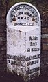 Milepost east of Holmfirth.jpg 405 × 689; 49 KB
-
 Milepost near railway viaduct, Denby Dale.jpg 744 × 1,263; 105 KB
-
 Milepost near Wheels Brook.jpg 489 × 665; 56 KB
-
 Milepost opposite Toss o'Coin pub.jpg 325 × 445; 37 KB
-
 Milepost west of Holmfirth.jpg 409 × 729; 71 KB
-
 Milepost, Bradshaw.jpg 427 × 640; 266 KB
-
 Milestone near Barnby Hall Farm, Cawthorne.jpg 480 × 640; 355 KB
-
 Milestone, Barugh Green.jpg 541 × 1,024; 89 KB
-
 Milestone, Clough Green, Cawthorne.jpg 545 × 800; 118 KB
-
 Milestone, Doncaster Road, Darfield.jpg 579 × 800; 81 KB
-
 Milestone, Lane Head Road, Cawthorne.jpg 675 × 1,024; 134 KB
-
 Milestone, Wilthorpe.jpg 480 × 640; 345 KB
-
 Milestone- In Place (geograph 6126493).jpg 744 × 1,325; 107 KB
-

-

-

-

-
 Ridgewood School - geograph.org.uk - 800815.jpg 640 × 480; 88 KB
-
 Road bridge - geograph.org.uk - 480963.jpg 640 × 480; 165 KB
-
 Saddleworth Moor - geograph.org.uk - 837440.jpg 640 × 480; 96 KB
-
 Skiers on Saddleworth Moor - geograph.org.uk - 993189.jpg 640 × 534; 99 KB
-
 Slow for the Ford Inn - geograph.org.uk - 1400131.jpg 640 × 480; 65 KB
-
 Snipe Inn - geograph.org.uk - 885430.jpg 640 × 480; 118 KB
-
 Snipe Inn - geograph.org.uk - 885432.jpg 638 × 480; 103 KB
-
 St Anne's Catholic Church, Openshaw (1).JPG 3,240 × 4,320; 2.68 MB
-
 Stagecoach bus (81).jpg 2,048 × 1,536; 899 KB
-
 The A635 at Knowl Height - geograph.org.uk - 1439241.jpg 640 × 480; 31 KB
-
 The A635 Huntsmans inn - geograph.org.uk - 1439243.jpg 640 × 480; 28 KB
-

-

-
 The Ford Inn - geograph.org.uk - 897864.jpg 640 × 480; 87 KB
-
 The Grove pub, Openshaw (1).JPG 4,320 × 3,240; 3.24 MB
-
 The Huntsman Inn - geograph.org.uk - 1305952.jpg 640 × 480; 109 KB
-
 The Huntsman Inn public house - geograph.org.uk - 1400125.jpg 640 × 480; 62 KB
-
 The Pennine Way crossing the A635 - geograph.org.uk - 1400108.jpg 640 × 411; 48 KB
-
 The Sovereign, Lane Head, Shepley - geograph.org.uk - 1275002.jpg 640 × 414; 72 KB
-

-
 Traffic on the A635 - geograph.org.uk - 4235445.jpg 640 × 430; 67 KB
-
 Turn right to Cudworth - geograph.org.uk - 744224.jpg 640 × 455; 96 KB
-
 UK road A635.PNG 568 × 184; 9 KB
-
 Waiting for the lights to change on the A635 - geograph.org.uk - 3362417.jpg 1,024 × 533; 69 KB
-
 Wessenden Head - geograph.org.uk - 837437.jpg 640 × 480; 100 KB
-
 Wessenden Head and A635 - geograph.org.uk - 131680.jpg 640 × 480; 90 KB
-

-

-
 Barnby Green Farm Track to the A635 road - geograph.org.uk - 520229.jpg 640 × 480; 114 KB
-
 Cat hill roundabout on A635. - geograph.org.uk - 519507.jpg 640 × 480; 79 KB
-

-
 Feeling Blue^ - geograph.org.uk - 48129.jpg 640 × 480; 43 KB
-
 Heading East on the A635 - geograph.org.uk - 546079.jpg 640 × 393; 78 KB
-
 Ivy Cottage on the A635 at Cawthorne - geograph.org.uk - 520238.jpg 640 × 480; 85 KB
-
 Morning on the A635 - geograph.org.uk - 546068.jpg 640 × 480; 93 KB
-
 The A635 Marr, looking West. - geograph.org.uk - 325399.jpg 640 × 480; 26 KB
-
 The A635 to Barnsley - geograph.org.uk - 531665.jpg 640 × 480; 86 KB
-
 The A635, Junction 37 with the A1(M) - geograph.org.uk - 282379.jpg 640 × 480; 83 KB


.jpg)


_-_geograph.org.uk_-_3345415.jpg)


_-_geograph.org.uk_-_3465866.jpg)


_-_geograph.org.uk_-_3365605.jpg)


.jpg)

.jpg)
.jpg)


.JPG)
.jpg)


.JPG)


_-_geograph.org.uk_-_282379.jpg)