Category:A55 road in Anglesey
Jump to navigation
Jump to search
Media in category "A55 road in Anglesey"
The following 27 files are in this category, out of 27 total.
-

-
 A55 at Gaerwen intersection - geograph.org.uk - 120634.jpg 640 × 480; 48 KB
-
 A55 Eastbound - geograph.org.uk - 38849.jpg 640 × 480; 61 KB
-
 A55 Expressway - geograph.org.uk - 153914.jpg 640 × 480; 68 KB
-
 A55 to Holyhead - geograph.org.uk - 1716720.jpg 2,816 × 2,112; 696 KB
-

-

-

-

-
 Eastbound carriageway of the A55 - geograph.org.uk - 186736.jpg 480 × 640; 48 KB
-
 Gaerwen interchange on A55 - geograph.org.uk - 121222.jpg 640 × 480; 35 KB
-

-
 Man-made lake east of Waen-hir bridge - geograph.org.uk - 887621.jpg 640 × 631; 96 KB
-
 The A55 for Holyhead - geograph.org.uk - 228750.jpg 640 × 480; 57 KB
-
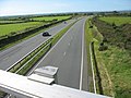
 The A55 from the A5 overbridge - geograph.org.uk - 819114.jpg 640 × 480; 56 KB
-
 The A55 from the B4545 overbridge - geograph.org.uk - 817677.jpg 640 × 480; 43 KB
-
 The A55 North Wales Expressway at the B4422 road bridge..jpg 1,600 × 1,200; 1.04 MB
-
 The A55 South of Gwalchmai - geograph.org.uk - 186675.jpg 640 × 480; 58 KB
-
 The A55 west of Dothan Bridge - geograph.org.uk - 971655.jpg 640 × 480; 81 KB
-

-
 View east along the A55 - geograph.org.uk - 780111.jpg 640 × 480; 61 KB
-
 View SE from Pont Cytir - geograph.org.uk - 895099.jpg 640 × 322; 45 KB
-

-
-
-
-


_at_Pont_Berw_-_geograph.org.uk_-_515170.jpg)


_from_a_crawling_bus_on_a_congested_A5114_-_geograph.org.uk_-_420348.jpg)