Category:A523 road (England)
Jump to navigation
Jump to search
road in England | |||||
| Upload media | |||||
| Instance of | |||||
|---|---|---|---|---|---|
| Location | Cheshire, North West England, England | ||||
| Transport network |
| ||||
| Has part(s) |
| ||||
| Length |
| ||||
| |||||
Subcategories
This category has the following 2 subcategories, out of 2 total.
B
G
Media in category "A523 road (England)"
The following 51 files are in this category, out of 51 total.
-
 192 Bus Terminus - geograph.org.uk - 3193278.jpg 640 × 533; 139 KB
-
 A523 - geograph.org.uk - 4264947.jpg 640 × 430; 49 KB
-
 A523 near Bottom House - geograph.org.uk - 5139352.jpg 640 × 480; 49 KB
-
 A523-A5149 junction, Poynton - geograph.org.uk - 2935981.jpg 3,456 × 2,304; 2.47 MB
-
 Adlington, the Legh Arms - geograph.org.uk - 263029.jpg 640 × 480; 137 KB
-
 Ash Almshouses, Leek.jpg 4,000 × 3,000; 2.23 MB
-
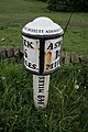
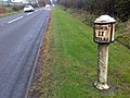 Milepost on the A523 - geograph.org.uk - 1549401.jpg 640 × 480; 92 KB
-
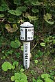
 Milepost on the A523 - geograph.org.uk - 1549414.jpg 640 × 480; 111 KB
-
 Milepost on the A523 - geograph.org.uk - 1549422.jpg 480 × 640; 130 KB
-
 Milepost on the A523 - geograph.org.uk - 1711012.jpg 1,600 × 1,067; 516 KB
-
 Milepost on the A523 - geograph.org.uk - 1712053.jpg 1,600 × 1,067; 384 KB
-
 The Morridge Side milepost - detail - geograph.org.uk - 1736946.jpg 480 × 640; 121 KB
-

-
 Flytip in lay-by - geograph.org.uk - 1707193.jpg 1,600 × 1,067; 777 KB
-
 Garage for sale - geograph.org.uk - 212899.jpg 640 × 506; 133 KB
-
 Harrington Arms - geograph.org.uk - 1549365.jpg 640 × 426; 77 KB
-
 Hope Green - geograph.org.uk - 345038.jpg 640 × 480; 74 KB
-
 Hug Bridge.jpg 3,456 × 2,304; 444 KB
-
 Hunthouse Plantation - geograph.org.uk - 460429.jpg 640 × 480; 181 KB
-
 Lay-by with Refreshments - geograph.org.uk - 1707191.jpg 1,600 × 1,067; 466 KB
-
 Low Bridge - geograph.org.uk - 248377.jpg 640 × 480; 118 KB
-
 Macclesfield Road - geograph.org.uk - 3193264.jpg 640 × 480; 125 KB
-
 Macclesfield Road Bridge - geograph.org.uk - 3193245.jpg 640 × 525; 156 KB
-
 Major road junction - geograph.org.uk - 58190.jpg 640 × 370; 38 KB
-
 Milepost at SK 047 524.jpg 427 × 640; 115 KB
-
 Milepost at SK 059 514.jpg 427 × 640; 128 KB
-
 Milepost at SK 07265065.jpg 427 × 640; 141 KB
-
 Milepost at SK 08685019.jpg 427 × 640; 154 KB
-
 Milepost at SK 10004950.jpg 427 × 640; 102 KB
-
 Milepost at SK 11414872.jpg 427 × 640; 106 KB
-
 Old Milestone by the A523, London Road North (geograph 5622785).jpg 1,147 × 1,682; 328 KB
-
-
 Old Milestone by the A523, south of Adlington (geograph 5622781).jpg 1,050 × 1,682; 286 KB
-
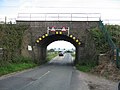
 Railway bridges on Macclesfield Road - geograph.org.uk - 5484594.jpg 1,024 × 798; 141 KB
-
 Rushton Spencer geograph-3503709-by-Ben-Brooksbank.jpg 2,282 × 1,448; 2.85 MB
-
 Rushton Spencer.JPG 1,600 × 1,200; 511 KB
-
 Smithy Green - geograph.org.uk - 210978.jpg 640 × 455; 87 KB
-
 Stoneyfold Lane - geograph.org.uk - 383100.jpg 640 × 421; 90 KB
-
 The A 523 near Calton Moor House - geograph.org.uk - 1705977.jpg 1,600 × 1,067; 489 KB
-
 The A 523 near Calton Moor House - geograph.org.uk - 1706909.jpg 1,600 × 1,067; 487 KB
-
 The A523 - geograph.org.uk - 947099.jpg 640 × 480; 89 KB
-
 The A523 east of Leek - geograph.org.uk - 1712162.jpg 1,600 × 1,067; 420 KB
-
 The A523 near Adlington - geograph.org.uk - 1707110.jpg 1,600 × 1,067; 413 KB
-
 The A523 near Rudyard Reservoir - geograph.org.uk - 1707053.jpg 1,600 × 1,067; 361 KB
-
 The A523 near Rudyard Reservoir - geograph.org.uk - 1707069.jpg 1,600 × 1,067; 499 KB
-
 The Fools Nook Public House - geograph.org.uk - 89182.jpg 640 × 480; 100 KB
-
 The George - geograph.org.uk - 944010.jpg 640 × 480; 62 KB
-
 The Queen's Arms Public House, Bosley - geograph.org.uk - 89200.jpg 640 × 480; 79 KB
-
 UK road A523.PNG 568 × 184; 8 KB
-
 Victoria Buildings, Leek.jpg 4,000 × 3,000; 2.11 MB
-
 Windy Ridge Cafe - geograph.org.uk - 423501.jpg 640 × 480; 54 KB


.jpg)
.jpg)
.jpg)


