Category:A226 road (England)
Jump to navigation
Jump to search
road which travels in a west-east direction in southeast London and north Kent  | |||||
| Upload media | |||||
| Instance of | |||||
|---|---|---|---|---|---|
| Location |
| ||||
| Transport network |
| ||||
| Length |
| ||||
| |||||
Media in category "A226 road (England)"
The following 32 files are in this category, out of 32 total.
-
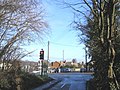 A226 crossroads, Higham - geograph.org.uk - 323049.jpg 640 × 481; 114 KB
-

-
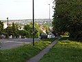
 A226 Gravesend Road, Higham - geograph.org.uk - 1398692.jpg 640 × 480; 70 KB
-
 Directions out of Strood, Gravesend Road 5118.jpg 4,608 × 3,456; 3.21 MB
-
 Gravesend Road Crossroads, Higham - geograph.org.uk - 1053752.jpg 640 × 481; 95 KB
-
 Gravesend Road, Strood 4955.jpg 4,608 × 3,456; 3.46 MB
-
 Gravesend Road, Strood 4956.jpg 4,608 × 3,456; 3.41 MB
-
 Gravesend Road, Strood 4957.jpg 4,608 × 3,456; 3.29 MB
-
 Gravesend Road, Strood 4958.jpg 4,608 × 3,456; 3.27 MB
-
 Strood Gravesend Road service station 5123.jpg 4,608 × 3,456; 3.13 MB
-
 Strood Gravesend Road service station from Rede Court Road 5117.jpg 4,608 × 3,456; 3.19 MB
-
 Strood, Gravesend Road 5092.jpg 4,608 × 3,456; 3.32 MB
-
 Strood, Gravesend Road 5093.jpg 4,608 × 3,456; 3.3 MB
-
 Strood, Gravesend Road 5094.jpg 4,608 × 3,456; 3.29 MB
-
 Strood, Gravesend Road 5095.jpg 4,608 × 3,456; 3.38 MB
-
 Strood, Gravesend Road 5097.jpg 4,608 × 3,456; 3.26 MB
-
 Strood, Gravesend Road 5098.jpg 4,608 × 3,456; 3.33 MB
-
 Strood, Gravesend Road 5099.jpg 4,608 × 3,456; 3.54 MB
-
 Strood, Gravesend Road 5120.jpg 4,608 × 3,456; 3.39 MB
-
 Strood, Gravesend Road 5121.jpg 4,608 × 3,456; 3.42 MB
-
 Strood, Gravesend Road 5122.jpg 4,608 × 3,456; 3.3 MB
-
 Strood, Gravesend Road doggy poo bin 5096.jpg 4,608 × 3,456; 3.53 MB
-
 Strood, Gravesend Road Strood Community Trail 5100.jpg 4,608 × 3,456; 3.52 MB
-
 All Saints Church, Swanscombe (1) - geograph.org.uk - 1411876.jpg 640 × 480; 66 KB
-
 All Saints, Swanscombe - geograph.org.uk - 1629582.jpg 640 × 480; 62 KB
-
 The A226 Thames Way - geograph.org.uk - 1558313.jpg 640 × 427; 56 KB
-
-

-
 The A226 Thames Way, near Ebbsfleet - geograph.org.uk - 1557985.jpg 640 × 427; 56 KB
-
 The Bird in Hand Pub, Dartford - geograph.org.uk - 1175309.jpg 640 × 481; 66 KB
-

-
 UK road A226.PNG 597 × 184; 8 KB


_-_geograph.org.uk_-_1411876.jpg)


