Category:A113 road (England)
Jump to navigation
Jump to search
road in England   | |||||
| Upload media | |||||
| Instance of | |||||
|---|---|---|---|---|---|
| Location | |||||
| Transport network |
| ||||
| Connects with | |||||
| |||||
Media in category "A113 road (England)"
The following 15 files are in this category, out of 15 total.
-
 Abridge, Essex.jpg 640 × 480; 83 KB
-
 'The Olde Kings Head' inn - geograph.org.uk - 731636.jpg 640 × 480; 92 KB
-
 Chigwell station geograph-3853854-by-Ben-Brooksbank.jpg 2,332 × 1,366; 2.89 MB
-
 Chigwell stn building.JPG 1,280 × 960; 343 KB
-
 Entrance to Abridge Village - geograph.org.uk - 91257.jpg 640 × 491; 111 KB
-
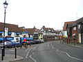
 High Road, Chigwell - geograph.org.uk - 92815.jpg 640 × 480; 124 KB
-

-
 Part of the original A113 - geograph.org.uk - 729347.jpg 640 × 430; 66 KB
-

-

-

-
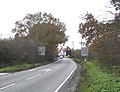
 The approach to Murrells Farm - geograph.org.uk - 729360.jpg 640 × 469; 87 KB
-
 Two buses at Chigwell - geograph.org.uk - 1486691.jpg 640 × 480; 73 KB
-
 UK road A113.PNG 597 × 184; 7 KB
-
 UK road A113.svg 405 × 190; 4 KB


