Category:A1079 road (England)
Jump to navigation
Jump to search
road in Northern England | |||||
| Upload media | |||||
| Instance of | |||||
|---|---|---|---|---|---|
| Location |
| ||||
| Transport network |
| ||||
 | |||||
Subcategories
This category has the following 4 subcategories, out of 4 total.
B
H
L
Media in category "A1079 road (England)"
The following 95 files are in this category, out of 95 total.
-
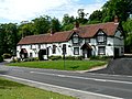 "The Altisidora", Bishop Burton - geograph.org.uk - 184469.jpg 640 × 480; 95 KB
-
 A1079 - B1230 Road Junction - geograph.org.uk - 1527888.jpg 640 × 480; 50 KB
-
 A1079 and a Bus From Hull - geograph.org.uk - 184368.jpg 640 × 480; 71 KB
-
 A1079 at Dunnington junction - geograph.org.uk - 284922.jpg 640 × 479; 60 KB
-
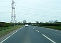 A1079 at power lines east of Wilberfoss (geograph 6824618).jpg 1,024 × 723; 184 KB
-
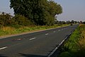
 A1079 at Wilberfoss (geograph 6824617).jpg 1,024 × 726; 174 KB
-
 A1079 High Point - geograph.org.uk - 825126.jpg 640 × 378; 140 KB
-
 A1079 Kexby - geograph.org.uk - 921100.jpg 640 × 480; 64 KB
-
 A1079 Looking to Hayton - geograph.org.uk - 236835.jpg 640 × 426; 123 KB
-

-
 A1079 through Kexby B ^ B to the left - geograph.org.uk - 5275420.jpg 3,641 × 2,628; 4.11 MB
-
 A1079 toward York - geograph.org.uk - 3166345.jpg 1,755 × 1,216; 481 KB
-
 A1079 towards Beverley - geograph.org.uk - 1861932.jpg 640 × 480; 73 KB
-
 A1079 towards Grimston Hill and York - geograph.org.uk - 3166367.jpg 2,560 × 1,920; 2.13 MB
-
 A1079 towards Market Weighton - geograph.org.uk - 1861944.jpg 640 × 480; 43 KB
-
 A1079 towards Wilberfoss - geograph.org.uk - 2371876.jpg 1,600 × 1,200; 541 KB
-
 A1079 towards York - geograph.org.uk - 1601069.jpg 640 × 480; 41 KB
-
 A1079 towards York - geograph.org.uk - 2384042.jpg 1,600 × 1,200; 511 KB
-
 A1079 York Road - geograph.org.uk - 5923791.jpg 1,024 × 741; 142 KB
-
 A1079 York Road near Bishop Burton College - geograph.org.uk - 5923800.jpg 1,024 × 739; 102 KB
-
 A164 - A1079 - geograph.org.uk - 97636.jpg 640 × 480; 135 KB
-
 A64 junction from A1079 - geograph.org.uk - 3166376.jpg 1,706 × 1,137; 338 KB
-
 Beverley Road enters East Yorkshire (geograph 3675973).jpg 800 × 600; 157 KB
-
 Bishop Burton - panoramio (1).jpg 979 × 734; 223 KB
-
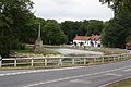 Bishop Burton Pond 1 (Nigel Coates).jpg 3,888 × 2,592; 4.59 MB
-
 Bridge over A1079 - geograph.org.uk - 836596.jpg 640 × 369; 136 KB
-
 Bridge over the A1079 - geograph.org.uk - 97945.jpg 640 × 480; 100 KB
-
 Bridleway at Scoreby Lodge on the A1079 - geograph.org.uk - 4076402.jpg 1,600 × 1,064; 845 KB
-
 Cottage on the A1079 - geograph.org.uk - 4084292.jpg 1,600 × 1,064; 825 KB
-
 Cycle path beside Beverley Road (A1079) (geograph 4351216).jpg 640 × 480; 78 KB
-
 Dunswell Lane IMG 3813 - panoramio.jpg 933 × 1,400; 408 KB
-
 Dunswell Rd IMG 3246 - panoramio.jpg 1,800 × 1,015; 461 KB
-
 East on the A1079 towards Four Lane Ends crossroad - geograph.org.uk - 3166330.jpg 1,706 × 1,137; 458 KB
-
 Farm on the A1079 at Four Lanes End, Dunnington - geograph.org.uk - 4084261.jpg 1,600 × 1,064; 819 KB
-
 Footpath leading to Cottage Plantation - geograph.org.uk - 4084280.jpg 1,600 × 1,064; 1.09 MB
-
 Four Lanes End Junction A1079 - geograph.org.uk - 3166323.jpg 1,857 × 1,170; 473 KB
-
 From Gardham Gap to the A1079 - geograph.org.uk - 184371.jpg 640 × 480; 75 KB
-
 Going down Weighton Hill - geograph.org.uk - 825162.jpg 640 × 314; 123 KB
-
 Hidden Dip - geograph.org.uk - 184372.jpg 640 × 480; 71 KB
-
 Highgate toward the A1079 York Road - geograph.org.uk - 5012788.jpg 4,608 × 3,456; 4.35 MB
-
 Holme Road, Market Weighton - geograph.org.uk - 1600624.jpg 640 × 480; 62 KB
-
 Houses alongside the A1079 - geograph.org.uk - 4084284.jpg 1,600 × 1,064; 694 KB
-
 Hull Road, York (A1079) heading east - geograph.org.uk - 2384909.jpg 1,600 × 1,200; 348 KB
-
 Humberside North.jpg 1,181 × 796; 218 KB
-
 Ings Bridge, Beverley Road, Hull - geograph.org.uk - 7150365.jpg 1,280 × 861; 232 KB
-
 Ivy House Farm on A1079 west of Kexby - geograph.org.uk - 3166315.jpg 2,560 × 1,920; 1.85 MB
-
 Junction of A1079 and Dauby Lane, west of Kexby - geograph.org.uk - 5275441.jpg 3,768 × 2,790; 2.96 MB
-
 Junction on the right Carr Lane to Yapham (geograph 5274527).jpg 3,789 × 2,813; 2.25 MB
-
 Junction with Hull Road - geograph.org.uk - 425324.jpg 640 × 478; 124 KB
-
 Killingwoldgraves roundabout - geograph.org.uk - 825042.jpg 640 × 331; 133 KB
-
 Lay-by on the A1079 - geograph.org.uk - 133621.jpg 640 × 480; 91 KB
-
 Lay-by on the A1079 - geograph.org.uk - 99938.jpg 640 × 480; 115 KB
-

-
 Layby on the A1079 - geograph.org.uk - 126003.jpg 640 × 480; 100 KB
-
 Leaving Hayton on the A1079 toward York - geograph.org.uk - 5274384.jpg 3,834 × 2,866; 3.83 MB
-
 Looking towards Shiptonthorpe - geograph.org.uk - 76913.jpg 640 × 393; 104 KB
-
 Manor Farm A1079 - geograph.org.uk - 236866.jpg 640 × 426; 129 KB
-
 Market Weighton bypass - geograph.org.uk - 933280.jpg 640 × 480; 182 KB
-
 Market Weighton Hill - geograph.org.uk - 825153.jpg 640 × 312; 116 KB
-
 Market Weighton Roundabout - geograph.org.uk - 825168.jpg 640 × 485; 166 KB
-
 Minor road junction on A1079 (geograph 5274542).jpg 3,532 × 2,408; 2.6 MB
-

-

-
 Petrol station and services on A1079 York Road - geograph.org.uk - 5558654.jpg 4,153 × 3,023; 3.44 MB
-
 Post Cottage, Bishop Burton - geograph.org.uk - 1500542.jpg 640 × 420; 54 KB
-
 Remember...... this way^ - geograph.org.uk - 1730927.jpg 3,438 × 2,626; 4.43 MB
-
 Road Junction - geograph.org.uk - 1422436.jpg 640 × 480; 70 KB
-
 Road junction south of Bramble Hill Farm (geograph 2459381).jpg 640 × 438; 47 KB
-
 Roundabout, A1079 - geograph.org.uk - 1601060.jpg 640 × 480; 52 KB
-
 The A1079 - geograph.org.uk - 1730844.jpg 3,642 × 2,262; 3.39 MB
-
 The A1079 at Grimston Bar, York - geograph.org.uk - 4096767.jpg 1,600 × 1,064; 674 KB
-
 The A1079 looking towards Hull - geograph.org.uk - 107791.jpg 640 × 480; 84 KB
-
 The A1079 looking towards York - geograph.org.uk - 107774.jpg 640 × 480; 73 KB
-
 The A1079 passing to the south of Wilberfoss (geograph 3166305).jpg 2,560 × 1,920; 2 MB
-
 The A1079 passing Wilberfoss toward Kexby Bridge (geograph 5274985).jpg 2,969 × 2,160; 1.95 MB
-
 The A1079, York Road, Shiptonthorpe - geograph.org.uk - 4073302.jpg 1,600 × 1,064; 629 KB
-
 The Altisidora, Bishop Burton - geograph.org.uk - 698535.jpg 640 × 480; 94 KB
-
 The Bull Inn pub sign - geograph.org.uk - 840620.jpg 447 × 640; 151 KB
-
 The bus shelter on the A1079 at Kexby - geograph.org.uk - 3131264.jpg 800 × 600; 291 KB
-
 The Crown, Shiptonthorpe - geograph.org.uk - 179587.jpg 640 × 480; 69 KB
-
 The end of Town Street, Hayton - geograph.org.uk - 1034643.jpg 640 × 343; 126 KB
-
 The Market Weighton Bypass - geograph.org.uk - 76920.jpg 640 × 480; 95 KB
-
 The new entrance to Bishop Burton College - geograph.org.uk - 825057.jpg 640 × 324; 149 KB
-
 The Road to York (A1079) - geograph.org.uk - 107821.jpg 640 × 480; 83 KB
-
 The Ship Inn - geograph.org.uk - 878866.jpg 640 × 427; 66 KB
-
 The Ship Inn, Shiptonthorpe - geograph.org.uk - 179582.jpg 640 × 480; 73 KB
-
 The Steer - geograph.org.uk - 109048.jpg 640 × 425; 71 KB
-
 Traffic at A64 Junction.jpg 2,560 × 1,920; 2.09 MB
-
 Turn right for Cherry Burton - geograph.org.uk - 825073.jpg 640 × 279; 108 KB
-
 UK road A1079.PNG 568 × 184; 8 KB
-
 Wellington Oak, Pocklington - geograph.org.uk - 1569979.jpg 640 × 426; 197 KB
-
 Wilberfoss In Bloom - geograph.org.uk - 746451.jpg 640 × 480; 109 KB
-
 York Road A1079 passing Barmby Moor - geograph.org.uk - 5558722.jpg 3,429 × 2,562; 2.67 MB
-
 York Road the A1079 west of Bishop Burton - geograph.org.uk - 3166167.jpg 1,920 × 1,280; 512 KB
-
 York Road, Bishop Burton - geograph.org.uk - 481110.jpg 640 × 465; 118 KB


.jpg)
.jpg)


.jpg)
.jpg)
.jpg)


_(geograph_4351216).jpg)


_heading_east_-_geograph.org.uk_-_2384909.jpg)


.jpg)


.jpg)
.jpg)
.jpg)


.jpg)


.jpg)
.jpg)


_-_geograph.org.uk_-_107821.jpg)


