Category:66 Krakowskie Przedmieście Street in Warsaw
Jump to navigation
Jump to search
| Object location | | View all coordinates using: OpenStreetMap |
|---|
library in Warsaw, Poland  | |||||
| Upload media | |||||
| Instance of |
| ||||
|---|---|---|---|---|---|
| Part of |
| ||||
| Location | Warsaw, Masovian Voivodeship, Poland | ||||
| Architect | |||||
| Heritage designation | |||||
| Inception |
| ||||
| Significant event |
| ||||
| official website | |||||
 | |||||
Subcategories
This category has only the following subcategory.
Media in category "66 Krakowskie Przedmieście Street in Warsaw"
The following 46 files are in this category, out of 46 total.
-
 Vogel Krakowskie Przedmieście.jpg 800 × 559; 94 KB
-
 66 Krakowskie Przedmieście Street in Warsaw 1b.jpg 1,200 × 1,600; 424 KB
-
 Canaletto Kościół św. Anny.JPG 500 × 449; 53 KB
-
 Centralna Biblioteka Rolnicza im. Michała Oczapowskiego w Warszawie.JPG 2,848 × 4,288; 3.04 MB
-
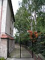
 Dziedziniec, Krakowskie Przedmieście 66, Warszawa.jpg 1,600 × 1,200; 392 KB
-
 Krakowskie Przedmiescie, Warsaw.JPG 1,655 × 2,773; 1.01 MB
-
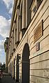
 Krakowskie Przedmieście 66 Warszawa 01.jpg 3,850 × 2,344; 1.42 MB
-
 Krakowskie Przedmieście 66 Warszawa plik a.JPG 3,249 × 2,474; 5.98 MB
-
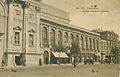 Muzeum Przemysłu i Rolnictwa w Warszawie 1908.jpg 1,627 × 1,047; 527 KB
-
 Muzeum Przemysłu i Rolnictwa w Warszawie w 1939.jpg 3,821 × 2,643; 3.21 MB
-
 Nowy Swiat utcarészlet - panoramio (2).jpg 3,584 × 2,016; 3.42 MB
-
 Odbudowa Krakowskie Przedmieście wiosna 1949.jpg 1,881 × 1,283; 1.21 MB
-
 PL Warsaw Krakowskie Przedmiescie Centralna Biblioteka Rolnicza.JPG 5,248 × 3,130; 3.77 MB
-
 Tablica Maria Skłodowska Muzeum Przemysłu i Rolnictwa.JPG 4,685 × 3,027; 1.96 MB
-
 Tablica Polskie Towarzystwo Krajoznawcze ul. Krakowskie Przedmieście 68.jpg 7,360 × 4,912; 20.87 MB
-
 Warsaw 2023 065.jpg 4,197 × 2,790; 6.11 MB
-
 Warszawa Muzeum Przemyslu i Rolnictwa.jpg 499 × 346; 78 KB
-
 Warszawa, klasztor, 1 poł. XVI, 1818, po 1945.jpg 2,317 × 1,738; 1,002 KB
-
 Warszawa, ul. Krakowskie Przedmieście 66 20170516 001.jpg 5,996 × 4,003; 8.83 MB
-
 Dwie mumie na wystawie starożytności w Muzeum Przemysłu i Rolnictwa (52705).jpg 2,890 × 2,965; 1.61 MB
-

-

-

-

-

-

-

-

-

-

-

-
 Muzeum Rzemiosł Warszawa (52832).jpg 5,858 × 6,611; 13.55 MB
-
 Obserwatorium meteorologiczne w Muzeum Rolnictwa i Przemysłu (54594).jpg 3,689 × 5,225; 3.05 MB
-
 Okazy ślusarstwa i wyrobów kutych w muzeum rzemieślniczem w Warszawie (59918).jpg 1,763 × 2,060; 845 KB
-
 Pracownia chemiczna p. Milicera, w muzeum przemysłowo - rolniczem w Warszawie (58731).jpg 2,848 × 2,299; 2.45 MB
-
 W Muzeum Przemysłu i Rolnictwa - Wystawa nasion (52908).jpg 4,550 × 6,466; 5.36 MB
-
 W Muzeum Przemysłu i Rolnictwa odczyt O węglu (52822).jpg 2,776 × 3,528; 1.56 MB
-
 Wykłady proff. Milicera i Boguskiego w Muzeum przemysłowo-rolniczem (52565).jpg 3,072 × 4,140; 3.3 MB
-
 Wystawa nasion w Muzeum Przemysłu i Rolnictwa w Warszawie (52639).jpg 3,331 × 4,699; 3.29 MB
-

-

-

-

-

-

-


.jpg)


.jpg)
.jpg)
.jpg)
.jpg)
.jpg)
.jpg)
.jpg)
.jpg)
.jpg)
.jpg)
.jpg)
.jpg)
.jpg)
.jpg)
.jpg)
.jpg)
.jpg)
.jpg)
.jpg)
.jpg)
.jpg)
.jpg)
.jpg)
.jpg)
.jpg)
.jpg)
.jpg)