Category:2 Pokoju Avenue (Scanmed health centre) in Kraków
Jump to navigation
Jump to search
| Object location | | View all coordinates using: OpenStreetMap |
|---|
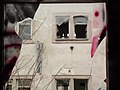
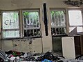
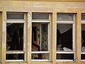
Demolished in January–Februar 2018 in connection with the unrealized plans to build a new seat of the Marshal's Office of the Lesser Poland Voivodeship
Media in category "2 Pokoju Avenue (Scanmed health centre) in Kraków"
The following 133 files are in this category, out of 133 total.
-
 Kraków, aleja Pokoju 2, dawna przychodnia przed wyburzeniem 01.jpg 4,000 × 3,000; 1.85 MB
-
 Kraków, aleja Pokoju 2, dawna przychodnia przed wyburzeniem 02.jpg 4,000 × 3,000; 2.88 MB
-
 Kraków, aleja Pokoju 2, dawna przychodnia przed wyburzeniem 03.jpg 4,000 × 3,000; 2.21 MB
-
 Kraków, aleja Pokoju 2, dawna przychodnia przed wyburzeniem 04.jpg 4,000 × 3,000; 5.95 MB
-
 Kraków, aleja Pokoju 2, dawna przychodnia przed wyburzeniem 05.jpg 3,000 × 4,000; 1.67 MB
-
 Kraków, aleja Pokoju 2, dawna przychodnia przed wyburzeniem 06.jpg 3,000 × 4,000; 1.3 MB
-
 Kraków, aleja Pokoju 2, dawna przychodnia przed wyburzeniem 07.jpg 4,000 × 3,000; 1.61 MB
-
 Kraków, aleja Pokoju 2, dawna przychodnia przed wyburzeniem 08.jpg 4,000 × 3,000; 2.47 MB
-
 Kraków, aleja Pokoju 2, dawna przychodnia przed wyburzeniem 09.jpg 4,000 × 3,000; 1.55 MB
-
 Kraków, aleja Pokoju 2, dawna przychodnia przed wyburzeniem 10.jpg 3,000 × 4,000; 2.18 MB
-
 Kraków, aleja Pokoju 2, dawna przychodnia przed wyburzeniem 100.jpg 4,000 × 3,000; 1.59 MB
-
 Kraków, aleja Pokoju 2, dawna przychodnia przed wyburzeniem 102.jpg 4,000 × 3,000; 2.13 MB
-
 Kraków, aleja Pokoju 2, dawna przychodnia przed wyburzeniem 103.jpg 3,000 × 4,000; 1.69 MB
-
 Kraków, aleja Pokoju 2, dawna przychodnia przed wyburzeniem 104.jpg 3,000 × 4,000; 1.55 MB
-
 Kraków, aleja Pokoju 2, dawna przychodnia przed wyburzeniem 105.jpg 4,000 × 3,000; 1.43 MB
-
 Kraków, aleja Pokoju 2, dawna przychodnia przed wyburzeniem 106.jpg 3,000 × 4,000; 1.52 MB
-
 Kraków, aleja Pokoju 2, dawna przychodnia przed wyburzeniem 107.jpg 4,000 × 3,000; 1.48 MB
-
 Kraków, aleja Pokoju 2, dawna przychodnia przed wyburzeniem 108.jpg 4,000 × 3,000; 3.11 MB
-
 Kraków, aleja Pokoju 2, dawna przychodnia przed wyburzeniem 109.jpg 4,000 × 3,000; 1.75 MB
-
 Kraków, aleja Pokoju 2, dawna przychodnia przed wyburzeniem 11.jpg 4,000 × 3,000; 1.6 MB
-
 Kraków, aleja Pokoju 2, dawna przychodnia przed wyburzeniem 110.jpg 4,000 × 3,000; 1.45 MB
-
 Kraków, aleja Pokoju 2, dawna przychodnia przed wyburzeniem 111.jpg 4,000 × 3,000; 1.61 MB
-
 Kraków, aleja Pokoju 2, dawna przychodnia przed wyburzeniem 112.jpg 4,000 × 3,000; 1.96 MB
-
 Kraków, aleja Pokoju 2, dawna przychodnia przed wyburzeniem 113.jpg 3,000 × 4,000; 2.02 MB
-
 Kraków, aleja Pokoju 2, dawna przychodnia przed wyburzeniem 114.jpg 3,000 × 3,928; 1.68 MB
-
 Kraków, aleja Pokoju 2, dawna przychodnia przed wyburzeniem 115.jpg 4,000 × 3,000; 2.49 MB
-
 Kraków, aleja Pokoju 2, dawna przychodnia przed wyburzeniem 116.jpg 4,000 × 3,000; 3.08 MB
-
 Kraków, aleja Pokoju 2, dawna przychodnia przed wyburzeniem 117.jpg 4,000 × 3,000; 3.19 MB
-
 Kraków, aleja Pokoju 2, dawna przychodnia przed wyburzeniem 118.jpg 4,000 × 3,000; 2.01 MB
-
 Kraków, aleja Pokoju 2, dawna przychodnia przed wyburzeniem 119.jpg 4,000 × 3,000; 7.24 MB
-
 Kraków, aleja Pokoju 2, dawna przychodnia przed wyburzeniem 12.jpg 4,000 × 3,000; 1.77 MB
-
 Kraków, aleja Pokoju 2, dawna przychodnia przed wyburzeniem 120.jpg 3,104 × 2,192; 1.3 MB
-
 Kraków, aleja Pokoju 2, dawna przychodnia przed wyburzeniem 121.jpg 3,000 × 4,000; 1.77 MB
-
 Kraków, aleja Pokoju 2, dawna przychodnia przed wyburzeniem 122.jpg 3,000 × 3,200; 1.42 MB
-
 Kraków, aleja Pokoju 2, dawna przychodnia przed wyburzeniem 123.jpg 4,000 × 3,000; 1.55 MB
-
 Kraków, aleja Pokoju 2, dawna przychodnia przed wyburzeniem 124.jpg 4,000 × 3,000; 2.19 MB
-
 Kraków, aleja Pokoju 2, dawna przychodnia przed wyburzeniem 125.jpg 2,169 × 2,153; 861 KB
-
 Kraków, aleja Pokoju 2, dawna przychodnia przed wyburzeniem 126.jpg 3,652 × 2,585; 1.37 MB
-
 Kraków, aleja Pokoju 2, dawna przychodnia przed wyburzeniem 127.jpg 3,652 × 2,585; 1.4 MB
-
 Kraków, aleja Pokoju 2, dawna przychodnia przed wyburzeniem 128.jpg 3,000 × 4,000; 2.8 MB
-
 Kraków, aleja Pokoju 2, dawna przychodnia przed wyburzeniem 129.jpg 3,880 × 2,458; 2.25 MB
-
 Kraków, aleja Pokoju 2, dawna przychodnia przed wyburzeniem 13.jpg 4,000 × 3,000; 1.62 MB
-
 Kraków, aleja Pokoju 2, dawna przychodnia przed wyburzeniem 130.jpg 3,000 × 4,000; 1.93 MB
-
 Kraków, aleja Pokoju 2, dawna przychodnia przed wyburzeniem 131.jpg 2,496 × 3,024; 837 KB
-
 Kraków, aleja Pokoju 2, dawna przychodnia przed wyburzeniem 132.jpg 2,065 × 2,249; 1.39 MB
-
 Kraków, aleja Pokoju 2, dawna przychodnia przed wyburzeniem 133.jpg 5,790 × 4,332; 4.64 MB
-
 Kraków, aleja Pokoju 2, dawna przychodnia przed wyburzeniem 134.jpg 2,880 × 3,224; 1.37 MB
-
 Kraków, aleja Pokoju 2, dawna przychodnia przed wyburzeniem 14.jpg 4,000 × 3,000; 1.48 MB
-
 Kraków, aleja Pokoju 2, dawna przychodnia przed wyburzeniem 15.jpg 4,000 × 3,000; 1.53 MB
-
 Kraków, aleja Pokoju 2, dawna przychodnia przed wyburzeniem 16.jpg 4,000 × 3,000; 1.51 MB
-
 Kraków, aleja Pokoju 2, dawna przychodnia przed wyburzeniem 17.jpg 3,000 × 4,000; 2.01 MB
-
 Kraków, aleja Pokoju 2, dawna przychodnia przed wyburzeniem 18.jpg 4,000 × 3,000; 1.76 MB
-
 Kraków, aleja Pokoju 2, dawna przychodnia przed wyburzeniem 19.jpg 4,000 × 3,000; 2.16 MB
-
 Kraków, aleja Pokoju 2, dawna przychodnia przed wyburzeniem 20.jpg 4,000 × 3,000; 2.42 MB
-
 Kraków, aleja Pokoju 2, dawna przychodnia przed wyburzeniem 21.jpg 4,000 × 3,000; 1.84 MB
-
 Kraków, aleja Pokoju 2, dawna przychodnia przed wyburzeniem 22.jpg 4,000 × 3,000; 1.46 MB
-
 Kraków, aleja Pokoju 2, dawna przychodnia przed wyburzeniem 23.jpg 4,000 × 3,000; 3.79 MB
-
 Kraków, aleja Pokoju 2, dawna przychodnia przed wyburzeniem 24.jpg 4,000 × 3,000; 2.83 MB
-
 Kraków, aleja Pokoju 2, dawna przychodnia przed wyburzeniem 25.jpg 3,000 × 4,000; 2.52 MB
-
 Kraków, aleja Pokoju 2, dawna przychodnia przed wyburzeniem 26.jpg 4,000 × 3,000; 1.76 MB
-
 Kraków, aleja Pokoju 2, dawna przychodnia przed wyburzeniem 27.jpg 4,000 × 3,000; 2.23 MB
-
 Kraków, aleja Pokoju 2, dawna przychodnia przed wyburzeniem 28.jpg 3,000 × 4,000; 1.5 MB
-
 Kraków, aleja Pokoju 2, dawna przychodnia przed wyburzeniem 29.jpg 3,000 × 4,000; 4.39 MB
-
 Kraków, aleja Pokoju 2, dawna przychodnia przed wyburzeniem 30.jpg 4,000 × 3,000; 1.76 MB
-
 Kraków, aleja Pokoju 2, dawna przychodnia przed wyburzeniem 31.jpg 3,000 × 4,000; 1.62 MB
-
 Kraków, aleja Pokoju 2, dawna przychodnia przed wyburzeniem 32.jpg 3,000 × 4,000; 3.52 MB
-
 Kraków, aleja Pokoju 2, dawna przychodnia przed wyburzeniem 33.jpg 4,000 × 3,000; 1.79 MB
-
 Kraków, aleja Pokoju 2, dawna przychodnia przed wyburzeniem 34.jpg 4,000 × 3,000; 2.18 MB
-
 Kraków, aleja Pokoju 2, dawna przychodnia przed wyburzeniem 35.jpg 4,000 × 3,000; 1.69 MB
-
 Kraków, aleja Pokoju 2, dawna przychodnia przed wyburzeniem 36.jpg 4,000 × 3,000; 2.98 MB
-
 Kraków, aleja Pokoju 2, dawna przychodnia przed wyburzeniem 37.jpg 4,000 × 3,000; 1.59 MB
-
 Kraków, aleja Pokoju 2, dawna przychodnia przed wyburzeniem 38.jpg 4,000 × 3,000; 1.85 MB
-
 Kraków, aleja Pokoju 2, dawna przychodnia przed wyburzeniem 39.jpg 4,000 × 3,000; 3.25 MB
-
 Kraków, aleja Pokoju 2, dawna przychodnia przed wyburzeniem 40.jpg 4,000 × 3,000; 3.08 MB
-
 Kraków, aleja Pokoju 2, dawna przychodnia przed wyburzeniem 41.jpg 4,000 × 3,000; 4.86 MB
-
 Kraków, aleja Pokoju 2, dawna przychodnia przed wyburzeniem 42.jpg 4,000 × 3,000; 1.52 MB
-
 Kraków, aleja Pokoju 2, dawna przychodnia przed wyburzeniem 43.jpg 4,000 × 3,000; 1.4 MB
-
 Kraków, aleja Pokoju 2, dawna przychodnia przed wyburzeniem 44.jpg 4,000 × 3,000; 1.63 MB
-
 Kraków, aleja Pokoju 2, dawna przychodnia przed wyburzeniem 45.jpg 3,000 × 4,000; 6.84 MB
-
 Kraków, aleja Pokoju 2, dawna przychodnia przed wyburzeniem 46.jpg 3,000 × 4,000; 2.09 MB
-
 Kraków, aleja Pokoju 2, dawna przychodnia przed wyburzeniem 47.jpg 4,000 × 3,000; 1.69 MB
-
 Kraków, aleja Pokoju 2, dawna przychodnia przed wyburzeniem 48.jpg 4,000 × 3,000; 2.26 MB
-
 Kraków, aleja Pokoju 2, dawna przychodnia przed wyburzeniem 49.jpg 4,000 × 3,000; 2.39 MB
-
 Kraków, aleja Pokoju 2, dawna przychodnia przed wyburzeniem 50.jpg 3,000 × 4,000; 2.11 MB
-
 Kraków, aleja Pokoju 2, dawna przychodnia przed wyburzeniem 51.jpg 4,000 × 3,000; 2.38 MB
-
 Kraków, aleja Pokoju 2, dawna przychodnia przed wyburzeniem 52.jpg 4,000 × 3,000; 4.16 MB
-
 Kraków, aleja Pokoju 2, dawna przychodnia przed wyburzeniem 53.jpg 4,000 × 3,000; 4.07 MB
-
 Kraków, aleja Pokoju 2, dawna przychodnia przed wyburzeniem 54.jpg 4,000 × 3,000; 2.91 MB
-
 Kraków, aleja Pokoju 2, dawna przychodnia przed wyburzeniem 55.jpg 4,000 × 3,000; 1.79 MB
-
 Kraków, aleja Pokoju 2, dawna przychodnia przed wyburzeniem 56.jpg 4,000 × 3,000; 2.17 MB
-
 Kraków, aleja Pokoju 2, dawna przychodnia przed wyburzeniem 57.jpg 4,000 × 3,000; 2.23 MB
-
 Kraków, aleja Pokoju 2, dawna przychodnia przed wyburzeniem 58.jpg 4,000 × 3,000; 2.06 MB
-
 Kraków, aleja Pokoju 2, dawna przychodnia przed wyburzeniem 59.jpg 4,000 × 3,000; 2.15 MB
-
 Kraków, aleja Pokoju 2, dawna przychodnia przed wyburzeniem 60.jpg 2,273 × 1,409; 606 KB
-
 Kraków, aleja Pokoju 2, dawna przychodnia przed wyburzeniem 61.jpg 3,000 × 4,000; 2.35 MB
-
 Kraków, aleja Pokoju 2, dawna przychodnia przed wyburzeniem 62.jpg 3,000 × 4,000; 1.89 MB
-
 Kraków, aleja Pokoju 2, dawna przychodnia przed wyburzeniem 63.jpg 2,117 × 1,505; 782 KB
-
 Kraków, aleja Pokoju 2, dawna przychodnia przed wyburzeniem 64.jpg 4,000 × 3,000; 2.77 MB
-
 Kraków, aleja Pokoju 2, dawna przychodnia przed wyburzeniem 65.jpg 4,000 × 3,000; 2.66 MB
-
 Kraków, aleja Pokoju 2, dawna przychodnia przed wyburzeniem 66.jpg 4,000 × 3,000; 1.67 MB
-
 Kraków, aleja Pokoju 2, dawna przychodnia przed wyburzeniem 67.jpg 3,000 × 4,000; 2.11 MB
-
 Kraków, aleja Pokoju 2, dawna przychodnia przed wyburzeniem 68.jpg 4,000 × 3,000; 2.7 MB
-
 Kraków, aleja Pokoju 2, dawna przychodnia przed wyburzeniem 69.jpg 4,000 × 3,000; 2.85 MB
-
 Kraków, aleja Pokoju 2, dawna przychodnia przed wyburzeniem 70.jpg 4,000 × 3,000; 1.77 MB
-
 Kraków, aleja Pokoju 2, dawna przychodnia przed wyburzeniem 71.jpg 4,000 × 3,000; 2.66 MB
-
 Kraków, aleja Pokoju 2, dawna przychodnia przed wyburzeniem 72.jpg 3,000 × 4,000; 2.95 MB
-
 Kraków, aleja Pokoju 2, dawna przychodnia przed wyburzeniem 73.jpg 3,000 × 4,000; 2.06 MB
-
 Kraków, aleja Pokoju 2, dawna przychodnia przed wyburzeniem 74.jpg 4,000 × 3,000; 2.8 MB
-
 Kraków, aleja Pokoju 2, dawna przychodnia przed wyburzeniem 75.jpg 4,000 × 3,000; 2.11 MB
-
 Kraków, aleja Pokoju 2, dawna przychodnia przed wyburzeniem 76.jpg 3,000 × 4,000; 2.29 MB
-
 Kraków, aleja Pokoju 2, dawna przychodnia przed wyburzeniem 77.jpg 4,000 × 3,000; 1.65 MB
-
 Kraków, aleja Pokoju 2, dawna przychodnia przed wyburzeniem 78.jpg 4,000 × 3,000; 3.66 MB
-
 Kraków, aleja Pokoju 2, dawna przychodnia przed wyburzeniem 79.jpg 3,000 × 4,000; 2.08 MB
-
 Kraków, aleja Pokoju 2, dawna przychodnia przed wyburzeniem 80.jpg 4,000 × 3,000; 1.77 MB
-
 Kraków, aleja Pokoju 2, dawna przychodnia przed wyburzeniem 81.jpg 3,000 × 4,000; 1.84 MB
-
 Kraków, aleja Pokoju 2, dawna przychodnia przed wyburzeniem 82.jpg 4,000 × 3,000; 2.58 MB
-
 Kraków, aleja Pokoju 2, dawna przychodnia przed wyburzeniem 83.jpg 4,000 × 3,000; 2.39 MB
-
 Kraków, aleja Pokoju 2, dawna przychodnia przed wyburzeniem 84.jpg 4,000 × 3,000; 2.2 MB
-
 Kraków, aleja Pokoju 2, dawna przychodnia przed wyburzeniem 85.jpg 4,000 × 3,000; 4.8 MB
-
 Kraków, aleja Pokoju 2, dawna przychodnia przed wyburzeniem 86.jpg 4,000 × 3,000; 2.27 MB
-
 Kraków, aleja Pokoju 2, dawna przychodnia przed wyburzeniem 87.jpg 4,000 × 3,000; 1.64 MB
-
 Kraków, aleja Pokoju 2, dawna przychodnia przed wyburzeniem 88.jpg 4,000 × 3,000; 2.08 MB
-
 Kraków, aleja Pokoju 2, dawna przychodnia przed wyburzeniem 89.jpg 4,000 × 3,000; 1.69 MB
-
 Kraków, aleja Pokoju 2, dawna przychodnia przed wyburzeniem 90.jpg 4,000 × 3,000; 1.9 MB
-
 Kraków, aleja Pokoju 2, dawna przychodnia przed wyburzeniem 91.jpg 4,000 × 3,000; 4.56 MB
-
 Kraków, aleja Pokoju 2, dawna przychodnia przed wyburzeniem 92.jpg 4,000 × 3,000; 1.93 MB
-
 Kraków, aleja Pokoju 2, dawna przychodnia przed wyburzeniem 93.jpg 4,000 × 3,000; 1.81 MB
-
 Kraków, aleja Pokoju 2, dawna przychodnia przed wyburzeniem 94.jpg 4,000 × 3,000; 1.78 MB
-
 Kraków, aleja Pokoju 2, dawna przychodnia przed wyburzeniem 95.jpg 4,000 × 3,000; 2.45 MB
-
 Kraków, aleja Pokoju 2, dawna przychodnia przed wyburzeniem 96.jpg 4,000 × 3,000; 2.01 MB
-
 Kraków, aleja Pokoju 2, dawna przychodnia przed wyburzeniem 97.jpg 4,000 × 3,000; 2.92 MB
-
 Kraków, aleja Pokoju 2, dawna przychodnia przed wyburzeniem 98.jpg 4,000 × 3,000; 1.52 MB
-
 Kraków, aleja Pokoju 2, dawna przychodnia przed wyburzeniem 99.jpg 572 × 799; 172 KB


