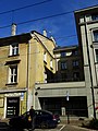
Category:26 Krakowska Street in Kraków
Jump to navigation
Jump to search
| Object location | | View all coordinates using: OpenStreetMap |
|---|
 | |||||
| Upload media | |||||
| Instance of | |||||
|---|---|---|---|---|---|
| Location | Kraków, Lesser Poland Voivodeship, Poland | ||||
| Street address |
| ||||
| Heritage designation |
| ||||
| Inception |
| ||||
 | |||||
| Address |
|
Media in category "26 Krakowska Street in Kraków"
The following 8 files are in this category, out of 8 total.
-
 22-28 Krakowska Street in Kraków in 2019.jpg 5,184 × 3,888; 5.71 MB
-
 26 Krakowska Street in Kraków in 2019.jpg 3,888 × 5,184; 6.23 MB
-
 26 Krakowska Street in Kraków, 2021 01.jpg 5,044 × 3,701; 4.13 MB
-
 26 Krakowska Street in Kraków, 2021 02.jpg 4,920 × 3,849; 3.99 MB
-
 26 Krakowska Street in Kraków, 2021 03.jpg 3,888 × 5,184; 4.54 MB
-
 26 Krakowska Street in Kraków, 2021 04.jpg 3,888 × 5,184; 4.23 MB
-
 26 Krakowska Street in Kraków, 2021 05.jpg 3,888 × 5,184; 4.26 MB
-
 Ulica Krakowska nr 26 B.jpg 3,456 × 2,592; 3.12 MB


