Category:20th-century maps of the Philippines
Jump to navigation
Jump to search
Countries of Asia: Afghanistan · Armenia‡ · Azerbaijan‡ · Bangladesh · Cambodia · People's Republic of China · Cyprus‡ · Egypt‡ · Georgia‡ · India · Indonesia‡ · Iran · Iraq · Israel · Japan · Jordan · Kazakhstan‡ · Kyrgyzstan · Laos · Lebanon · Malaysia · Mongolia · Myanmar · Nepal · North Korea · Oman · Pakistan · Philippines · Russia‡ · Saudi Arabia · Singapore · South Korea · Sri Lanka · Syria · Tajikistan · Thailand · Turkey‡ · Turkmenistan · United Arab Emirates · Uzbekistan · Vietnam · Yemen
Limited recognition: Abkhazia‡ · Taiwan · State of Palestine
‡: partly located in Asia
Limited recognition: Abkhazia‡ · Taiwan · State of Palestine
‡: partly located in Asia
Subcategories
This category has the following 9 subcategories, out of 9 total.
#
Media in category "20th-century maps of the Philippines"
The following 3 files are in this category, out of 3 total.
-
 Luzon Strait n7184.jpg 542 × 1,020; 77 KB
-
 San Agustin Church in Intramuros (Manila) 20180703, bild 47.jpg 2,321 × 4,135; 2 MB
-
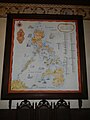 SanAgustinMuseumjf4688 12.JPG 3,456 × 4,608; 6.05 MB

_20180703,_bild_47.jpg)
