Category:2020 presidential election maps of Michigan
Jump to navigation
Jump to search
States of the United States: Alabama · Alaska · Arizona · Arkansas · California · Colorado · Connecticut · Delaware · Florida · Georgia · Hawaii · Idaho · Illinois · Indiana · Iowa · Kansas · Kentucky · Louisiana · Maine · Maryland · Massachusetts · Michigan · Minnesota · Mississippi · Missouri · Montana · Nebraska · Nevada · New Hampshire · New Jersey · New York · North Carolina · Ohio · Pennsylvania · Texas
Media in category "2020 presidential election maps of Michigan"
The following 11 files are in this category, out of 11 total.
-
 2020 US Presidential Election in Oakland County, Michigan.svg 512 × 531; 27 KB
-
 2020 US Presidential Election in Wayne County, Michigan.svg 512 × 343; 34 KB
-
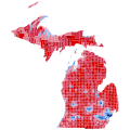
 MI President 2020.svg 810 × 810; 10.31 MB
-
 MI President Democratic Primary 2020.svg 810 × 810; 43 KB
-
 MI-20-pres-districts.svg 810 × 810; 77 KB
-
 Michigan County Flips 2020.svg 810 × 810; 36 KB
-
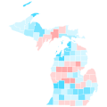 Michigan County Swing 2020.svg 810 × 810; 38 KB
-
 Michigan County Trend 2020.svg 810 × 810; 38 KB
-

-

-
 Michigan Presidential Results 2020 by Municipality.svg 810 × 810; 1.06 MB


.svg)

