Category:2020 in Victoria, Australia
Jump to navigation
Jump to search
States of Australia: New South Wales · Queensland · South Australia · Tasmania · Victoria · Western Australia
Internal territories of Australia: Australian Capital Territory · Jervis Bay · Northern Territory
External territories of Australia:
Internal territories of Australia: Australian Capital Territory · Jervis Bay · Northern Territory
External territories of Australia:
Deutsch: 2020 in Victoria, Australien
English: 2020 in Victoria, Australia
Svenska: 2020 i Victoria, Australien
Wikimedia category | |||||
| Upload media | |||||
| Instance of | |||||
|---|---|---|---|---|---|
| Category combines topics | |||||
| Victoria | |||||
state of Australia  View of Victoria, Australia taken during ISS Expedition 12 .svg)    | |||||
| Pronunciation audio | |||||
| Instance of |
| ||||
| Part of | |||||
| Named after | |||||
| Location | AUS | ||||
| Located in or next to body of water |
| ||||
| Capital | |||||
| Basic form of government |
| ||||
| Legislative body |
| ||||
| Executive body |
| ||||
| Highest judicial authority | |||||
| Official language |
| ||||
| Head of state |
| ||||
| Head of government |
| ||||
| Inception |
| ||||
| Highest point |
| ||||
| Population |
| ||||
| Area |
| ||||
| Elevation above sea level |
| ||||
| Replaces |
| ||||
| Maximum temperature record |
| ||||
| Minimum temperature record |
| ||||
| official website | |||||
 | |||||
Subcategories
This category has the following 29 subcategories, out of 29 total.
*
2
B
C
G
M
N
P
S
T
Media in category "2020 in Victoria, Australia"
The following 21 files are in this category, out of 21 total.
-
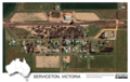 Aerial image of Serviceton, Victoria, Australia, 2020.tif 2,156 × 1,363; 11.21 MB
-
 Berry Street Richmond.jpg 2,976 × 3,656; 5.32 MB
-

-

-
 Bushfires in Victoria, Australia - January 15th, 2020 (49391007351).jpg 8,128 × 4,931; 22.66 MB
-

-
 Flinders Street entrance to Degraves Street subway, Melbourne (49982327833).jpg 3,456 × 5,184; 9.3 MB
-
 Intersection of Darebin Creek Trail and Main Yarra Trail, Kew East (50857881051).jpg 4,000 × 2,250; 4.34 MB
-
 Kew Synagogue (Norman Smorgon Hall).jpg 5,184 × 3,456; 14.06 MB
-
 Mount Cannibal.jpg 6,384 × 3,056; 3.86 MB
-
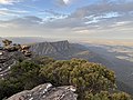
 Mount William (Duwil) view to the North at dusk, Grampians National Park.jpg 4,032 × 3,024; 4.03 MB
-
 Mount William (Duwil) view to the North, Grampians National Park.jpg 4,032 × 3,024; 3.39 MB
-
 Mount William (Duwil) view to the West, Grampians National Park.jpg 4,032 × 3,024; 3.66 MB
-
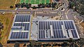 Mullum Mullim Stadium from the air 1.jpg 4,000 × 2,250; 3.97 MB
-
 Mullum Mullim Stadium from the air 2.jpg 4,000 × 2,250; 4.14 MB
-
 Mullum Mullim Stadium from the air 3.jpg 4,000 × 2,250; 3.6 MB
-
 Rounded noon-flower at Cape Schanck, Mornington Peninsula National Park.jpg 3,024 × 4,032; 4.19 MB
-
 St George's River Lookout, Lorne view to the South-West.jpg 4,032 × 3,024; 3.42 MB
-
 The Poppet Head.jpg 4,744 × 3,162; 4.5 MB
-
 Traffic on Chandler Highway, Kew.jpg 4,032 × 3,024; 2.42 MB
-
 Western side of Kew Tram Depot (50209703551).jpg 4,032 × 3,024; 3 MB

.jpg)
.jpg)
.jpg)
.jpg)
.jpg)
.jpg)
.jpg)

_view_to_the_North_at_dusk,_Grampians_National_Park.jpg)
_view_to_the_North,_Grampians_National_Park.jpg)
_view_to_the_West,_Grampians_National_Park.jpg)


.jpg)