Category:2009 maps of Africa
Jump to navigation
Jump to search
Temperate regions: North America · South America · Africa · Europe · Asia · Oceania – Polar regions: – Other regions:
| ← 2000 2001 2002 2003 2004 2005 2006 2007 2008 2009 → |
Subcategories
This category has the following 3 subcategories, out of 3 total.
2
E
- 2009 maps of Eritrea (2 F)
- 2009 maps of Ethiopia (2 F)
Media in category "2009 maps of Africa"
The following 7 files are in this category, out of 7 total.
-
 Domestic Flights from johannesburg International Airport.svg 600 × 400; 146 KB
-
 HDI-AFRICA-2009.png 837 × 607; 78 KB
-
 Horn of Africa. LOC 2010592338.jpg 3,249 × 4,247; 1 MB
-
 Horn of Africa. LOC 2010592338.tif 3,249 × 4,247; 39.48 MB
-
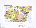 Northern Africa and the Middle East. LOC 2010585096.jpg 4,433 × 3,378; 1.3 MB
-
 Northern Africa and the Middle East. LOC 2010585096.tif 4,433 × 3,378; 42.84 MB
-
 Águila Real Ibérica.png 952 × 712; 22 KB


