Category:2007 maps of California
Jump to navigation
Jump to search
States of the United States: California · Florida · Georgia · Massachusetts · Michigan · Minnesota · Montana · Pennsylvania · South Carolina · Texas · Virginia – Washington, D.C.
| ← 2000 2002 2003 2004 2005 2006 2007 2008 2009 → |
Subcategories
This category has only the following subcategory.
Media in category "2007 maps of California"
The following 10 files are in this category, out of 10 total.
-
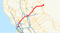 California Interstate 80.svg 1,152 × 640; 631 KB
-
 California Quake September 2 2007.jpg 612 × 625; 104 KB
-
 CISN Shakemap - 2007 Alum Rock earthquake.jpg 612 × 643; 108 KB
-
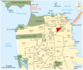
 Districts San Fransisco.png 618 × 520; 734 KB
-

-
 LA County Incorporated Areas Santa Monica highlighted.svg 950 × 780; 262 KB
-
 Quartiers de San Francisco.png 800 × 1,000; 212 KB
-
 Quartiers de San Francisco2.png 800 × 680; 219 KB
-

-
 SF Civic Center map.png 400 × 340; 85 KB


