Category:19th-century maps of Trinidad and Tobago
Jump to navigation
Jump to search
Media in category "19th-century maps of Trinidad and Tobago"
The following 8 files are in this category, out of 8 total.
-

-

-

-

-
 Admiralty Chart No 1821 Tobago Scarborough Port, Published 1847.jpg 5,512 × 3,888; 1.81 MB
-
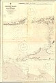 Admiralty Chart No 483a Trinidad Island and Gulf of Paria, Published 1869.jpg 11,074 × 16,238; 35.21 MB
-

-

.jpg)
%27_(16588978701).jpg)
_(14774254044).jpg)
.jpg)


