Category:19th-century maps of Tartary
Jump to navigation
Jump to search
Media in category "19th-century maps of Tartary"
The following 10 files are in this category, out of 10 total.
-
 1806 Cary Map of Tartary or Central Asia - Geographicus - Tartary-cary-1806.jpg 5,000 × 4,569; 8.57 MB
-
 Iran und Turan Persien, Afghanistan, Biludschistan, Turkestan eine geographische Skizze.tif 5,179 × 4,172; 61.82 MB
-
 Map of Persia, Arabia, Tartary, Afghanistan 1835.tif 3,917 × 5,007; 56.14 MB
-
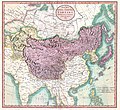
 John-Tallis-1851-Tibet-Mongolia-and-Manchuria-33621.jpg 4,030 × 3,102; 12.64 MB
-

-
 Turkestan or Independent Tartary.jpg 6,611 × 4,606; 8.48 MB
-

-
 General Map of Central Asia - I.png 1,397 × 1,024; 2.55 MB
-
 Map of the seat of war in Asia 1885.tif 6,980 × 5,548; 110.81 MB
-
 Tataria from Court Game of Geography MET DP862910.jpg 800 × 1,186; 366 KB


_-_Geographicus_-_IndepndentTartary-tallis-1851.jpg)


