Category:19th-century maps of Mexico City
Jump to navigation
Jump to search
Media in category "19th-century maps of Mexico City"
The following 26 files are in this category, out of 26 total.
-
-
 1850 Mitchell Map of Mexico ^ Texas - Geographicus - MexicoTexas-m-50.jpg 3,117 × 2,533; 2.37 MB
-

-
 192 of 'About Mexico, past and present ... With ... maps, etc' (11287886275).jpg 1,211 × 1,351; 487 KB
-
 210 of 'About Mexico, past and present ... With ... maps, etc' (11287972254).jpg 1,208 × 1,350; 480 KB
-
 AMPP D194 The valley of Mexico.jpg 1,604 × 1,797; 789 KB
-
 AMPP D212 The valley of Mexico.jpg 1,627 × 1,828; 821 KB
-

-
 1897 San Lorenzo closeup on Tacubaya map.jpg 509 × 292; 58 KB
-
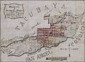
 1897 Tacubaya.jpg 4,747 × 3,302; 1.67 MB
-
 260 of 'Disertaciones sobre la Historia de la República Megicana, etc' (11023064535).jpg 1,487 × 1,961; 643 KB
-

-
 568 of 'A Popular History of the Mexican People' (11192992066).jpg 2,108 × 1,376; 556 KB
-

-

-
-

-
-
-
 Karte des Thales von Mexico.jpeg 1,421 × 1,242; 538 KB
-
 Map of Mexico City WDL2967.png 1,535 × 1,024; 2.3 MB
-
 Map of Tacubaya, D.F. 1897.jpg 4,310 × 3,045; 5.98 MB
-
 Mixcoac 1891.jpg 3,426 × 2,517; 3.78 MB
-
-
 United States attack of Mexico City, September 13th and 14th, 1847. LOC 2001620538.jpg 6,235 × 4,348; 3.03 MB
-
 United States attack of Mexico City, September 13th and 14th, 1847. LOC 2001620538.tif 6,235 × 4,348; 77.56 MB
.jpg)

.jpg)
.jpg)
.jpg)


.jpg)


.jpg)
%27_(11024364815).jpg)
.jpg)
.jpg)
.jpg)


.jpg)


