Category:19th-century maps of Eure
Jump to navigation
Jump to search
Subcategories
This category has the following 2 subcategories, out of 2 total.
Media in category "19th-century maps of Eure"
The following 7 files are in this category, out of 7 total.
-

-
 Carte du département de l'Eure - 1837.jpg 10,516 × 7,252; 11.28 MB
-
 Detail-carte-Tourville-CF-Paris-Rouen-1845.jpg 699 × 522; 190 KB
-
 Département de l'Eure - 1854.jpg 8,601 × 6,534; 9.54 MB
-
 Dépt. de l'Eure (région du nord) - Fonds Ancely - B315556101 A LEVASSEUR 030.jpg 3,054 × 2,076; 2.19 MB
-
 Eure on 1855 Spruneri Map of Gaul in Ancient Times.jpg 607 × 448; 296 KB
-
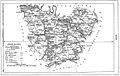 Géographie illustrée de la France et de ses colonies 073.jpg 1,185 × 752; 214 KB


_-_Fonds_Ancely_-_B315556101_A_LEVASSEUR_030.jpg)

