Category:1996 United States Senate election maps
Jump to navigation
Jump to search
Media in category "1996 United States Senate election maps"
The following 57 files are in this category, out of 57 total.
-
 1996 MA Senate.png 2,400 × 1,492; 116 KB
-
 1996 NM senate election.png 215 × 239; 23 KB
-

-
-

-

-

-
-

-

-
 1996 United States Senate election in Iowa results map by county.svg 810 × 532; 31 KB
-

-

-

-
 1996 United States Senate Election in Massachusetts by Town.svg 810 × 502; 182 KB
-

-
 1996 United States Senate election in Massachusetts results map by municipality.svg 2,100 × 1,300; 1.56 MB
-

-

-

-

-
-
-

-

-

-

-

-

-

-

-

-

-
 1996 United States Senate election in Texas results map by county.svg 810 × 769; 104 KB
-

-

-
-
 1996 United States Senate elections results map.svg 959 × 593; 83 KB
-

-

-

-

-
 1996 virginia senate election map.png 833 × 364; 34 KB
-
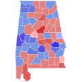
 96ALSenateCounties.PNG 379 × 600; 54 KB
-
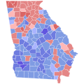
 96GASenateCounties.PNG 517 × 599; 90 KB
-
 96MNSenateCounties.PNG 527 × 600; 55 KB
-
 96MTSenateCounties.PNG 800 × 461; 79 KB
-
 96ORSenSpecialElectionCounties.PNG 800 × 596; 80 KB
-
 96SDSenateCounties.PNG 800 × 492; 76 KB
-
 96TXSenateCounties.PNG 599 × 583; 178 KB
-
 Colorado 2002 senate.PNG 275 × 217; 20 KB
-
 LASen96Counties.png 246 × 231; 3 KB
-
 MN US Senate 1996.svg 744 × 744; 4.36 MB
-

-
 96NESenateCounties.PNG 800 × 368; 62 KB
-
 New mexico 96.png 539 × 599; 38 KB
-
 Virginia (Senate Election, 1996).PNG 887 × 433; 26 KB


.PNG)