Category:1992 maps of the United States
Jump to navigation
Jump to search
Subcategories
This category has the following 7 subcategories, out of 7 total.
K
- 1992 maps of Kentucky (2 F)
N
O
- 1992 maps of Ohio (4 F)
P
S
- 1992 maps of South Carolina (2 F)
V
- 1992 maps of Virginia (2 F)
Media in category "1992 maps of the United States"
The following 170 files are in this category, out of 170 total.
-

-

-
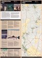
 Acadia National Park, Maine, official map and guide LOC 92683225.jpg 5,250 × 14,568; 10.45 MB
-
 Acadia National Park, Maine, official map and guide LOC 92683225.tif 5,250 × 14,568; 218.82 MB
-
 Alaska pictorial.jpg 1,354 × 647; 493 KB
-
 Antietam National Battlefield, Maryland LOC 92680492.jpg 5,114 × 4,720; 3.99 MB
-
 Antietam National Battlefield, Maryland LOC 92680492.tif 5,114 × 4,720; 69.06 MB
-
 Antietam National Battlefield, Maryland LOC 95680173.jpg 5,070 × 4,713; 3.81 MB
-
 Antietam National Battlefield, Maryland LOC 95680173.tif 5,070 × 4,713; 68.36 MB
-

-

-
 Big Bend National Park, Texas LOC 93684157.jpg 10,118 × 7,165; 12.63 MB
-
 Big Bend National Park, Texas LOC 93684157.tif 10,118 × 7,165; 207.41 MB
-
 Biscayne National Park, Florida LOC 92683270.jpg 10,030 × 7,069; 11.82 MB
-
 Bombay Hook National Wildlife Refuge, Delaware LOC 93686708.jpg 9,084 × 2,741; 3.08 MB
-
 Bombay Hook National Wildlife Refuge, Delaware LOC 93686708.tif 9,084 × 2,741; 71.24 MB
-

-

-
 Cape Cod National Seashore, Massachusetts, official map and guide LOC 92683340.jpg 5,070 × 7,070; 5.26 MB
-
 Cape Cod National Seashore, Massachusetts, official map and guide LOC 92683340.tif 5,070 × 7,070; 102.55 MB
-
 Cape Lookout National Seashore, North Carolina LOC 93681901.jpg 5,279 × 7,092; 5.22 MB
-
 Cape Lookout National Seashore, North Carolina LOC 93681901.tif 5,279 × 7,092; 107.11 MB
-
 Chattahoochee River National Recreation Area, Georgia LOC 92683269.jpg 5,160 × 7,119; 5.74 MB
-
 Chattahoochee River National Recreation Area, Georgia LOC 92683269.tif 5,160 × 7,119; 105.1 MB
-
 Chesapeake Bay watershed, highly erodible land on cropland, 1992 LOC 95684472.jpg 2,633 × 3,351; 1.08 MB
-
 Chesapeake Bay watershed, highly erodible land on cropland, 1992 LOC 95684472.tif 2,633 × 3,351; 25.24 MB
-
 Chesapeake Bay watershed, percent area hydrological soil group "A" 1992 LOC 95684475.jpg 2,632 × 3,369; 1.17 MB
-
 Chesapeake Bay watershed, percent area hydrological soil group "A" 1992 LOC 95684475.tif 2,632 × 3,369; 25.37 MB
-
 Chesapeake Bay watershed, percent area pastureland, 1992 LOC 95684474.jpg 2,640 × 3,369; 1.06 MB
-
 Chesapeake Bay watershed, percent area pastureland, 1992 LOC 95684474.tif 2,640 × 3,369; 25.45 MB
-
 Chesapeake Bay watershed, percent cropland area in corn, 1992 LOC 95684473.jpg 2,620 × 3,360; 1.07 MB
-
 Chesapeake Bay watershed, percent cropland area in corn, 1992 LOC 95684473.tif 2,620 × 3,360; 25.19 MB
-
 Chickamauga and Chattanooga National Military Park, Georgia-Tennessee LOC 93683051.jpg 10,107 × 4,764; 9.03 MB
-
 Chickamauga and Chattanooga National Military Park, Georgia-Tennessee LOC 93683051.tif 10,107 × 4,764; 137.76 MB
-
 Chickasaw National Recreation Area, Oklahoma LOC 93684149.jpg 10,145 × 4,807; 5.92 MB
-
 Chickasaw National Recreation Area, Oklahoma LOC 93684149.tif 10,145 × 4,807; 139.52 MB
-
 CIA declassified map of Groom Lake and Area 51.jpg 957 × 1,199; 163 KB
-

-

-

-
-

-
 Commission mission statement - (Altoona region of southwestern Pennsylvania). LOC 92686679.tif 4,040 × 3,424; 39.58 MB
-
 Conemaugh River Lake LOC 98689605.jpg 7,283 × 5,476; 4.83 MB
-
 Conemaugh River Lake LOC 98689605.tif 7,283 × 5,476; 114.1 MB
-
 Conservation planning and application, Massachusetts - January 1992 LOC 92683174.jpg 5,041 × 3,270; 1.77 MB
-
 Conservation planning and application, Massachusetts - January 1992 LOC 92683174.tif 5,041 × 3,270; 47.16 MB
-
 Crooked Creek Lake LOC 98689790.jpg 9,750 × 5,504; 5.15 MB
-
 Crooked Creek Lake LOC 98689790.tif 9,750 × 5,504; 153.53 MB
-
 Cumberland Gap, National Historical Park, Kentucky-Virginia-Tennessee LOC 92684875.jpg 10,086 × 4,726; 6.49 MB
-
 Cumberland Gap, National Historical Park, Kentucky-Virginia-Tennessee LOC 92684875.tif 10,086 × 4,726; 136.38 MB
-
 Cumberland Island National Seashore, Georgia - official map and guide LOC 92683392.jpg 5,187 × 7,087; 6.24 MB
-
 Cumberland Island National Seashore, Georgia - official map and guide LOC 92683392.tif 5,187 × 7,087; 105.17 MB
-

-
-

-
 Designated counties in Great Plains Conservation Program, P.L. 1021, Oklahoma LOC 92682930.tif 3,217 × 2,473; 22.76 MB
-
 Designated counties in rural abandoned mine program, Oklahoma LOC 93682953.jpg 3,275 × 2,467; 500 KB
-
 Designated counties in rural abandoned mine program, Oklahoma LOC 93682953.tif 3,275 × 2,467; 23.12 MB
-

-

-

-
-
 Fort Jefferson National Monument, Florida LOC 92683268.jpg 10,001 × 4,726; 9.26 MB
-
 Fort Jefferson National Monument, Florida LOC 92683268.tif 10,001 × 4,726; 135.23 MB
-
 Fort Pulaski National Monument, Georgia LOC 93683157.jpg 10,153 × 4,791; 8.78 MB
-
 Fort Pulaski National Monument, Georgia LOC 93683157.tif 10,153 × 4,791; 139.17 MB
-
 Gateway National Recreation Area, New York-New Jersey LOC 2009584097.jpg 10,156 × 7,172; 7.5 MB
-
 Gateway National Recreation Area, New York-New Jersey LOC 2009584097.tif 10,156 × 7,172; 208.39 MB
-
 George Washington Birthplace National Monument, Virginia LOC 93681945.jpg 13,510 × 6,420; 13.99 MB
-
 George Washington Birthplace National Monument, Virginia LOC 93681945.tif 13,510 × 6,420; 248.15 MB
-
 Gettysburg National Military Park, Pennsylvania, official map and guide LOC 92683620.jpg 10,131 × 4,779; 6.5 MB
-
 Gettysburg National Military Park, Pennsylvania, official map and guide LOC 92683620.tif 10,131 × 4,779; 138.52 MB
-
 Glen Echo Park, Glen Echo Park, Maryland LOC 93680412.jpg 5,114 × 4,704; 4.35 MB
-
 Glen Echo Park, Glen Echo Park, Maryland LOC 93680412.tif 5,114 × 4,704; 68.83 MB
-
 Glen Echo Park, Glen Echo Park, Maryland LOC 96681977.jpg 5,062 × 4,720; 4.27 MB
-
 Glen Echo Park, Glen Echo Park, Maryland LOC 96681977.tif 5,062 × 4,720; 68.36 MB
-
 Great Falls Park, Virginia LOC 94686077.jpg 6,922 × 6,380; 8.78 MB
-
 Great Falls Park, Virginia LOC 94686077.tif 6,922 × 6,380; 126.35 MB
-
 Great Plains Conservation Program LOC 93682070.jpg 3,431 × 4,474; 1.62 MB
-
 Great Plains Conservation Program LOC 93682070.tif 3,431 × 4,474; 43.92 MB
-
 Great Smoky Mountains National Park, North Carolina-Tennessee LOC 93681889.jpg 4,731 × 2,513; 3.06 MB
-
 Great Smoky Mountains National Park, North Carolina-Tennessee LOC 93681889.tif 4,731 × 2,513; 34.01 MB
-
 Gulf Islands LOC 92684983.jpg 10,094 × 4,738; 7.64 MB
-
 Gulf Islands LOC 92684983.tif 10,094 × 4,738; 136.83 MB
-
 Gulf Islands National Seashore, Mississippi and Florida LOC 2005631791.jpg 10,102 × 4,740; 7.17 MB
-
 Gulf Islands National Seashore, Mississippi and Florida LOC 2005631791.tif 10,102 × 4,740; 137 MB
-
 Harpers Ferry National Historical Park, West Virginia LOC 94681923.jpg 10,495 × 5,008; 7.03 MB
-
 Harpers Ferry National Historical Park, West Virginia LOC 94681923.tif 10,495 × 5,008; 150.37 MB
-
 Hawaii pictorial.jpg 1,353 × 425; 276 KB
-
 Hot Springs National Park, Arkansas LOC 92684624.jpg 10,594 × 5,113; 8.19 MB
-
 Hot Springs National Park, Arkansas LOC 92684624.tif 10,594 × 5,113; 154.97 MB
-
 Jacksonville downtown bridges.jpg 660 × 608; 125 KB
-
 John H. Kerr Dam & Reservoir, Virginia and North Carolina LOC 2013587301.jpg 9,569 × 7,308; 8.22 MB
-
 John H. Kerr Dam & Reservoir, Virginia and North Carolina LOC 2013587301.tif 9,569 × 7,308; 200.07 MB
-
 Kennesaw Mountain, Kennesaw Mountain National Battlefield Park, Georgia LOC 92683165.jpg 5,044 × 4,727; 4.27 MB
-
 Kennesaw Mountain, Kennesaw Mountain National Battlefield Park, Georgia LOC 92683165.tif 5,044 × 4,727; 68.22 MB
-
 Lakes in the Kansas City District LOC 97680537.jpg 6,546 × 5,062; 3.08 MB
-
 Lakes in the Kansas City District LOC 97680537.tif 6,546 × 5,062; 94.8 MB
-
 Land reasource regions and major land resource areas, Mississippi LOC 96681208.jpg 5,084 × 3,281; 1.63 MB
-
 Land reasource regions and major land resource areas, Mississippi LOC 96681208.tif 5,084 × 3,281; 47.72 MB
-
 Land resource regions and major land resource areas, Mississippi LOC 92684971.jpg 5,445 × 4,171; 2.54 MB
-
 Land resource regions and major land resource areas, Mississippi LOC 92684971.tif 5,445 × 4,171; 64.98 MB
-
 Location, Fishing Creek watershed, Frederick County, Maryland LOC 92683651.jpg 2,652 × 3,373; 1.53 MB
-
 Location, Fishing Creek watershed, Frederick County, Maryland LOC 92683651.tif 2,652 × 3,373; 25.59 MB
-
 Manassas National Battlefield Park, Virginia LOC 96680213.jpg 5,086 × 9,576; 6.43 MB
-
 Manassas National Battlefield Park, Virginia LOC 96680213.tif 5,086 × 9,576; 139.34 MB
-

-

-
 Martin Luther King, Jr., National Historic Site, Georgia LOC 92683393.jpg 10,051 × 4,767; 8.04 MB
-
 Moores Creek National Battlefield, North Carolina LOC 2007632349.tif 5,229 × 4,757; 71.17 MB
-
 National Gallery of Art, brief guide and plan. LOC 93680044.jpg 11,086 × 5,578; 6.08 MB
-
 New River Gorge, West Virginia LOC 2013587385.jpg 5,381 × 7,213; 6.22 MB
-
 New River Gorge, West Virginia LOC 2013587385.tif 5,381 × 7,213; 111.05 MB
-

-
 PA-671 project map, Pitchpine Run watershed, Jefferson County, Pennsylvania LOC 93680056.jpg 3,024 × 3,770; 1.23 MB
-
 PA-671 project map, Pitchpine Run watershed, Jefferson County, Pennsylvania LOC 93680056.tif 3,024 × 3,770; 32.62 MB
-
 Pea Ridge National Military Park, Arkansas - official map and guide LOC 92684982.jpg 5,068 × 4,724; 4.03 MB
-
 Pea Ridge National Military Park, Arkansas - official map and guide LOC 92684982.tif 5,068 × 4,724; 68.5 MB
-
 Prince William Forest Park, Virginia LOC 94686129.jpg 6,718 × 9,406; 9.72 MB
-
 Prince William Forest Park, Virginia LOC 94686129.tif 6,718 × 9,406; 180.79 MB
-

-

-

-

-
 Project-related sites, southwestern Pennsylvania LOC 93685203.jpg 11,026 × 7,260; 7.49 MB
-
 Project-related sites, southwestern Pennsylvania LOC 93685203.tif 11,026 × 7,260; 229.02 MB
-
 Resource conservation & development areas, Massachusetts - January 1992 LOC 92683173.jpg 5,065 × 3,281; 1.89 MB
-
 Resource conservation & development areas, Massachusetts - January 1992 LOC 92683173.tif 5,065 × 3,281; 47.55 MB
-
 San Antonio missions - official map and guide LOC 92684502.jpg 5,121 × 9,651; 6.81 MB
-
 San Antonio missions - official map and guide LOC 92684502.tif 5,121 × 9,651; 141.4 MB
-
 SCS administrative divisions and offices, Texas LOC 92684974.jpg 7,417 × 5,616; 2.44 MB
-
 SCS administrative divisions and offices, Texas LOC 92684974.tif 7,417 × 5,616; 119.17 MB
-

-
 Snow Totals.jpg 2,030 × 2,632; 1.53 MB
-
 South technical service area LOC 93684049.jpg 9,176 × 7,385; 4.47 MB
-
 South technical service area LOC 93684049.tif 9,176 × 7,385; 193.88 MB
-

-

-

-

-

-
 Spruce Knob-Seneca Rocks National Recreation Area, Monongahela National Forest LOC 2010589021.tif 9,841 × 5,506; 155.02 MB
-
 State of West Virginia - radar composite mosaic. LOC 2004632118.jpg 6,412 × 5,823; 9.49 MB
-
 State of West Virginia - radar composite mosaic. LOC 2004632118.tif 6,412 × 5,823; 106.82 MB
-
 Status of P.L. 566 watersheds, Massachusetts - January 1992 LOC 92683175.jpg 5,009 × 3,215; 1.67 MB
-
 Status of P.L. 566 watersheds, Massachusetts - January 1992 LOC 92683175.tif 5,009 × 3,215; 46.07 MB
-
 Status of soil surveys, Maine - February 1992 LOC 92683389.jpg 5,619 × 7,486; 4.76 MB
-
 Status of soil surveys, Maine - February 1992 LOC 92683389.tif 5,619 × 7,486; 120.35 MB
-
 Status of soil surveys, Massachusetts - January 1992 LOC 92683237.jpg 5,047 × 3,265; 1.91 MB
-
 Status of soil surveys, Massachusetts - January 1992 LOC 92683237.tif 5,047 × 3,265; 47.15 MB
-
 Status of upstream watershed development, Texas LOC 92684976.jpg 7,440 × 5,649; 2.93 MB
-
 Status of upstream watershed development, Texas LOC 92684976.tif 7,440 × 5,649; 120.24 MB
-

-

-
 Theodore Roosevelt Island, Washington DC - Washington LOC 92680483.jpg 6,189 × 5,803; 5.55 MB
-
 Theodore Roosevelt Island, Washington DC - Washington LOC 92680483.tif 6,189 × 5,803; 102.75 MB
-
 Union City Reservoir LOC 98689810.jpg 9,724 × 5,475; 4.3 MB
-
 Union City Reservoir LOC 98689810.tif 9,724 × 5,475; 152.32 MB
-
 USA (lower 48) pictorial.jpg 3,024 × 1,965; 3.39 MB
-

-

-
 Vicksburg National Military Park, Mississippi LOC 93682713.jpg 5,034 × 7,037; 6.87 MB
-
 Vicksburg National Military Park, Mississippi LOC 93682713.tif 5,034 × 7,037; 101.35 MB
-
 W. Kerr Scott Dam & Reservoir, Yadkin River, North Carolina. LOC 00556374.jpg 7,246 × 10,936; 14.54 MB
-
 W. Kerr Scott Dam & Reservoir, Yadkin River, North Carolina. LOC 00556374.tif 7,246 × 10,936; 226.71 MB
-
 Welcome to Washington LOC 92685250.jpg 6,906 × 8,573; 9.38 MB
-
 Welcome to Washington LOC 92685250.tif 6,906 × 8,573; 169.39 MB
-
 Woodcock Creek Lake LOC 98689750.jpg 9,733 × 5,499; 5.18 MB
-
 Woodcock Creek Lake LOC 98689750.tif 9,733 × 5,499; 153.13 MB


_Merritt_Island_National_Wildlife_Refuge,_Florida._LOC_97687044.jpg)


._LOC_92686679.jpg)


_LOC_93680157.jpg)


_pictorial.jpg)


