Category:1990s maps of Portugal
Jump to navigation
Jump to search
Countries of Europe: Albania · Armenia‡ · Austria · Azerbaijan‡ · Belarus · Belgium · Bosnia and Herzegovina · Bulgaria · Croatia · Czech Republic · Denmark · Estonia · Finland · France‡ · Georgia‡ · Germany · Greece · Hungary · Republic of Ireland · Italy · Kazakhstan‡ · Lithuania · Moldova · Netherlands‡ · Norway · Poland · Portugal‡ · Romania · Russia‡ · Serbia · Slovakia · Slovenia · Spain‡ · Sweden · Switzerland · Turkey‡ · Ukraine · United Kingdom
‡: partly located in Europe
‡: partly located in Europe
Media in category "1990s maps of Portugal"
The following 6 files are in this category, out of 6 total.
-
 Abortion Map Portugal 1998 de.svg 744 × 1,052; 210 KB
-
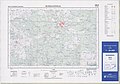
 MTN25-0648c1-1992-Couto Das Cegonhas (Portugal).jpg 7,825 × 5,472; 6.09 MB
-
 MTN25-0648c3-1992-Rosmaninhal (Portugal).jpg 7,821 × 5,462; 6.73 MB
-
 StrassenbahnGleisplanLisboa1995(angeschlossen).png 5,820 × 2,296; 1.03 MB
-
 StrassenbahnGleisplanLisboa1995.png 3,300 × 2,455; 1.05 MB
-
 TP air portugal 1998 portugal.jpg 923 × 1,200; 260 KB

.jpg)
.jpg)


.png)