Category:1980 maps of Connecticut
Jump to navigation
Jump to search
States of the United States: Alabama · Arkansas · California · Connecticut · Delaware · Florida · Georgia · Kentucky · Maine · Maryland · Massachusetts · Mississippi · New Jersey · New York · North Carolina · Ohio · Pennsylvania · South Carolina · Tennessee · Texas · Utah · Vermont · Virginia · West Virginia
| 1980 1981 1987 |
Media in category "1980 maps of Connecticut"
The following 7 files are in this category, out of 7 total.
-

-
 New Haven County, Connecticut LOC 88690906.jpg 16,512 × 14,196; 36.45 MB
-
 New Haven County, Connecticut LOC 88690906.tif 16,512 × 14,196; 670.64 MB
-
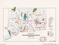 Status of water resource projects, Connecticut LOC 81690081.jpg 3,273 × 2,500; 1 MB
-
 Status of water resource projects, Connecticut LOC 81690081.tif 3,273 × 2,500; 23.41 MB
-
 Windham County, Connecticut LOC 88690921.jpg 9,994 × 12,178; 22.35 MB
-
 Windham County, Connecticut LOC 88690921.tif 9,994 × 12,178; 348.21 MB


