Category:1975 maps of Georgia (U.S. state)
Jump to navigation
Jump to search
States of the United States: Florida · Georgia · Hawaii · Louisiana · Maine · New Jersey · North Carolina · Ohio · Oklahoma · Texas · West Virginia – Washington, D.C.
| 1970 1971 1972 1975 1976 1977 1978 1979 → |
Media in category "1975 maps of Georgia (U.S. state)"
The following 6 files are in this category, out of 6 total.
-
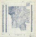 Georgia, Chickamauga and Chattanooga National Military Park (Chickamauga Battlefield) LOC 78694461.jpg 10,420 × 10,840; 16.23 MB
-
 Georgia, Chickamauga and Chattanooga National Military Park (Chickamauga Battlefield) LOC 78694461.tif 10,420 × 10,840; 323.16 MB
-
 Transportation map of Georgia. LOC 77694776.jpg 5,241 × 6,739; 4.05 MB
-
 Transportation map of Georgia. LOC 77694776.tif 5,241 × 6,739; 101.05 MB
-
 Transportation map of Georgia. LOC 77694825.jpg 5,208 × 6,699; 3.97 MB
-
 Transportation map of Georgia. LOC 77694825.tif 5,208 × 6,699; 99.82 MB
_LOC_78694461.jpg)