Category:1960s maps of Indonesia
Jump to navigation
Jump to search
Countries of Asia: Afghanistan · Armenia‡ · Cambodia · People's Republic of China · Cyprus‡ · Egypt‡ · India · Indonesia‡ · Iran · Iraq · Israel · Japan · Laos · Malaysia · Mongolia · Myanmar · North Korea · Pakistan · Philippines · Russia‡ · Saudi Arabia · Syria · Thailand · Turkey‡ · Turkmenistan · Uzbekistan · Vietnam
Limited recognition: Taiwan · State of Palestine
‡: partly located in Asia
Limited recognition: Taiwan · State of Palestine
‡: partly located in Asia
Subcategories
This category has the following 4 subcategories, out of 4 total.
- 1961 maps of Indonesia (3 F)
- 1962 maps of Indonesia (2 F)
- 1963 maps of Indonesia (1 F)
- 1964 maps of Indonesia (2 F)
Media in category "1960s maps of Indonesia"
The following 7 files are in this category, out of 7 total.
-
 1967 data of Burma, Thailand and Insulindia.jpg 3,960 × 2,896; 1.54 MB
-
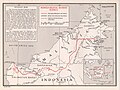 Indo Malay border.jpg 1,002 × 753; 264 KB
-
 Indo Malay border2.jpg 994 × 750; 227 KB
-
 Indonesia linguistic groups. LOC 75690917.jpg 11,344 × 4,280; 4.96 MB
-
 Indonesia linguistic groups. LOC 75690917.tif 11,344 × 4,280; 138.91 MB
-
 Republic of Indonesia (and Portuguese Timor). LOC 93682098.jpg 5,427 × 2,530; 1.72 MB
-
 Republic of Indonesia (and Portuguese Timor). LOC 93682098.tif 5,427 × 2,530; 39.28 MB


._LOC_93682098.jpg)