Category:1956 maps of Africa
Jump to navigation
Jump to search
Temperate regions: North America · South America · Africa · Europe · Asia · – Polar regions: – Other regions:
| ← 1950 1951 1952 1953 1954 1955 1956 1957 1958 1959 → |
Media in category "1956 maps of Africa"
The following 12 files are in this category, out of 12 total.
-
 AMS - Series P502 - North Africa - Index Map.jpg 2,015 × 1,122; 1.93 MB
-
 AMS - Series P502 - North Africa - NF-36-01 Bir Murr.jpg 5,000 × 3,804; 1.15 MB
-
 AMS - Series P502 - North Africa - NF-36-02 Wadi Kalabsha.jpg 5,000 × 3,814; 2.24 MB
-
 AMS - Series P502 - North Africa - NF-36-03 W. El-Quffa.jpg 5,000 × 3,813; 2.37 MB
-
 AMS - Series P502 - North Africa - NF-36-06 El-Diwan.jpg 5,000 × 3,809; 3.56 MB
-
 AMS - Series P502 - North Africa - NF-36-07 Gebel Seiga.jpg 5,000 × 3,774; 3.98 MB
-
 AMS - Series P502 - North Africa - NG-35-04 'Ain Khoman.jpg 5,000 × 3,804; 1.17 MB
-
 AMS - Series P502 - North Africa - NG-36-01 Asyut.jpg 5,000 × 3,796; 3.49 MB
-
 Gondar sector, East African Campaign.jpg 1,014 × 1,630; 1,022 KB
-
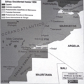
 Mapa de África Occicdental hasta 1956.png 1,210 × 1,210; 270 KB
-
 Mapas de África Occidental, p. 23.png 331 × 332; 190 KB
-
 Sudan politisch 1956.png 539 × 652; 219 KB


