Category:1950 maps of Massachusetts
Jump to navigation
Jump to search
States of the United States: Arkansas · California · Colorado · Georgia · Hawaii · Illinois · Iowa · Louisiana · Massachusetts · Michigan · Nebraska · New Jersey · New York · Ohio · Oregon · Pennsylvania · Texas · Utah · Wisconsin
| 1950 → |
Subcategories
This category has only the following subcategory.
Media in category "1950 maps of Massachusetts"
This category contains only the following file.
-
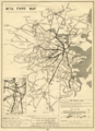 M.T.A. fare map, circa 1950.png 2,530 × 3,500; 14.56 MB
