Category:1947 maps of Asia
Jump to navigation
Jump to search
Temperate regions: North America · South America · Africa · Europe · Asia · – Polar regions: – Other regions:
| ← 1940 1941 1942 1943 1944 1945 1946 1947 1948 1949 → |
Subcategories
This category has the following 10 subcategories, out of 10 total.
C
- 1947 maps of China (13 F)
I
- 1947 maps of India (4 F)
- 1947 maps of Indonesia (2 F)
- 1947 maps of Iran (3 F)
- 1947 maps of Israel (3 F)
J
M
- 1947 maps of Malaysia (1 F)
- 1947 maps of Mongolia (2 F)
T
- 1947 maps of Thailand (2 F)
- 1947 maps of the Philippines (6 F)
Media in category "1947 maps of Asia"
The following 15 files are in this category, out of 15 total.
-
 1947 Nanhai Zhudao.png 2,654 × 3,840; 3.31 MB
-
 1947 Nanyang Qundao.png 3,057 × 1,975; 13.05 MB
-
 1947 Zhonghua Minguo Quantu.png 3,044 × 2,000; 13.79 MB
-
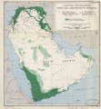
 Arab states (excluding Egypt), tribes and administrative divisions LOC 2001620692.jpg 5,634 × 6,072; 3.86 MB
-
 Arab states (excluding Egypt), tribes and administrative divisions LOC 2001620692.tif 5,634 × 6,072; 97.87 MB
-
 Asia politica - por J. Forest... - btv1b53196887t.jpg 15,813 × 12,190; 34.81 MB
-
 Map of Mashhad, 1947.jpg 7,321 × 8,350; 7.7 MB
-

-
 Molotov plan 1947.png 596 × 219; 9 KB
-
-
-

-
 United Bengal.png 7,926 × 6,304; 2.29 MB
-
 Zhonghua Minguo quan tu guo min xue xiao shi yung LOC 2006635194.jpg 9,079 × 6,414; 11.03 MB
-
 Zhonghua Minguo quan tu guo min xue xiao shi yung LOC 2006635194.tif 9,079 × 6,414; 166.61 MB


,_tribes_and_administrative_divisions_LOC_2001620692.jpg)


.jpg)
_-_DPLA_-_46f58d0b813f254daf1f790439ef53da.jpg)


