Category:1920s maps of Louisiana
Jump to navigation
Jump to search
States of the United States: Alabama · Alaska · Arizona · Arkansas · California · Colorado · Connecticut · Delaware · Florida · Georgia · Hawaii · Idaho · Illinois · Indiana · Iowa · Kansas · Kentucky · Louisiana · Maine · Maryland · Massachusetts · Michigan · Minnesota · Mississippi · Missouri · Nebraska · Nevada · New Hampshire · New Jersey · New Mexico · New York · North Carolina · North Dakota · Ohio · Oklahoma · Pennsylvania · Rhode Island · South Carolina · South Dakota · Tennessee · Texas · Utah · Vermont · Virginia · Washington · West Virginia · Wisconsin · Wyoming – Washington, D.C.
Puerto Rico
Puerto Rico
Subcategories
This category has the following 5 subcategories, out of 5 total.
- 1920 maps of Louisiana (2 F)
- 1921 maps of Louisiana (15 F)
N
- 1920s maps of New Orleans (4 F)
Media in category "1920s maps of Louisiana"
The following 3 files are in this category, out of 3 total.
-
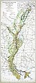 1927 LA Flood Map.jpg 2,292 × 5,214; 9.56 MB
-
 Bossier Parish and Webster Parish, Louisiana, 1925.png 435 × 613; 759 KB
-
 LouisianaPavedHighways1929.jpg 600 × 548; 116 KB


