Category:1920s maps of Armenia
Jump to navigation
Jump to search
Countries of Asia: Armenia‡ · Azerbaijan‡ · Cambodia · People's Republic of China · Egypt‡ · Georgia‡ · India · Indonesia‡ · Iran · Iraq · Israel · Japan · Jordan · Laos · Lebanon · Philippines · Russia‡ · Syria · Turkey‡ · Vietnam
Limited recognition: Taiwan · State of Palestine
‡: partly located in Asia
Limited recognition: Taiwan · State of Palestine
‡: partly located in Asia
Media in category "1920s maps of Armenia"
The following 4 files are in this category, out of 4 total.
-
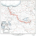 Boundary between Turkey and Armenia as determined by Woodrow Wilson.jpg 8,953 × 8,820; 42.55 MB
-
 Plan of Yerevan WDL9873.png 1,394 × 1,024; 2.18 MB
-

-
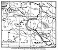 TreatyofKarsMap.jpg 1,000 × 864; 404 KB


