Category:1920 maps of Ukraine
Jump to navigation
Jump to search
Countries of Europe: Belarus · Croatia · Estonia · Finland · France‡ · Germany · Greece · Latvia · Lithuania · Norway · Poland · Russia‡ · Serbia · Slovenia · Spain‡ · Switzerland · Turkey‡ · Ukraine · United Kingdom
‡: partly located in Europe
‡: partly located in Europe
Media in category "1920 maps of Ukraine"
The following 6 files are in this category, out of 6 total.
-
 1920 Rowne map Poland by Henryk Arctowski BPL 10105.png 1,046 × 748; 1.3 MB
-
 London-geographical-institute the-peoples-atlas 1920 eukrainia.jpg 3,992 × 3,012; 2.12 MB
-
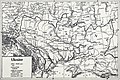
 The peoples atlas 1920; partition of Russia; Ukraine cropped.jpg 1,209 × 1,056; 330 KB
-
 Ukraine 1920.jpg 3,500 × 2,333; 2.36 MB
-

-
 Україна у своїх етноґрафічних межах.jpg 3,524 × 2,575; 2.84 MB


