Category:1917 maps of Europe
Jump to navigation
Jump to search
Temperate regions: North America · South America · Africa · Europe · Asia · – Polar regions: – Other regions:
English: 1917 maps of Europe
Español: Mapas de Europa en 1917
Suomi: Euroopan kartat vuodelta 1917
Română: Hărți ale Europei din 1917
Subcategories
This category has the following 14 subcategories, out of 14 total.
.
F
- 1917 maps of France (4 F)
G
I
- 1917 maps of Ireland (1 F)
- 1917 maps of Italy (1 F)
L
- 1917 maps of Lithuania (9 F)
N
- 1917 maps of Norway (49 F)
R
S
- 1917 maps of Spain (3 F)
- 1917 maps of Switzerland (4 F)
T
- 1917 maps of Turkey (5 F)
U
Media in category "1917 maps of Europe"
The following 17 files are in this category, out of 17 total.
-
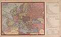
 17-Karte des russischen Kriegsgebiets zwischen Ostsee und Schwarzem Meer (1917).png 9,673 × 13,660; 212.92 MB
-
-
 Caricature map 1914--1915--1916--1917--??.jpg 5,223 × 3,909; 5.5 MB
-
 Carte Landudec 1917.jpg 1,127 × 883; 513 KB
-
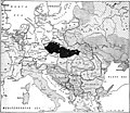
 Czechs and Slovaks in Austria-Hungary, 1917.jpg 671 × 869; 451 KB
-
 En 1788 Mirabeau disait deja - La Guerre est l’industrie Nationale de la Prusse.jpg 18,990 × 14,040; 77.75 MB
-
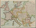 Europe embracing all the countries involved (5008156).jpg 5,000 × 3,979; 4.36 MB
-
 Heights of Moronvilliers.png 1,028 × 388; 859 KB
-
 La Guerre est l'industrie Nationale de la Prusse.jpg 6,500 × 4,812; 8.18 MB
-
 LocationMoldova1917.png 1,280 × 588; 128 KB
-
 Map of European states and nationalities in 1917 (without caption).jpg 1,878 × 1,627; 1.41 MB
-
 Map of European states and nationalities in 1917.jpg 2,061 × 2,002; 1.56 MB
-
 Outline map of Bohemian-Slovak state in The Heart of Europe.jpg 2,682 × 2,046; 714 KB
-
 Racial distribution of Czechs and Slovaks in 1917.jpg 2,732 × 1,755; 3.2 MB
-
 The battle fronts of Europe LOC 2016432164.tif 4,468 × 2,961; 37.85 MB
-

-
 Карта Поучитсльная Гражданъ Российскихъ 1917.jpg 11,635 × 7,686; 28.04 MB
.png)


.jpg)


.jpg)


