Category:1912 maps of South Dakota
Jump to navigation
Jump to search
States of the United States: California · Delaware · Georgia · Hawaii · Idaho · Illinois · Iowa · Kansas · Louisiana · Massachusetts · Michigan · Minnesota · Missouri · Nevada · New Mexico · New York · Ohio · Pennsylvania · South Dakota · Texas · Vermont · Virginia · Wisconsin · Wyoming
| ← 1910 1911 1912 1914 1915 1916 1917 1918 |
Subcategories
This category has the following 3 subcategories, out of 3 total.
Media in category "1912 maps of South Dakota"
The following 12 files are in this category, out of 12 total.
-

-
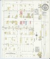 Sanborn Fire Insurance Map from Ashton, Spink County, South Dakota. LOC sanborn08203 004-1.tif 6,510 × 7,707; 143.55 MB
-

-
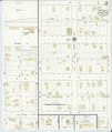 Sanborn Fire Insurance Map from Ashton, Spink County, South Dakota. LOC sanborn08203 004-2.tif 6,510 × 7,707; 143.55 MB
-

-
 Sanborn Fire Insurance Map from Warner, Brown County, South Dakota. LOC sanborn08272 003.jpg 6,510 × 7,707; 3.62 MB
-

-
 Sanborn Fire Insurance Map from Vermillion, Clay County, South Dakota. LOC sanborn08270 005-1.tif 6,510 × 7,707; 143.55 MB
-

-
 Sanborn Fire Insurance Map from Vermillion, Clay County, South Dakota. LOC sanborn08270 005-2.tif 6,510 × 7,707; 143.55 MB
-

-
 Sanborn Fire Insurance Map from Vermillion, Clay County, South Dakota. LOC sanborn08270 005-3.tif 6,510 × 7,707; 143.55 MB


