Category:1912 maps of Canada
Jump to navigation
Jump to search
Countries of North America: Belize · Canada · Mexico · United States of America‡
‡: partly located in North America
‡: partly located in North America
| ← 1910 1911 1912 1913 1914 1915 1916 1917 1918 1919 → |
English: Maps of Canada from 1912 or related to Canada in 1912
Français : Les cartes du Canada de 1912 ou se rapportant au Canada en 1912
Subcategories
This category has the following 2 subcategories, out of 2 total.
O
Q
- 1912 maps of Quebec (1 F)
Media in category "1912 maps of Canada"
The following 7 files are in this category, out of 7 total.
-
 Carte cadastrale de canton Ham.png 2,126 × 1,887; 3.35 MB
-
-

-

-
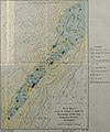
 Map of the mouths of the Nelson, Hayes and Fourteen Rivers (1912).jpg 3,581 × 2,051; 3.42 MB
-
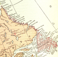 NFL in 1912.png 975 × 963; 1.75 MB
-
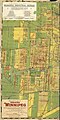 West Sheet of Chataway’s Map of Greater Winnipeg (1912) (2201273363).jpg 5,312 × 10,666; 8.37 MB

_(1912)_(14781636484).jpg)

_(14595704157).jpg)
.jpg)

_(2201273363).jpg)