Category:1910s maps of the Levant
Jump to navigation
Jump to search
English: This category is intended to collect old maps from the 1910s that depict the Levantine coast, i.e. the area of Cilicia, Syria and Palestine, including the areas of modern Israel and Lebanon. Compare also 20th-century maps of the Near East, which should depict larger areas, usually including Egypt, Turkey, Mesopotamia and Arabia. Old maps that are thematically intended to show the Holy Land and/or its history, should instead be sorted into Old maps of the Holy Land and its subcategories.
| 20th-century maps of the Levant: ← 1900s 1910s 1920s |
Subcategories
This category has only the following subcategory.
P
Media in category "1910s maps of the Levant"
The following 14 files are in this category, out of 14 total.
-
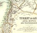 W. & A.K. Johnston. Asia Minor. 1911 DA.jpg 1,482 × 1,305; 438 KB
-
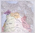
 W. & A.K. Johnston. Asia Minor. 1911 DB.jpg 920 × 1,154; 263 KB
-
 1913 Ottoman Geography Textbook Showing the Sanjak of Jerusalem and Palestine.jpeg 1,313 × 2,208; 461 KB
-
 1915 bird's eye view map of the Middle Eastern theatre of World War I.jpg 6,440 × 5,240; 5.28 MB
-
 Syria Beirut.png 9,966 × 7,584; 78.28 MB
-
 Syria Haifa.png 10,859 × 7,588; 85 MB
-
 Syria Jaffa - Damascus.png 11,807 × 8,693; 133.68 MB
-
 Syria Jerusalem (Kuds-esh-Sherif).png 9,703 × 8,444; 102.56 MB
-
 Syria Jerusalem - Damascus.png 9,163 × 11,981; 123.72 MB
-
 Syria Ladikiya.png 9,262 × 8,028; 73.55 MB
-
 Übersichtsskizze der deutschen Etappeneinrichtungen in der Türkei.jpg 7,171 × 5,951; 33.07 MB
-
-
 Syria Tripoli.png 9,832 × 7,532; 81.74 MB
-
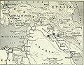 The war in April, 1918 (1918) (14576800000).jpg 3,072 × 2,376; 2.18 MB


.png)


_(14576800000).jpg)