Category:1910s maps of the British Empire
Jump to navigation
Jump to search
Subcategories
This category has the following 3 subcategories, out of 3 total.
Media in category "1910s maps of the British Empire"
The following 4 files are in this category, out of 4 total.
-
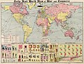 Daily Mail world map of war and commerce LOC 2013593057.jpg 11,817 × 9,001; 16.43 MB
-
 Diagram to illustrate contrast between British and Chinese Empires, 1916.jpg 1,942 × 1,075; 569 KB
-
 Southern and Northern Nigeria c. 1914.jpg 1,433 × 1,175; 843 KB
-
 The World Divided Into Land and Water Hemispheres, 1916.jpg 2,011 × 1,066; 507 KB


