Category:1910s maps of Denver, Colorado
Jump to navigation
Jump to search
Media in category "1910s maps of Denver, Colorado"
The following 8 files are in this category, out of 8 total.
-
 Map of Denver - DPLA - aa983ef4adbcaff0a801ca42ff735f70.jpg 9,000 × 8,659; 12.58 MB
-
 Map of the city and county of Denver - DPLA - 49ce5d837e708d5d86e718b0ea8bf841.jpg 8,948 × 9,000; 11.63 MB
-

-

-

-

-

-
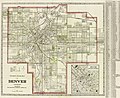 Clason's guide map of Denver, Colorado - DPLA - 1971a5ba59018d1aa253b07ba887c157.jpg 9,000 × 7,347; 11.7 MB


