Category:1909 maps of Massachusetts
Jump to navigation
Jump to search
States of the United States: California · Georgia · Hawaii · Idaho · Illinois · Indiana · Iowa · Kansas · Kentucky · Louisiana · Massachusetts · Michigan · Minnesota · Missouri · Nevada · New Jersey · New York · North Dakota · Ohio · Pennsylvania · South Dakota · Texas · Utah · Vermont · Washington · Wisconsin – Washington, D.C.
| ← 1900 1901 1902 1903 1904 1905 1906 1907 1908 1909 → |
Media in category "1909 maps of Massachusetts"
The following 19 files are in this category, out of 19 total.
-
 1909 map of Brockton, Massachusetts.jpg 6,944 × 4,860; 4.21 MB
-

-
 1909 map of the Boston and Northern Street Railway and Old Colony Street Railway.jpg 1,375 × 2,323; 1.02 MB
-
 1909 New York, New Haven and Hartford Railroad map.png 3,000 × 1,610; 5.29 MB
-
 1909 streetcar map of New England.jpg 2,653 × 4,000; 1.66 MB
-
 Annual report of the Massachusetts Highway Commission (1909) (14569172290).jpg 3,038 × 1,944; 1.48 MB
-
 Annual report of the Massachusetts Highway Commission (1909) (14753507034).jpg 3,160 × 1,982; 1.19 MB
-
 Buzzards Bay, Mass. (2673776441).jpg 2,000 × 1,024; 2.28 MB
-
 City of Haverhill, Massachusetts (9472522165).jpg 800 × 559; 107 KB
-
 City of Marlborough (9138716834).jpg 799 × 564; 92 KB
-
 City of Melrose (9472522369).jpg 800 × 561; 82 KB
-
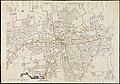
 Map of Boston (3720214841).jpg 1,024 × 707; 723 KB
-
 Map of maneuver ground, Massachusetts, 1909 (3855460061).jpg 2,000 × 1,265; 2.69 MB
-

-

-
 Massachusetts (2674268631).jpg 2,000 × 1,636; 3.57 MB
-
 Sanborn Boston 1909 Vol 1 Sheet 0c.png 6,019 × 7,231; 995 KB
-
 Sanborn Boston 1909 Vol 1 Sheet 49.png 6,019 × 7,254; 464 KB
-
 This week in Boston (1905) (14781212442).jpg 1,624 × 1,976; 524 KB


_(14569172290).jpg)
_(14753507034).jpg)
.jpg)
.jpg)
.jpg)
.jpg)
.jpg)
.jpg)
.jpg)
.jpg)
.jpg)


_(14781212442).jpg)