Category:1900s maps showing history
Jump to navigation
Jump to search
Subcategories
This category has the following 11 subcategories, out of 11 total.
1
- Atlas Antiquus (1909) (29 F)
- Atlas of European history (1909) (32 F)
Media in category "1900s maps showing history"
The following 154 files are in this category, out of 154 total.
-
 Plán Hradu Kozí.jpg 1,770 × 1,552; 743 KB
-
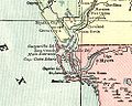 1901CharlotteHarborMap.jpg 500 × 400; 53 KB
-
 (Putzger) Europe 1559.jpg 3,946 × 3,048; 2.11 MB
-
 (Putzger) Germany and German Confederation, 1815-1866.jpg 3,845 × 3,026; 1.98 MB
-
 (Putzger) Prussia, 1415-1806.jpg 4,072 × 3,118; 2.27 MB
-
 (Putzger) Prussia, 1806-1918.jpg 3,699 × 3,111; 2.12 MB
-
 Central States of the Church c 1430.png 1,900 × 3,106; 12.57 MB
-
 East Africa, c.1500.jpg 736 × 1,074; 86 KB
-
 Europe after the Peace of Westphalia, 1648.jpg 4,045 × 3,000; 3.36 MB
-
 Germany 1648-1795.jpg 4,014 × 3,100; 4 MB
-
 Italy 1454 after the Peace of Lodi.jpg 3,000 × 3,840; 8.08 MB
-
 Lake Moeris.jpg 1,620 × 1,122; 949 KB
-
 Napoleonic northern Italy circa 1795–1801.jpg 861 × 635; 196 KB
-
 Original Providence Rhode Island town layout of homesteads.jpg 1,812 × 1,268; 656 KB
-
 Russland BV043571922.jpg 1,952 × 1,535; 309 KB
-
 Russland BV043571923.jpg 1,889 × 1,456; 458 KB
-
 1663Bowerie.jpg 3,248 × 4,800; 1.58 MB
-
 C+B-Assyria-DetailedMap.JPG 1,897 × 1,350; 757 KB
-
 C+B-Babylon-Map.PNG 543 × 837; 288 KB
-
 C+B-Damascus-Map.PNG 734 × 527; 212 KB
-
 C+B-Egypt-Fig1-SinaiAndNileDeltaInPluvial.PNG 498 × 597; 179 KB
-
 C+B-Egypt-Fig10-TabletOfMenesFromNaqada.PNG 635 × 585; 240 KB
-
 C+B-Egypt-Map2-NileAndEuphrates.JPG 526 × 943; 159 KB
-
 C+B-Egypt-Map4-EgyptInDetail.JPG 1,559 × 2,251; 808 KB
-
 C+B-Exodus-Map.PNG 713 × 853; 242 KB
-
 C+B-Galatia-Map.JPG 1,643 × 1,216; 630 KB
-
 C+B-Galilee-Map.JPG 1,131 × 1,600; 718 KB
-
 C+B-Geography-Map2-IsraeliteWorldviewDuringJudges.PNG 755 × 433; 76 KB
-
 C+B-Geography-Map3-IsraeliteWorldviewIn10thCentury.PNG 756 × 433; 94 KB
-
 C+B-Geography-Map4-IsraeliteWorldviewIn8thCentury.PNG 757 × 441; 226 KB
-
 C+B-Geography-Map5-IsraeliteWorldviewIn5thCentury.PNG 758 × 439; 249 KB
-
 C+B-Gilead-Map.JPG 1,042 × 1,590; 595 KB
-
 C+B-Goshen-MapOfVicinity.PNG 578 × 370; 53 KB
-
 C+B-Jerusalem-Map1-Terrain.PNG 468 × 586; 235 KB
-
 C+B-Judah-Map.JPG 1,402 × 966; 520 KB
-
 C+B-Mesopotamia-Map.JPG 1,672 × 1,079; 484 KB
-
 C+B-Negeb-Map.JPG 1,049 × 1,484; 482 KB
-
 C+B-Nineveh-Map2-Site.PNG 598 × 588; 269 KB
-
 C+B-Paul-MapOfEasternMediterranean.JPG 1,709 × 1,106; 618 KB
-
 C+B-Phoenicia-Map.JPG 845 × 1,332; 379 KB
-
 C+B-Syria-Map1-AccordingToMonuments.JPG 689 × 2,047; 534 KB
-
 C+B-Syria-Map2-AccordingToAmarnaLetters.JPG 670 × 2,048; 503 KB
-
 C+B-Trachonitis-Map.JPG 1,215 × 1,489; 438 KB
-
 C+B-Trade-Map1-HitherAsiaTradeRoutes.JPG 1,690 × 1,244; 552 KB
-
 C+B-Trade-Map2-PalestineTradeRoutes.JPG 845 × 1,287; 297 KB
-
 Encyclopaedia Biblica map of Syria, Mesopotamia, Babylonia, and Assyria.jpg 2,383 × 1,703; 1.59 MB
-
 Europa BV042512114.jpg 1,171 × 1,197; 204 KB
-
 Europa BV042518417 (cropped).jpg 1,132 × 1,066; 192 KB
-
 Europa BV042518459.jpg 1,954 × 1,337; 308 KB
-
 Europa BV042518474.jpg 1,954 × 1,337; 316 KB
-
 Europa BV042518560.jpg 1,954 × 1,337; 297 KB
-
 Europa BV042518575.jpg 1,954 × 1,337; 304 KB
-
 Europa BV042518589.jpg 1,954 × 1,337; 315 KB
-
 Europa BV043417545.jpg 1,954 × 1,337; 311 KB
-
 Europa BV043445407.jpg 1,954 × 1,337; 310 KB
-
 Gallia, Britannia, Germania, Provinciae Danuvienses, Heinrich Kiepert (1903).jpg 7,133 × 5,622; 8.43 MB
-
 Heinrich Kiepert. Hispania, Mauretania et Africa.jpg 8,499 × 5,638; 8.15 MB
-
 Map of Greece 1903 Peloponissos.png 854 × 886; 1.98 MB
-
 Mitteleuropa BV042511874.jpg 1,954 × 1,337; 295 KB
-
 Mitteleuropa BV042512124.jpg 1,954 × 1,337; 302 KB
-
 Mitteleuropa BV042517659.jpg 1,954 × 1,337; 297 KB
-
 Osteuropa BV042511931.jpg 1,954 × 1,337; 265 KB
-
 Osteuropa BV042518538.jpg 1,954 × 1,337; 324 KB
-
 Ostmitteleuropa BV042518421.jpg 1,954 × 1,337; 281 KB
-
 Ostmitteleuropa BV042518440.jpg 1,954 × 1,337; 292 KB
-
 Ostmitteleuropa BV042518465.jpg 1,954 × 1,337; 286 KB
-
 Ostmitteleuropa BV043417758.jpg 1,019 × 1,258; 188 KB
-
 Polen BV042518617.jpg 1,313 × 1,953; 277 KB
-
 Südeuropa BV042511812.jpg 1,135 × 1,190; 190 KB
-
 Ungarn BV042512105.jpg 1,584 × 1,127; 255 KB
-
 Westfloridaitsre00cham 0010.jpg 2,616 × 1,920; 456 KB
-
 Düsseldorf um 1288 zur Zeit seiner Stadterhebung.jpg 691 × 521; 119 KB
-
 Modern history; Europe (1904) (14579040280).jpg 1,976 × 2,944; 1.8 MB
-
 Modern history; Europe (1904) (14579040970).jpg 2,016 × 3,004; 1.92 MB
-
 Modern history; Europe (1904) (14579052990).jpg 2,024 × 2,884; 1.58 MB
-
 Modern history; Europe (1904) (14579066890).jpg 3,040 × 2,072; 1.88 MB
-
 Modern history; Europe (1904) (14579068250).jpg 3,072 × 1,768; 1.64 MB
-
 Modern history; Europe (1904) (14579083699).jpg 1,716 × 2,892; 1.46 MB
-
 Modern history; Europe (1904) (14579088628).jpg 2,992 × 2,024; 1.77 MB
-
 Modern history; Europe (1904) (14579105790).jpg 1,768 × 2,916; 1.44 MB
-
 Modern history; Europe (1904) (14579112078).jpg 1,772 × 2,908; 1.27 MB
-
 Modern history; Europe (1904) (14579125700).jpg 3,024 × 1,988; 1.49 MB
-
 Modern history; Europe (1904) (14579136218).jpg 2,960 × 1,724; 2.17 MB
-
 Modern history; Europe (1904) (14579139950).jpg 3,008 × 2,012; 1.8 MB
-
 Modern history; Europe (1904) (14579170718).jpg 3,008 × 2,040; 1.54 MB
-
 Modern history; Europe (1904) (14579312337).jpg 3,008 × 2,016; 1.72 MB
-
 Modern history; Europe (1904) (14579364887).jpg 2,992 × 2,096; 1.87 MB
-
 Modern history; Europe (1904) (14742728726).jpg 3,008 × 2,028; 1.47 MB
-
 Modern history; Europe (1904) (14742795316).jpg 2,016 × 2,972; 1.95 MB
-
 Modern history; Europe (1904) (14742800856).jpg 2,912 × 1,988; 1.57 MB
-
 Modern history; Europe (1904) (14742824516).jpg 3,056 × 1,780; 2.03 MB
-
 Modern history; Europe (1904) (14762549261).jpg 3,008 × 2,024; 1.43 MB
-
 Modern history; Europe (1904) (14762570541).jpg 3,104 × 1,800; 1.68 MB
-
 Modern history; Europe (1904) (14762636251).jpg 3,072 × 1,760; 1.67 MB
-
 Modern history; Europe (1904) (14763412114).jpg 2,040 × 1,800; 886 KB
-
 Modern history; Europe (1904) (14763413054).jpg 1,928 × 2,888; 1.74 MB
-
 Modern history; Europe (1904) (14763463394).jpg 3,008 × 1,996; 1.76 MB
-
 Modern history; Europe (1904) (14765415832).jpg 2,028 × 3,008; 2.05 MB
-
 Modern history; Europe (1904) (14765419072).jpg 2,992 × 2,028; 1.67 MB
-
 Modern history; Europe (1904) (14765420362).jpg 2,056 × 3,032; 1.86 MB
-
 Modern history; Europe (1904) (14765448382).jpg 2,992 × 2,020; 1.83 MB
-
 Modern history; Europe (1904) (14765509652).jpg 2,976 × 1,636; 1.42 MB
-
 Modern history; Europe (1904) (14765514552).jpg 1,984 × 1,268; 596 KB
-
 Modern history; Europe (1904) (14765804245).jpg 1,984 × 1,256; 716 KB
-
 Modern history; Europe (1904) (14765816235).jpg 2,880 × 1,984; 1.38 MB
-
 Modern history; Europe (1904) (14765859545).jpg 2,004 × 3,000; 1.96 MB
-
 Modern history; Europe (1904) (14785615523).jpg 2,960 × 2,036; 1.49 MB
-
 Modern history; Europe (1904) (14785683873).jpg 2,960 × 1,988; 1.72 MB
-
 Modern history; Europe (1904) (14785732103).jpg 1,952 × 3,020; 1.47 MB
-
 D355- Quelques Routes de la Civilisation mondiale. -L1-Ch 6.png 1,510 × 1,984; 62 KB
-
 D595 - N° 312. Royaumes chrétiens en Orient. -liv3-ch6.png 1,442 × 1,956; 200 KB
-

-

-
 1907 rzeczpospolita yr.jpg 1,167 × 906; 329 KB
-
 India in 1398 Joppen.jpg 2,043 × 2,877; 1.7 MB
-

-

-
 The Bible and its story.. (1908) (14740255176).jpg 2,880 × 1,940; 1.1 MB
-

-
 17cenBaltic.jpg 1,434 × 1,402; 1.07 MB
-
 Atlas of ancient and classical geography (1909) (14782039652).jpg 1,328 × 2,880; 901 KB
-
 Fourth Crusade.png 732 × 454; 305 KB
-
 Nr. 3. Aegypten.png 4,192 × 3,322; 6.8 MB
-
 Gardiner814.jpg 1,116 × 874; 253 KB
-

-

-
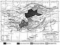
 Alexander den stores rike, Nordisk familjebok Caucasus.jpg 782 × 512; 159 KB
-
 Brandenburg 1688 and 1320.jpg 1,468 × 1,221; 2.16 MB
-
 C+B-Egypt-Map1-NileValley.JPG 493 × 1,597; 240 KB
-
 Deutsche Ostsiedlung.jpg 797 × 417; 399 KB
-
 Dictionnaire de la Bible - F. Vigouroux - Tome I - 40-Afrique des prophetes.jpg 1,765 × 1,100; 477 KB
-

-
 Empire of Charlemagne.jpg 3,354 × 3,033; 1.8 MB
-
 Europa BV042511914.jpg 1,954 × 1,337; 322 KB
-
 Frankreich BV042518624.jpg 1,566 × 1,072; 271 KB
-
 India in 250 B. C.jpg 892 × 1,252; 201 KB
-
 LangobardM.jpg 644 × 658; 141 KB
-
 Plan Hradu Krakovce.jpg 1,314 × 2,456; 859 KB
-
 Planche II - Civilisations successives et leurs aires d influence -L1-Ch 6.png 4,436 × 3,167; 3.35 MB
-
 Planche VII - Découvertes du monde de 1400 a 1550 - liv3-ch10.png 4,000 × 2,968; 2 MB
-
 Public Schools Historical Atlas - England 878.jpg 801 × 1,194; 336 KB
-
 Putz27.jpg 3,641 × 2,848; 2.04 MB
-
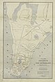
 Russian map of Pensa.jpg 1,995 × 841; 221 KB
-
 Russland BV042518413.jpg 1,954 × 1,337; 326 KB
-
 Russland BV043571920.jpg 1,959 × 1,517; 265 KB
-
 Samogitië.png 335 × 274; 163 KB
-
-

-
 The Rhineland circa 1789.jpg 516 × 1,522; 443 KB
-

-
 Ungarn BV042517718.jpg 11,200 × 7,627; 5.94 MB
-
 Vlachovo Brezi - Jan Hus.jpg 1,227 × 1,715; 699 KB
-
 Westindies.jpg 1,581 × 1,111; 214 KB
-
 Балканы в 1878.jpg 1,740 × 1,370; 797 KB


_Europe_1559.jpg)
_Germany_and_German_Confederation,_1815-1866.jpg)
_Prussia,_1415-1806.jpg)
_Prussia,_1806-1918.jpg)


.jpg)


.jpg)


_(14579040280).jpg)
_(14579040970).jpg)
_(14579052990).jpg)
_(14579066890).jpg)
_(14579068250).jpg)
_(14579083699).jpg)
_(14579088628).jpg)
_(14579105790).jpg)
_(14579112078).jpg)
_(14579125700).jpg)
_(14579136218).jpg)
_(14579139950).jpg)
_(14579170718).jpg)
_(14579312337).jpg)
_(14579364887).jpg)
_(14742728726).jpg)
_(14742795316).jpg)
_(14742800856).jpg)
_(14742824516).jpg)
_(14762549261).jpg)
_(14762570541).jpg)
_(14762636251).jpg)
_(14763412114).jpg)
_(14763413054).jpg)
_(14763463394).jpg)
_(14765415832).jpg)
_(14765419072).jpg)
_(14765420362).jpg)
_(14765448382).jpg)
_(14765509652).jpg)
_(14765514552).jpg)
_(14765804245).jpg)
_(14765816235).jpg)
_(14765859545).jpg)
_(14785615523).jpg)
_(14785683873).jpg)
_(14785732103).jpg)


_(14775987011).jpg)
_(14779142115).jpg)


_(14773703404).jpg)
_(14775704692).jpg)
_(14740255176).jpg)
_(14596835738).jpg)

_(14782039652).jpg)


_(14589410978).jpg)
_(14795921593).jpg)


