Category:18th-century maps of West Africa
Jump to navigation
Jump to search
Subcategories
This category has the following 14 subcategories, out of 14 total.
B
- 18th-century maps of Benin (4 F)
C
- 18th-century maps of Cape Verde (32 F)
G
- 18th-century maps of Ghana (8 F)
- 18th-century maps of Guinea (8 F)
I
M
S
Media in category "18th-century maps of West Africa"
The following 61 files are in this category, out of 61 total.
-
-

-
 1743 map of West Africa by Johann Matthias Hase Cropped.jpg 4,744 × 5,141; 6.15 MB
-
 1743 map of West Africa by Johann Matthias Hase.jpg 14,435 × 12,468; 35.08 MB
-

-

-
-

-

-

-

-

-
-
-
-
 AMH-7422-NA Map of west Africa.jpg 1,655 × 2,400; 780 KB
-
 AMH-7593-NA Map of Gabon and Angola.jpg 1,618 × 2,400; 771 KB
-
 Archipelagus atlanticus cum suis insulis Canariis, Hesperidibus et Azoribus (5960813003).jpg 2,000 × 1,245; 2.27 MB
-
 Carte de l'Afrique franc̨oise ou du Senegal.jpg 11,269 × 8,109; 26.34 MB
-

-
-
-
-

-

-
-

-

-
 Carte réduite des costes de l'Equateur à 5 degrés 1-2 - Degaulle - btv1b53168617x.jpg 5,764 × 5,955; 4.97 MB
-

-

-

-
-
 Chart of Western Africa - from the River Senegal to Biafra - btv1b8495298h.jpg 9,248 × 4,877; 4.81 MB
-
 De la rivière de Sierra Leona au cap dos Palmas - Bellin - btv1b53153518z.jpg 4,236 × 3,090; 1.53 MB
-

-
-

-
-

-

-

-

-

-
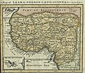
 Map of Zaara Negroe-land Guinea &c - DPLA - ab10f398aeddccd1507cbfcce71ca7a7.jpg 1,000 × 855; 291 KB
-

-

-

-
 Negroland and Guinea - DPLA - 0301aeb562206a56672aaab9ba66bc75.jpg 1,000 × 756; 257 KB
-

-
-
 New & Accurate Map of Negroland - DPLA - 4c1e7a939c99adfc779e5ac80ada9d1d.jpg 1,000 × 780; 256 KB
-
 New & Accurate Map of Negroland.jpg 4,000 × 3,117; 3.09 MB
-

-
-

-
 Rigobert-Bonne-Atlas-de-toutes-les-parties-connues-du-globe-terrestre MG 0025.tif 3,574 × 5,232; 53.53 MB
-
 Rigobert-Bonne-Atlas-de-toutes-les-parties-connues-du-globe-terrestre MG 9990.tif 5,073 × 3,439; 49.95 MB
-

-
-
 Moll Map of Zaara, Negro-Land, Guinea &c. 1701 UTA.jpg 2,299 × 2,002; 2.34 MB
_%22Guinea%22_-_Geographicus_-_Aethiopia-hmhr-1743.jpg)


_-_Geographicus_-_WestAfrica2-bellin-1765.jpg)


_-_btv1b85957972.jpg)


.jpg)


.jpg)

_et_les_Isles_Canaries,_seconde_feuille_Depuis..._-_btv1b10678512f_(1_of_2).jpg)
_et_les_Isles_Canaries,_seconde_feuille_Depuis..._-_btv1b10678512f_(2_of_2).jpg)
_-_D%C3%A9p%C3%B4t_-_btv1b531773436.jpg)


_%C3%86thiopia_inferior,_%26_hujus_quidem_pars_australis_LOC_96687096.jpg)

.jpg)
.jpg)
.jpg)
.jpg)


.jpg)


_-_btv1b8595533f.jpg)
_-_btv1b85955321.jpg)
.jpg)


_-_par_le_S(ieur)_d%27Anville,_G%C3%A9ographe_Ord(inaire)_du_Roi,_Juillet_1729..._-_btv1b530532334.jpg)