Category:18th-century maps of Newfoundland and Labrador
Jump to navigation
Jump to search
Provinces and territories of Canada: British Columbia · Manitoba · New Brunswick · Newfoundland and Labrador · Nova Scotia · Ontario · Prince Edward Island · Quebec ·
Subcategories
This category has only the following subcategory.
Media in category "18th-century maps of Newfoundland and Labrador"
The following 20 files are in this category, out of 20 total.
-

-

-
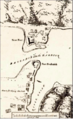 FortFrederickNewfoundland.png 279 × 455; 248 KB
-
-
 A chart of the banks of New Foundland - btv1b59704926 (1 of 2).jpg 8,912 × 6,656; 7.01 MB
-

-

-

-

-
 A Chart of the gulf of St Laurence - R. Sayer - btv1b53089612c (1 of 2).jpg 6,640 × 8,992; 7.5 MB
-

-
 A Chart of the Streights of Belle Isle - R. Sayer - btv1b530897403 (1 of 2).jpg 10,205 × 7,926; 11 MB
-
 A Chart of the Streights of Belle Isle - R. Sayer - btv1b530897403 (2 of 2).jpg 5,349 × 8,088; 5.2 MB
-

-

-

-
 Carte du Golphe de St-Laurent et Pays Voisins.png 1,375 × 870; 2.51 MB
-
 Memoires-des-commissaires-du-roi-et-de-ceux-de-sa-majesté-brittanique MG 1220.tif 5,010 × 3,621; 51.94 MB
-
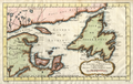
 Part of Newfoundland (3046334048).jpg 1,607 × 2,000; 3.1 MB
-
 Rigobert-Bonne-Atlas-de-toutes-les-parties-connues-du-globe-terrestre MG 0026.tif 5,251 × 3,605; 54.19 MB
.jpg)
.jpg)

.jpg)
.jpg)
.jpg)
.jpg)
.jpg)
_-_btv1b5970369m_(1_of_2).jpg)
.jpg)
.jpg)
.jpg)
.jpg)

.jpg)
.jpg)

.jpg)